Overview of Commercial Property Aerial Photography
Commercial property aerial photography involves capturing high-quality images and videos of business premises, development sites, and commercial real estate from an elevated perspective. Utilizing specialized aircraft, drones, or helicopters, this approach offers a comprehensive view of large-scale properties, industrial complexes, retail centers, and office parks. In Miami’s vibrant real estate and development markets, aerial imagery has become an essential tool for showcasing property assets, facilitating project planning, and enhancing marketing strategies.
The significance of this method extends beyond simple visual appeal. Aerial photography enables stakeholders to assess property layouts, highlight proximity to key infrastructure, and visualize development potential with clarity that ground-level images cannot provide. This is particularly valuable in Miami, where expansive commercial projects often require detailed presentations to attract investors, tenants, or regulatory agencies. Moreover, aerial visuals provide an impactful means of storytelling, conveying the scale and context of commercial investments to prospective clients and partners.
In addition to marketing, aerial photography supports site analysis, due diligence, and strategic planning. By offering a bird’s-eye perspective, developers can better understand site conditions, identify potential obstacles, and evaluate surrounding environment factors that influence project success. For property owners and investors, this visual intel helps in making informed decisions, securing funding, and streamlining project approval processes.
As Miami continues to grow and diversify its commercial landscape, the role of professional aerial photography becomes increasingly vital. High-resolution imagery, drone capabilities, and advanced imaging technology ensure that every detail of a property is accurately captured, making it an indispensable part of modern commercial real estate development and marketing efforts. The demand for top-tier commercial property aerial photography in Miami reflects its critical function in creating compelling visual narratives, attracting investment, and supporting sustainable development strategies.
Key Types of Aerial Equipment and Technology
Professional commercial property aerial photography relies on a variety of advanced equipment and technological solutions to ensure high-quality imagery that captures the essence of Miami’s dynamic urban landscape. Selecting the appropriate tools is essential for delivering images that meet client expectations and project specifications. Here, the focus is on the most effective and reliable aerial platforms and imaging technologies.
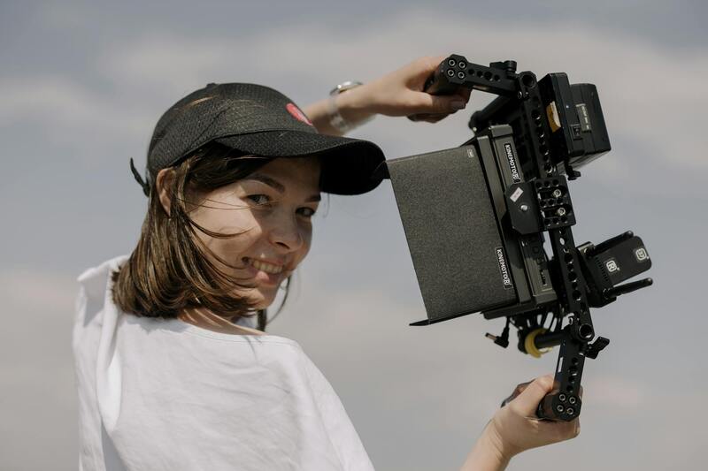
One of the most widely used tools in this field is the drone, or unmanned aerial vehicle (UAV). Drones equipped with high-resolution digital cameras allow operators to capture detailed images from multiple angles and heights. Modern drones feature GPS stabilization, autonomous flight modes, and obstacle avoidance sensors, which enable precise navigation around complex environments and ensure safety during operation.
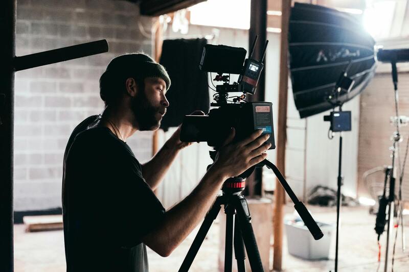
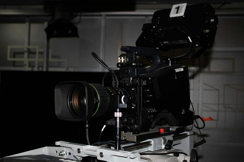
Beyond drones, traditional aircraft such as helicopters are occasionally employed for larger-scale projects where extended flight times and larger coverage areas are required. Equipped with sophisticated camera systems, helicopters can provide high-altitude, wide-angle shots that are particularly valuable for extensive developments or properties requiring comprehensive overview imagery.
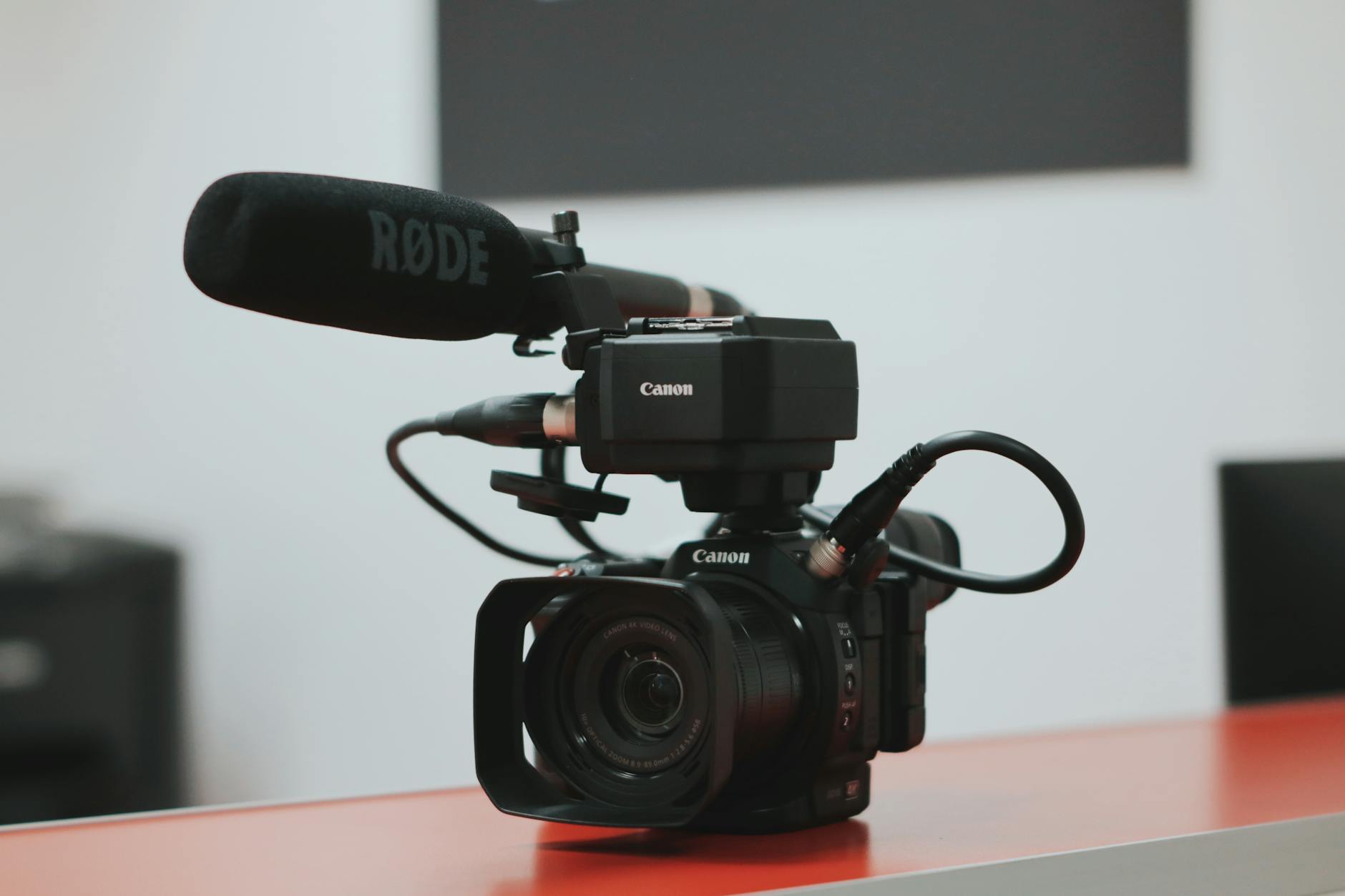
Imaging technology has advanced significantly, with many operators utilizing aerial cameras that incorporate stabilize gimbals, 4K or higher resolution sensors, and infrared capabilities. These innovations allow for sharp, color-accurate images that can be utilized for marketing, planning, and analysis.
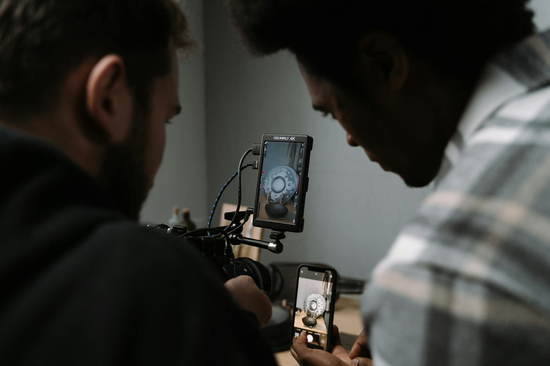
Software solutions play a vital role in planning and processing aerial footage. Flight planning tools assist pilots in designing optimal routes that maximize coverage while adhering to safety protocols. Post-flight processing software enables the stitching of images into comprehensive mosaics, 3D modeling, and detailed measurements—all critical for presenting accurate and compelling visual narratives.
Furthermore, some providers incorporate multispectral imaging and LiDAR technology to gather advanced data for detailed site analysis. These tools are invaluable for assessing terrain, identifying underground utilities, and conducting environmental impact assessments in commercial development projects.
Key Types of Aerial Equipment and Technology
In the realm of commercial property aerial photography, utilizing the appropriate equipment is essential to capturing precise and highly detailed imagery. The selection of technology largely depends on the project's scope, the property's size, and the desired output quality. Among the most prevalent tools are unmanned aerial vehicles, commonly known as drones, which have revolutionized the way aerial imagery is captured in urban environments such as Miami.

Modern drones utilized in Miami's commercial real estate market are equipped with sophisticated camera systems that include stabilized gimbals, 4K or higher resolution sensors, and infrared capabilities. These features ensure clear, color-accurate images with minimal motion blur, even in challenging lighting conditions. Drones offer flexibility in capturing multiple angles and perspectives that traditional methods cannot achieve with ease, making them ideal for showcasing the full extent of large or complex properties.
Beyond drones, traditional aerial platforms such as helicopters and fixed-wing aircraft are still employed, especially for expansive developments or large-scale infrastructure projects. These aircraft can sustain longer flight durations and cover extensive areas efficiently. Equipped with high-end imaging systems, they provide comprehensive, high-altitude shots that are invaluable for strategic planning and marketing efforts.

The integration of advanced sensors, such as multispectral imaging and Light Detection and Ranging (LiDAR), has further expanded the capabilities of aerial imaging. These technologies facilitate detailed terrain analysis, underground utility detection, and environmental assessments, all critical components in commercial development projects. They enable operators to gather data beyond simple visual imagery, supporting informed decision-making through precise measurements and three-dimensional modeling.
Software solutions form an integral part of modern aerial photography workflows. Flight planning applications help pilots design efficient routes that maximize coverage while maintaining safety protocols. Post-flight processing tools allow for stitching multiple images into seamless mosaics, generating textured 3D models, and conducting detailed measurements. These digital advancements have significantly enhanced the accuracy and visual impact of commercial property imagery, making it a vital resource for investors, developers, and marketing professionals in Miami.
By carefully choosing the right equipment and technology, professionals can ensure the delivery of high-quality, precise visual content that accurately represents the property's scale and features. This strategic use of equipment underscores the importance of technical expertise in producing compelling aerial imagery tailored to the specific needs of each commercial project.
Official and Verified Methods for Capturing Commercial Property Aerial Imagery
Utilizing authorized aerial photography methods ensures the collection of high-quality, accurate imagery essential for commercial property analysis. Licensed drone operators and aerial imaging providers employ compliant techniques that adhere to local regulations, safety standards, and industry best practices. These professionals typically obtain required permits from relevant authorities, such as the Federal Aviation Administration (FAA) and local Miami agencies, to operate UAVs or aircraft within designated airspace. Engaging certified operators guarantees adherence to prescribed altitude limits, flight zones, and operational guidelines, mitigating risks and ensuring a smooth project workflow.
Additionally, the use of sophisticated equipment including manned aircraft with stabilized camera systems and industrial-grade drones improves image resolution, stability, and coverage. These devices are often equipped with high-resolution sensors, panoramic lenses, and GPS stabilization which produce detailed, distortion-free images necessary for precise evaluations of commercial sites.
Pre-flight planning involving thorough site surveys and flight path analysis is a standard procedure among professionals. This ensures comprehensive coverage of the property and minimizes the risk of omissions. Operators also utilize official weather reports and airspace data to select optimal flying conditions, contributing to the clarity and consistency of the imagery.
Furthermore, post-capture processing of images involves expert editing and stitching, which consolidates multiple shots into cohesive mosaics. This digital workflow enhances the visual presentation of the property and enables detailed measurements that are critical for property assessment, development planning, and promotional activities. By relying on official techniques underpinned by industry standards, stakeholders can enhance their decision-making processes with reliable, high-quality visual data.

Choosing licensed and experienced aerial photography service providers in Miami integrates these official methods seamlessly into commercial project workflows. These providers leverage the latest technology and regulatory knowledge to deliver imagery that is not only visually impressive but also substantively valuable for analysis, planning, and promotional campaigns. The reliance on legitimate sources and methods underscores a commitment to accuracy, safety, and professionalism, vital for achieving project goals and maintaining industry standards in competitive markets.
Official Techniques and Equipment for Commercial Property Aerial Photography in Miami
Effective commercial property aerial photography relies on the use of official, tested methods and cutting-edge equipment designed to produce precise, high-resolution images. Operators adhere to established protocols for flight planning, ensuring that every shoot complies with the latest safety and technical standards relevant to the Miami airspace. This meticulous planning involves using government-approved airspace maps, weather data, and dedicated flight clearance procedures to secure the necessary permissions for operating UAVs or aircraft over commercial properties.
Modern aerial photography professionals employ a variety of advanced equipment tailored to the demands of commercial real estate. High-end drones equipped with stabilized gimbals and 4K or higher resolution cameras enable capturing clear, detailed images from various angles and altitudes. Some projects may necessitate manned aircraft, particularly for large-scale or hard-to-reach sites, where licensed fixed-wing or helicopter operators utilize professional-grade cameras with extensive zoom capabilities and high-precision sensors.

Telemetry and GPS technologies are integral for aligning images with real-world coordinates, facilitating accurate measurements and geographic referencing. When combined with emerging imaging techniques like multispectral or thermal imaging, these tools expand the scope of analysis, enabling precise documentation of property conditions, land use, and environmental impact assessments.
All aerial data collection is performed following strict operational guidelines that prioritize safety, data quality, and regulatory compliance. Operators are trained in official procedures for drone handling, airspace awareness, and emergency protocols, ensuring that flights are conducted within authorized zones and under legitimate conditions. Such adherence not only guarantees high standards of professionalism but also safeguards the integrity of the images produced, thereby supporting effective decision-making for commercial real estate projects.
Technological Innovations Enhancing Commercial Aerial Photography
Recent innovations include the integration of automated flight planning systems that optimize flight paths for efficiency and safety, along with real-time data transmission systems that provide immediate feedback on image quality. These advancements reduce the likelihood of missed shots or poor-quality data, ultimately saving time and resources while ensuring the delivery of comprehensive visual documentation.
The use of software solutions such as photogrammetry and image stitching is also commonplace, allowing for the creation of detailed orthomosaic maps. These maps serve as invaluable assets for site analysis, development planning, and marketing presentations, further emphasizing the importance of employing legitimate, professional-grade equipment in every project.
Regulatory Compliance and Best Practices for Aerial Data Collection
Ensuring the accuracy and integrity of commercial property aerial photography involves adhering to established operational standards that respect the complexities of airspace management in Miami. These standards are rooted in methodical planning, precise execution, and rigorous safety protocols to guarantee high-quality visuals while maintaining lawful interactions with local airspace authorities.
Prior to any aerial data collection, detailed planning is essential. This includes obtaining necessary permissions, defining the approved flight zones, and coordinating with relevant authorities to confirm that flight operations are conducted within the authorized parameters. Advanced flight planning tools are employed to map out optimal routes that avoid sensitive zones, protected areas, or crowded airspace, minimizing risks and ensuring compliance with established guidelines.

During execution, professional operators exercise meticulous control over drone handling, maintaining constant awareness of airspace restrictions and weather conditions. They utilize real-time monitoring systems that provide immediate feedback on situations that could compromise safety or image quality, enabling prompt adjustments or mission aborts if necessary.
Post-flight procedures involve thorough data verification to confirm that collected imagery meets quality standards and aligns with project objectives. Data are processed using authorized software tools, such as photogrammetric systems, to generate accurate orthomosaic maps, 3D models, or detailed site analyses. Maintaining a transparent record of flight details, data handling, and processing methods bolsters the credibility and reproducibility of the results, laying a foundation for trustworthy analysis and decision-making.
To uphold the highest standards throughout all phases of the project, collaboration with licensed and experienced aerial photography providers is recommended. These specialists are equipped with the latest technology and possess a thorough understanding of Miami’s airspace regulations, ensuring each project adheres strictly to operational guidelines while delivering superior visual data. This professional approach minimizes potential disruptions, enhances safety, and guarantees that the images captured are both comprehensive and compliant with current operational standards, ultimately supporting the strategic goals of commercial real estate ventures in Miami.
Legal and Regulatory Considerations in Miami
When conducting commercial property aerial photography in Miami, understanding and adhering to the region’s airspace regulations is crucial. The Miami airspace is managed by the Federal Aviation Administration (FAA), which enforces guidelines designed to ensure the safety of all aerial activities. Compliance involves obtaining the appropriate operational authorizations, including Part 107 commercial drone certification, and adhering to altitude restrictions and no-fly zones that often encompass important landmarks, airports, and sensitive infrastructure.
Operators must conduct pre-flight assessments to confirm they are operating within permitted airspace and maintain awareness of temporary flight restrictions (TFRs), especially during special events or in proximity to government facilities. Prior coordination with local authorities or air traffic control may be necessary for complex projects, particularly when flying in congested urban environments like Miami’s downtown or near its beaches.
Operators should also maintain detailed logs of their flights, including flight paths, altitude levels, and data collected. This documentation can be essential for demonstrating compliance with established operational standards and for resolving any questions that may arise during or after the project. Additionally, staying informed about evolving regulations and participating in continuing education can help aerial photography providers maintain adherence to best practices in Miami’s dynamic airspace environment.
In terms of equipment, using compliant drones equipped with geo-fencing capabilities, automatic altitude controls, and real-time monitoring systems enhances operational safety and legal adherence. These tools enable professional aerial photography firms to perform high-quality imaging sessions within the prescribed regulatory frameworks while minimizing the risk of inadvertent airspace violations.
Given the intricacies of operating in an urban setting like Miami, engaging with well-versed aerial photography specialists who understand local regulations can significantly streamline project execution. These professionals can facilitate necessary permissions, optimize flight plans, and manage the technical aspects of aerial data collection, ensuring legal compliance is seamlessly integrated into project workflows.

By maintaining rigorous adherence to all operational protocols, commercial entities can leverage aerial imagery for marketing, site analysis, and investment decisions confidently. Collaborating with experienced providers familiar with Miami’s unique regulatory landscape guarantees that projects are executed efficiently, safely, and within established legal parameters, thereby bolstering the integrity and professionalism of the commercial real estate sector.
Future Trends in Commercial Property Aerial Photography
As technology continues to evolve, the landscape of commercial property aerial photography is witnessing significant advancements that promise to enhance both the quality and utility of aerial imagery in Miami's vibrant real estate market.
One of the prominent trends is the integration of 3D mapping and modeling capabilities with aerial imagery. This allows for highly detailed, accurate representations of commercial sites, facilitating better visualization, planning, and development assessments. These 3D models can support sophisticated analyses such as volumetric measurements, site planning, and infrastructure development, making them invaluable tools for developers, investors, and property managers.
Additionally, the adoption of high-resolution sensors and multispectral imaging technologies extends the depth of data collected during aerial sessions. This advancement enables professionals to examine properties not only visually but also in terms of environmental impact, vegetation health, and other critical parameters that influence commercial real estate decisions.
The regulatory environment is also progressing alongside technological progress. Evolving guidelines aim to streamline aerial data collection processes while maintaining safety and privacy standards. These updates tend to favor innovative solutions like automated flight planning and geo-fencing, which help operators comply with airspace restrictions effortlessly.
Furthermore, the future of commercial aerial photography is leaning toward greater integration with artificial intelligence (AI) and data analytics. AI-powered image processing enhances clarity and detail, while analytics enable extracting actionable insights from collected data. This combination can identify trends, assess risks, and support strategic planning for commercial developments with unprecedented precision.
Finally, the push toward sustainable and eco-friendly aerial imaging practices gains momentum, driven by technological innovation and societal emphasis on environmentally responsible operations. Companies focusing on this aspect are developing quieter, more energy-efficient drones equipped with advanced navigation and collision-avoidance features, easing their integration into Miami's busy urban airspace.
Overall, the convergence of these technological and regulatory developments signals a forward-looking era for commercial property aerial photography in Miami. The ongoing adoption of innovative tools and methods promises enhanced accuracy, efficiency, and strategic value—making aerial imagery an indispensable asset for commercial real estate stakeholders seeking a competitive edge in an increasingly sophisticated market.