Understanding Aerial Real Estate Photography
Aerial real estate photography has become a transformative element in property marketing, offering a unique perspective that ground-level photography cannot achieve. This specialized form of photography involves capturing images of properties from elevated vantage points, typically using unmanned aerial vehicles (UAVs), commonly referred to as drones, or manned aircraft in some cases. The goal is to showcase the full scope and layout of a property, emphasizing its size, surrounding amenities, landscape features, and neighborhood context.
Through the use of aerial photography, real estate professionals can highlight the property's exterior features, such as expansive lawns, waterfront access, or nearby attractions, which are often difficult to convey through traditional photography. This approach not only enhances the visual appeal of listings but also provides potential buyers with a comprehensive understanding of the property's position within its environment. As technology advances, drone footage often combines with high-resolution imagery and dynamic video tours, providing a compelling multimedia experience for prospective buyers.
Typically, aerial real estate photography is integrated into marketing strategies to differentiate listings. It is particularly effective in competitive markets such as Miami, where luxury properties, waterfront homes, and sprawling estates benefit significantly from aerial perspectives. The process involves careful planning to identify optimal shooting angles and times of day that maximize natural light, ensuring that each image captures the property in the most appealing way. Moreover, aerial images can be used alongside traditional ground-level photos and virtual tours, creating a holistic view that engages potential buyers and accelerates the decision-making process.
Employing aerial photography in real estate marketing requires technical expertise and a high standard of safety and quality control. Properly executed images not only attract more interest but also convey a sense of professionalism and commitment to excellence. As a result, real estate agents and developers increasingly rely on specialized aerial photography services to elevate their property presentations, making this a valuable component of comprehensive marketing campaigns.
Types of Aerial Photography Equipment and Technology
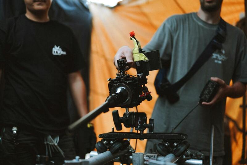
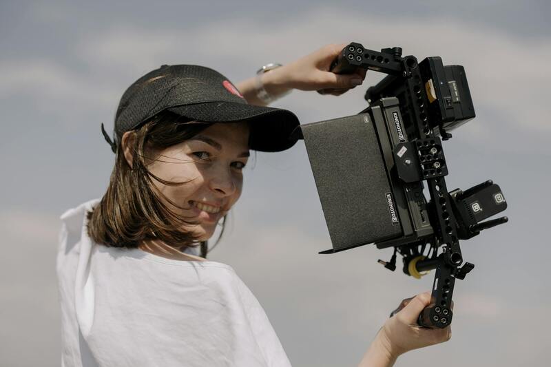
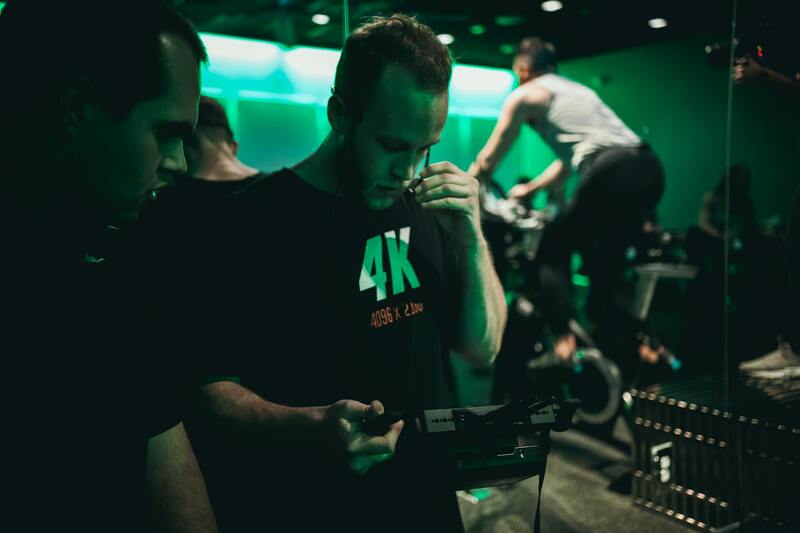
When it comes to capturing high-quality aerial imagery for real estate, selecting the appropriate equipment is crucial to ensure clarity, safety, and efficiency. The primary tools utilized in this field include various types of drones, each offering distinct features suited for different project needs. Multi-rotor drones are the most common choice, known for their maneuverability and ability to hover precisely, making them ideal for detailed property shots and complex angles. Fixed-wing drones, on the other hand, are better suited for covering larger areas swiftly, such as expansive estate grounds or extensive waterfront properties.
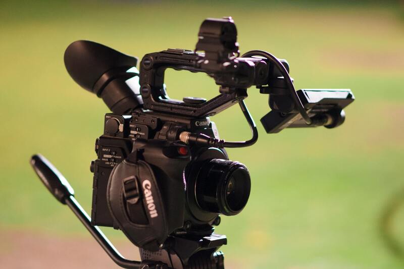
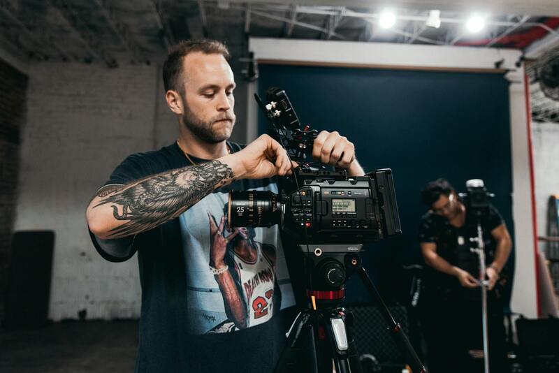
Camera technology plays a pivotal role in the quality of aerial photographs. Modern drones are equipped with high-resolution digital cameras capable of capturing images with exceptional detail, often supporting 20-megapixel sensors and adjustable lenses. Some systems incorporate stabilized gimbals to eliminate motion blur and ensure sharp, professional-grade images. Additionally, advanced models support 4K or even 8K video recording, enabling dynamic aerial tours that showcase properties from multiple perspectives.
Emerging Technologies Enhancing Aerial Photography
- LiDAR Sensors: Light Detection and Ranging (LiDAR) technology provides detailed topographical data, ideal for large development projects or properties with complex landscapes.
- Thermal Imaging: Some drones include thermal cameras that can reveal heat leaks or structural issues, adding value to certain property evaluations.
- Autonomous Flight Software: Flight planning software allows for precise, repeatable shots, ensuring consistent quality across multiple shoots and easier management of complex property layouts.
The integration of these technologies not only elevates the visual quality of property images but also enhances data collection and analysis, empowering real estate professionals with more comprehensive property insights.
Ensuring the proper operational safety and adhering to best practices during aerial shoots is essential. This involves pre-flight checks, considering weather conditions, and precisely planning flight paths to avoid hazards and achieve optimal angles. Maintaining top-tier equipment and employing skilled operators directly impacts the overall success of aerial real estate photographs, thereby reinforcing the property’s appeal and supporting effective marketing campaigns.
Understanding Aerial Real Estate Photography
Aerial real estate photography is a specialized service that captures stunning visuals of properties from above, providing potential buyers and investors with a comprehensive perspective that ground-level photography simply cannot offer. This form of imaging leverages advanced drone technology and professional equipment to showcase the full scope of a property's features, surrounding landscapes, and neighborhood context. The key to effective aerial photography lies in utilizing legitimate and certified methods that ensure safety, precision, and high-quality results. Carefully planned flight paths, adherence to operational guidelines, and use of certified equipment all contribute to producing images that are both compelling and compliant with regional standards.
In addition to capturing static images, many providers now offer dynamic video tours that can significantly enhance a property's online presentation. These videos often include smooth, cinematic footage aided by stabilized gimbals and professional-grade cameras, allowing real estate professionals to highlight key property attributes from a variety of angles. When selecting aerial real estate photography services, it is vital to ensure the methods employed are backed by certified operators who adhere to established operational standards. This guarantees not only high-quality visuals but also a safe and seamless shooting process that respects residents' privacy and local regulations.
Key Benefits for Miami Real Estate Market
- Enhanced Visual Appeal: Aerial images and videos provide a comprehensive view that captivates potential buyers, showcasing the entire property and surrounding amenities effectively.
- Property Differentiation: High-quality aerial visuals set listings apart in the competitive Miami market, offering unique perspectives that ground photography cannot replicate.
- Increased Engagement: Listings with aerial content tend to attract more views and inquiries, leading to faster sales cycles and better market visibility.
- Data Collection and Analysis: Emerging technologies such as LiDAR and thermal imaging contribute valuable data insights, optimizing property evaluations and development planning.
- Accurate Property Representation: Professional aerial shots help convey the true size, layout, and landscape features of properties, reducing misunderstandings and setting clear expectations for buyers.
In the dynamic Miami real estate scene, leveraging aerial photography can be a central element of an effective marketing strategy. By offering prospective clients a vivid, accurate, and engaging visual experience, real estate professionals can foster greater trust and interest. Proper integration of professional aerial services ensures that the visuals are not only attractive but also compliant with all operational and regional standards, maintaining the credibility and reputation of the agency or individual agent involved.
Image Placeholder
Legal and Regulatory Considerations in Miami
In the vibrant Miami real estate landscape, utilizing aerial imagery requires adherence to specific operational standards designed to ensure safety, professionalism, and quality. While the focus remains on obtaining captivating visuals, understanding the regional guidelines around aerial photography is essential for seamless integration into your marketing efforts. Miami’s dynamic urban environment necessitates careful planning when deploying aerial equipment. This includes acquiring necessary permissions for airspace use, respecting privacy boundaries, and coordinating with local authorities when operating in restricted zones. Establishing a clear understanding of local flight zones and permissible altitudes helps prevent disruptions and maintains a professional reputation. Professional aerial operators in Miami often work closely with local authorities and utilize up-to-date navigational data to comply with regional standards. This cooperation ensures that flights are conducted smoothly while minimizing risk and avoiding conflicts with other aerial activities. Operational safety extends beyond local regulations, encompassing adherence to operational best practices such as maintaining line-of-sight, ensuring equipment reliability, and avoiding adverse weather conditions that could compromise safety or image quality. This disciplined approach helps capture high-quality visuals consistently and avoids costly delays or re-shoots. Furthermore, regional considerations may influence scheduling flexibility. Weather patterns in Miami, characterized by frequent storms and high humidity, can impact optimal shooting times. Planning sessions include weather assessments to secure optimal lighting and visibility, which are crucial for producing stunning aerial images. Partnering with a reputable Miami-based aerial photography service ensures these regulations and standards are thoroughly understood and followed. Experienced providers carry the necessary operational certifications and possess an in-depth knowledge of local airspace constraints, facilitating smooth and compliant shooting sessions. For real estate professionals seeking to elevate their listings, working with a licensed and compliant aerial photography provider mitigates potential operational risks and enhances the overall quality of marketing content. These specialists are equipped to handle the complex facets of aerial imaging, including obtaining permits where required and coordinating with local authorities, ensuring a professional and efficient process.
Legal and Regulatory Considerations in Miami
Operating aerial real estate photography services in Miami involves adherence to a set of established procedures designed to ensure safe and efficient flight activities. These procedures typically include acquiring necessary permits for drone operations, especially when capturing images over private properties or densely populated areas. It is essential to coordinate with local authorities and comply with city-specific guidelines to secure clearances, which facilitate a smooth shooting process without disruptions.
Enhanced safety protocols are also a critical part of operational standards. These involve thorough pre-flight risk assessments, maintaining appropriate flight altitudes, and establishing safe distances from buildings, people, and restricted airspace zones. Additionally, operators must often undertake detailed site evaluations beforehand to identify potential hazards and plan flight paths accordingly.
Equipment safety procedures are equally important, ensuring all devices are regularly inspected and maintained to avoid malfunctions during flights. In regions such as Miami, with its vibrant urban landscape and frequent weather changes, having contingency plans and weather assessment protocols plays a significant role in successful photo sessions. This proactive approach mitigates unexpected disruptions or safety concerns that could arise due to sudden storms or high humidity conditions.
- Pre-flight site assessments and weather checks
- Securing necessary permits and clearances
- Maintaining comprehensive safety protocols
- Regular equipment inspections and maintenance
- Establishing communication with local authorities where required
Partnering with an experienced Miami-based aerial photography service ensures these operational standards are comprehensively managed. Such providers typically have in-depth local knowledge, operational certifications, and established relationships with regulatory bodies, all of which contribute to seamless project execution. This framework supports professional, high-quality imagery that enhances property marketing efforts while complying with regional guidelines.
Optimal Techniques for Aerial Photography in the Miami Real Estate Sector
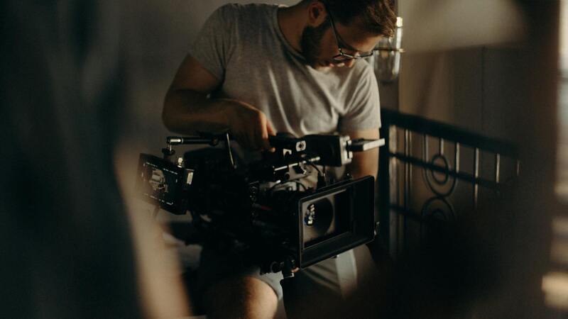
Executing high-quality aerial real estate photography in Miami demands adherence to specific best practices that ensure the images captured accurately represent the property while highlighting its unique features. The process involves meticulous planning, precise equipment handling, and environmental awareness.
To begin, pre-shoot preparation entails examining the site for potential obstacles like power lines, mature trees, or transient objects such as vehicles and pedestrians that could interfere with the drone’s flight path or compromise image clarity. Identifying these elements in advance allows for the creation of a detailed flight plan, which maximizes the safety and efficiency of the shoot.
Optimal lighting conditions are crucial; early mornings or late afternoons often provide softer natural light, reducing harsh shadows and enhancing the aesthetic appeal of the property. Miami’s often dynamic weather — including high humidity or sudden storms — necessitates real-time weather monitoring to determine the ideal timing for capturing images. Cloud cover, wind speeds, and thermal activity can all impact drone stability and image sharpness, requiring operators to be flexible and ready to reschedule if conditions deteriorate.
Camera settings such as aperture, shutter speed, and ISO must be carefully calibrated to ensure clarity and depth of field, especially when capturing expansive vistas or intricate exterior details. Using a high-resolution camera allows for detailed close-ups and wide-angle shots that can be utilized in various marketing formats, from digital listings to printed brochures.
In terms of flight technique, maintaining steady, controlled movements while avoiding abrupt directional changes results in smoother footage and sharper images. Employing automatic or manual gimbal stabilization further enhances image quality by minimizing vibrations. Additionally, executing multiple passes from different altitudes and angles can provide comprehensive visual coverage, offering prospective buyers a compelling view of the property from every conceivable perspective.
Post-shoot, editing plays a vital role in refining images. Color correction, perspective adjustments, and selective highlighting can accentuate features such as waterfront views, landscaped gardens, or architectural details. High dynamic range (HDR) techniques can be used to balance exposure levels across the image, ensuring both bright skies and shaded areas retain detail without washing out or becoming too dark.
Implementing these advanced practices ensures that aerial real estate photography not only meets professional standards but also actively enhances marketing campaigns. Captivating aerial images can significantly elevate a property’s online presence, making it stand out in a competitive Miami market. Whether emphasizing the scale of a sprawling estate, showcasing panoramic waterfront views, or capturing lush landscaped yards, effective aerial imagery conveys the property’s unique selling points with clarity and visual appeal.
Understanding Aerial Real Estate Photography
Aerial real estate photography involves capturing high-quality images and videos of properties from elevated perspectives using unmanned aircraft systems, commonly known as drones. This specialized visual technique enables real estate professionals to showcase properties in a way that ground-level photography cannot—highlighting expansive land plots, multi-faceted architectural features, surrounding amenities, and the property's relationship with its environment. The clarity and scope provided through aerial imagery play a significant role in creating immersive property listings that attract potential buyers and investors.
Utilizing aerial photos effectively requires a combination of technical skill and an understanding of visual storytelling. High-resolution imagery ensures that details such as rooflines, landscaping edges, pool layouts, and outdoor recreational areas are vividly depicted. Video fly-throughs, when executed smoothly, offer dynamic perspectives that can guide viewers through the property's flow and space, creating a more engaging experience. Professional aerial photography captures the property's essence, emphasizing its unique selling points and helping it stand out in a bustling Miami real estate market.
Technology and Equipment Integration
Effective aerial real estate photography hinges on the use of advanced equipment. Drones equipped with high-resolution cameras, stabilizers, and GPS technology facilitate precise and steady shots. Multi-rotor and hybrid drone platforms offer versatility for different property sizes and locations, ensuring optimal image quality regardless of the terrain or environmental conditions. Additionally, incorporating 4K or higher video resolution capabilities allows the creation of immersive virtual tours that can be seamlessly integrated into real estate marketing platforms.
Geographical Considerations for Miami Properties
Miami's distinctive landscape—characterized by waterfront properties, lush gardens, and urban developments—demands tailored aerial photography approaches. Utilizing drones that can handle coastal breezes and navigate complex urban environments ensures comprehensive coverage of various property types. Strategic planning of flight paths and altitudes minimizes obstructions like trees or neighboring structures, capturing the full scope of each listing. In a market where views and location are pivotal, high-quality aerial imagery becomes a crucial tool for real estate professionals seeking to highlight the unique appeal of Miami properties.
Legal and Regulatory Considerations in Miami
Operating aerial real estate photography services in Miami requires strict adherence to established protocols that govern the use of aerial platforms. Due to the dense urban landscape and proximity to various sensitive areas, professionals must implement comprehensive safety measures to ensure operations are conducted responsibly. This includes awareness of designated flight zones and restricted airspace, which are often detailed by local aviation authorities, and ensuring that drone operations do not interfere with manned aircraft or other aerial activities.
Maintaining proper documentation, such as flight plans, safety checklists, and operation logs, is also essential. These records demonstrate compliance with established standards and facilitate smoother coordination with relevant authorities when necessary. Moreover, personnel involved in aerial photography should be trained in maneuvering and safety protocols, continuously updating their knowledge to keep pace with technological advancements and regulatory updates.
Furthermore, understanding specific local ordinances related to drone usage in urban environments helps prevent inadvertent violations. Miami's diverse neighborhoods may have different restrictions, and engaging with local authorities can clarify permitted activities. Such proactive engagement not only mitigates potential issues but also demonstrates professionalism and respect for community standards.
Implementing these measures enhances the reliability and safety of aerial photography practices. Proper compliance reflects an image of integrity and professionalism, which is critical in building trust with clients and stakeholders in Miami’s competitive real estate market.