Overview of 3d Drone Photography
3D drone photography represents a significant advancement in aerial imaging technology, combining high-precision drone equipment with sophisticated software to create detailed three-dimensional representations of landscapes, structures, and environments. Unlike traditional drone photography, which typically captures flat, two-dimensional images from above, 3D drone photography involves capturing multiple overlapping images from various angles to enable the generation of detailed 3D models. This approach allows for highly accurate visualizations that can replicate complex geometries and spatial relationships with remarkable fidelity.
At its core, 3D drone photography involves a combination of aerial imaging, spatial data collection, and advanced processing techniques. The drones used are often equipped with high-resolution cameras, GPS systems, and inertial measurement units (IMUs) to ensure precise positioning and data collection. Multiple images are taken systematically around the target area, covering every angle possible. These images are then processed through photogrammetry software to produce digital elevation models (DEMs), textured meshes, and point clouds that provide comprehensive three-dimensional insights into the surveyed space.
This technological approach differs significantly from conventional drone photography, which primarily emphasizes capturing high-quality, visually appealing images for marketing, inspection, or documentary purposes. Instead, 3D drone photography emphasizes spatial accuracy and detailed analysis, making it invaluable for applications that require precise measurements, terrain analysis, or structural assessments.
Key features of 3D drone photography include high spatial resolution, the ability to produce accurate 3D models of complex environments, and integration with Geographic Information System (GIS) platforms for detailed spatial analysis. These features make it particularly useful in fields such as construction monitoring, land surveying, architecture, environmental management, and infrastructure inspection. Its capacity to provide detailed volumetric measurements and surface analyses surpasses traditional imaging methods, offering a robust tool for industries that rely on precise spatial data.
Technologies and Equipment Used
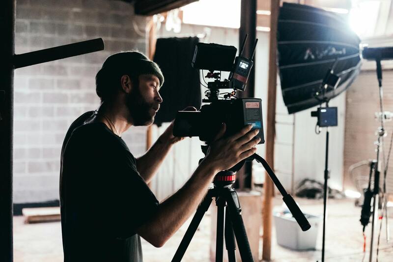
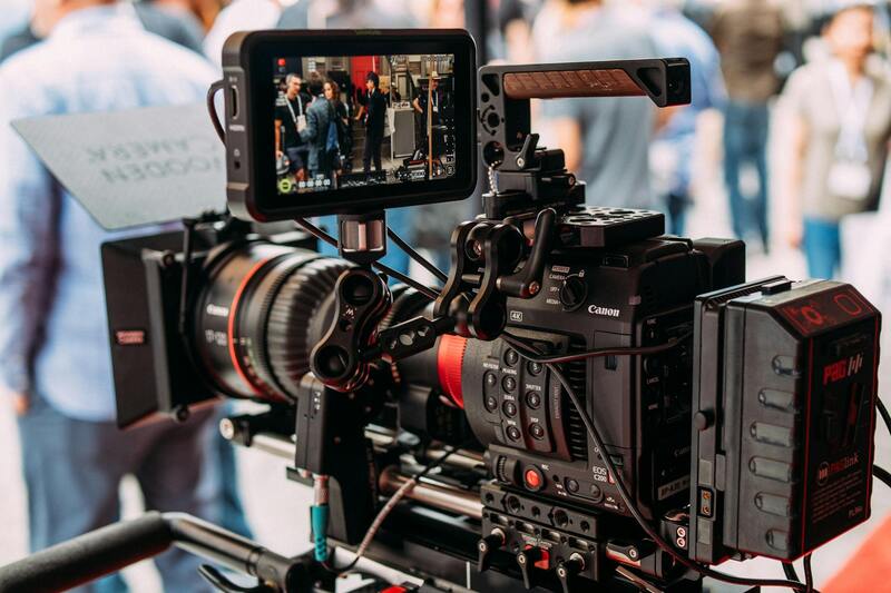
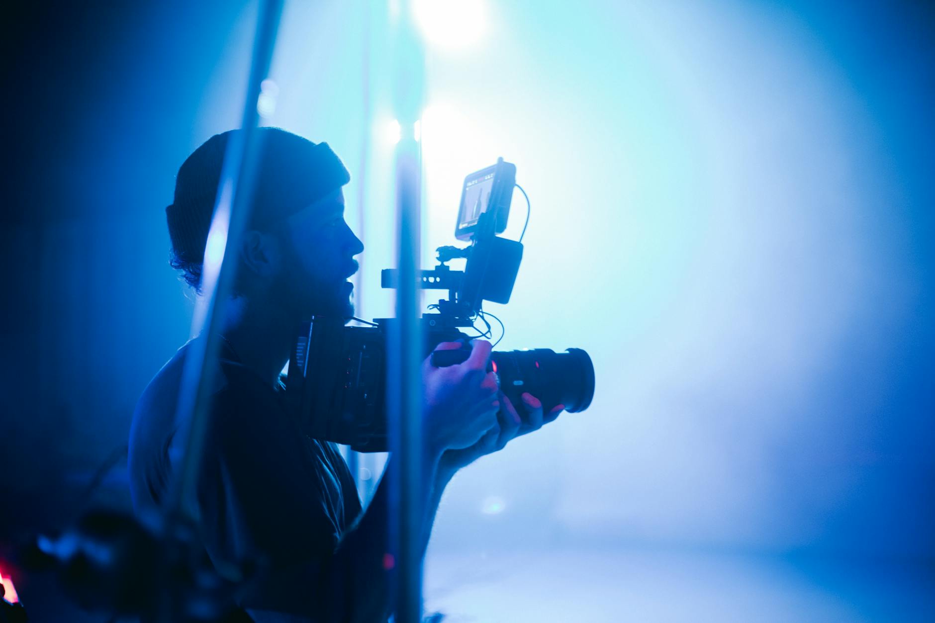
Implementing high-quality 3d drone photography in Miami necessitates a carefully selected range of advanced equipment to ensure accuracy, efficiency, and safety. Central to this process are specialized unmanned aerial vehicles (UAVs) equipped with top-tier aerial cameras, often stabilized with gimbals to achieve sharp, distortion-free imagery from multiple angles. These drones are designed to handle complex survey missions, with features such as autonomous flight capabilities, obstacle avoidance, and extended battery life to cover large or intricate sites.
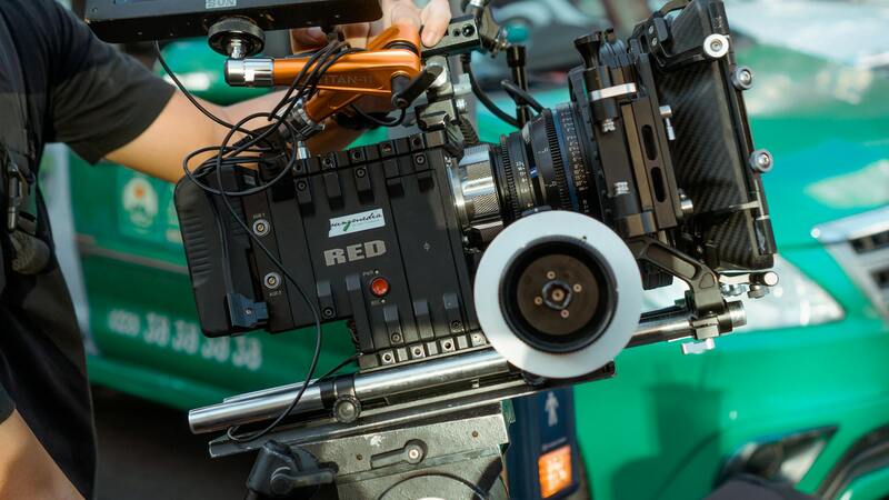
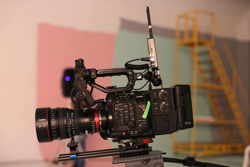
For capturing detailed 3D data, high-resolution cameras with adjustable zoom, wide dynamic range, and precise geotagging capabilities are essential. These features facilitate the collection of datasets that can later be refined into highly accurate digital models. The integration of multispectral or LiDAR sensors can further enhance the drone’s ability to capture diverse data sets, particularly when detailed terrain or forest analysis is necessary.
Processing 3D data involves robust software suites capable of photogrammetric reconstruction. Programs such as Pix4D, DroneDeploy, and Agisoft Metashape are popular choices among professional Miami-based drone operators. These software packages perform complex algorithms for aligning images, generating dense point clouds, and creating textured meshes and digital elevation models (DEMs). Preference is given to solutions offering seamless integration with GIS platforms, which allows for comprehensive spatial analysis.
In addition, ground control points (GCPs) equipped with high-precision GPS units are often deployed during data collection to improve spatial accuracy. These markings are crucial when developing detailed project-specific models, especially in projects like construction site monitoring or environmental surveys.
Choosing the right combination of drone platforms, camera systems, and processing software is vital in achieving the desired level of detail and accuracy. The diverse terrain and urban landscape of Miami demand versatile, reliable equipment capable of operating in various environmental conditions while maintaining data integrity.
Technologies and Equipment Used in 3D Drone Photography
The foundation of high-quality 3D drone photography lies in deploying advanced technologies and specialized equipment designed to capture detailed spatial data. Miami-based professionals commonly utilize multi-sensor drone platforms equipped with high-resolution RGB cameras to gather dense imagery necessary for accurate 3D reconstruction. These platforms often incorporate additional sensors such as LiDAR or multispectral cameras, expanding the scope of data collection to include detailed terrain, vegetation, and infrastructure analysis.
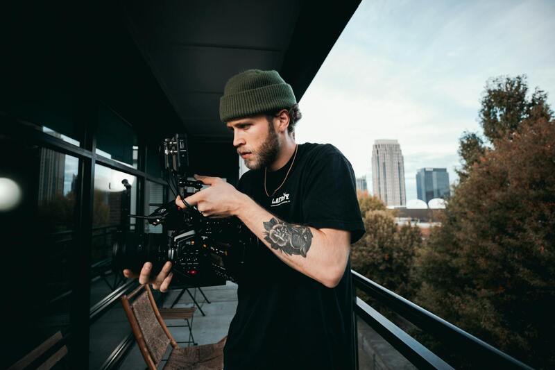
In terms of hardware, the drones themselves are selected based on their stability, flight endurance, and payload capacity. For example, lightweight quadcopters or octocopters with stable flight profiles are preferred for their precision and ability to operate in various environmental conditions encountered in Miami’s diverse urban and natural landscapes. These drones are often fitted with gimbals to stabilize camera movement, ensuring sharp, clear images during flight, which is critical for subsequent processing.
Processing software plays a pivotal role in transforming raw aerial images into comprehensive 3D models. Professional-grade photogrammetry tools such as Pix4D, DroneDeploy, and Agisoft Metashape utilize sophisticated algorithms to align images, generate dense point clouds, and create textured meshes. Integration with GIS systems allows for enhanced spatial analysis, making these tools indispensable for urban planning, environmental monitoring, and construction projects in Miami. State-of-the-art software options also support the use of ground control points (GCPs), which, when used with high-precision GPS devices, significantly improve the accuracy of the resulting 3D models.
Moreover, the selection of equipment must consider environmental adaptability. Miami’s climate, characterized by humidity, heat, and occasional strong winds, demands resilient hardware capable of sustained operations without compromising data quality. As such, professionals frequently opt for weather-resistant drones and cameras with optimal sensor sensitivity to ensure data integrity across diverse environmental conditions.
Process of Capturing 3D Drone Data
Executing high-quality 3D drone photography involves meticulous planning and execution. The process begins with detailed site assessment and flight planning, where flight paths are designed to ensure complete coverage from multiple angles. Pre-flight checks include calibrating sensors and verifying the functionality of GPS and other onboard systems to guarantee precision.
During the flight phase, pilots follow predetermined routes, capturing overlapping images at multiple altitudes and angles. Overlap ratios often range between 75-85% to ensure sufficient data density for accurate 3D reconstruction. Multiple passes may be necessary in complex environments to avoid occlusions and capture intricate details of structures or terrain.
Post-flight, the raw images are transferred to processing software. The initial step involves aligning images through feature matching algorithms, which identify common points across overlapping photos. This process results in a comprehensive point cloud that models the scanned environment. Subsequent steps include filtering and refining the point cloud, texturing the mesh, and generating accurate digital elevation models (DEMs) or textured 3D surfaces. Ground control points (GCPs) are integrated during this phase to enhance spatial accuracy, especially in projects requiring high precision for measurements or analysis.
Legal and Regulatory Considerations in Miami
When employing 3D drone photography for commercial projects in Miami, adhering to established procedures and regulations is essential. This ensures the safe and compliant operation of drone equipment within the city's airspace, safeguarding both the operators and the public.
Operators must familiarise themselves with the specific requirements set forth by local authorities and federal agencies overseeing aerial operations. This involves obtaining necessary permits for drone flights conducted for commercial purposes, especially in densely populated urban areas. Permits typically require submitting detailed flight plans, explaining the purpose of the project, and demonstrating the operator's proficiency in drone piloting.
In addition, drone operators should carefully plan flights to avoid restricted zones such as airports, helipads, and other sensitive locations. Miami’s airspace may include special zones that require additional permissions or coordination, particularly when flights occur near critical infrastructure or large events.
Compliance also involves respecting privacy rights and operational restrictions during specific times or in particular neighborhoods. Using official channels to obtain authorization minimizes the risk of disruptions and ensures a seamless workflow. Drone operators are advised to maintain detailed records of all flights, permissions, and safety protocols followed during each project.
This proactive approach not only aligns with local standards but also enhances the credibility of the service provider. As Miami continues to evolve as a hub for innovative aerial imaging, staying informed about evolving rules and best practices remains a cornerstone of responsible drone photography.

Process of Capturing 3D Drone Data
Executing high-quality 3D drone photography in Miami requires a meticulous and technically advanced approach. This process begins with comprehensive flight planning, where specific flight paths are mapped out to ensure optimal data collection while maintaining safe distances from sensitive structures and restricted zones. Detailed pre-flight surveys are conducted to determine the best angles, altitudes, and timings, often considering lighting conditions and weather patterns that could impact image quality.
During flight operations, precise control and stabilization of the drone are paramount. Modern 3D drone photography utilizes multi-rotor or fixed-wing UAVs equipped with high-resolution cameras and advanced sensors, including LiDAR (Light Detection and Ranging), to gather detailed spatial data. These sensors capture multiple overlapping images or point clouds from different angles, forming the basis for three-dimensional models.
Once data acquisition is complete, the captured images and point cloud data are processed using sophisticated photogrammetry software. The software aligns images, constructs detailed 3D meshes, and generates accurate topographical maps. Georeferencing data is integrated to ensure spatial precision, enabling the creation of models that can be manipulated for various applications.
Post-processing also involves quality checks and possible enhancements, such as color correction and noise reduction, to ensure clarity and fidelity of the final model. This comprehensive workflow ensures that the results are highly detailed and reliable, suitable for engineering analysis, urban planning, or immersive virtual presentations.
Importantly, throughout this process, adherence to operational standards and safety protocols must be maintained to avoid disruptions and ensure the integrity of the data collection. Professional operators routinely verify the calibration of sensors and the stability of their platforms, making adjustments as necessary to account for environmental factors such as wind or interference. Emphasizing proper technique and technological sophistication guarantees meticulous, high-quality output that stands up to scrutiny in professional applications.
Legal and Regulatory Considerations in Miami
When undertaking 3D drone photography in Miami, it is imperative to adhere to established procedures and regulations governing drone operations. This ensures smooth project execution and compliance with local standards designed to safeguard public interest and airspace management.
Registration of drone equipment with the Federal Aviation Administration (FAA) is an initial step. This process involves providing detailed information about the drone's specifications and intended use, which establishes a formal record of the device's operation within authorized parameters. Drone operators must also ensure that their operational credentials are up-to-date and readily available during flight activities.
Operational authorization, especially for commercial purposes such as 3D mapping and surveying, may necessitate obtaining specific waivers or certificates of authorization. These permissions validate the flight plan and confirm adherence to safety protocols, particularly when operating in controlled or congested airspaces in Miami. It's advisable to work with licensed remote pilots who possess current certifications and have received specialized training in aerial data collection.
In addition to approvals, understanding Miami's local airspace restrictions is crucial. Certain zones, including areas near airports, government facilities, or densely populated districts, have designated no-fly zones or altitude limitations. Prior to flying, comprehensive risk assessments should be conducted to identify potential obstructions, interference sources, and environmental factors that could impact flight safety and data quality.
Compliance also extends to respecting privacy considerations. Miami's urban landscape, featuring residential, commercial, and public spaces, requires operators to avoid infringing on individuals' privacy rights. Maintaining proper distances from private property and securing necessary permissions help prevent disputes and foster community trust.
Operators should familiarize themselves with local policies related to environmental factors, such as bird nesting seasons or wildlife protection zones, which may restrict flight activities. Additionally, documenting all flight plans, permissions obtained, and safety checks conducted can serve as valuable records to demonstrate adherence to operational standards.

By aligning operational practices with established regulations, professionals can achieve high-quality 3D drone imagery that supports a broad range of applications—from urban planning and infrastructure monitoring to virtual tourism and real estate development—while maintaining the integrity and harmony of Miami's dynamic environment.
Challenges and Limitations
While 3d drone photography offers numerous benefits, it also presents specific challenges that professionals must address to ensure optimal results. One of the primary hurdles involves environmental conditions such as wind, rain, or fog, which can compromise drone stability and data accuracy. Weather unpredictability necessitates meticulous planning and flexibility, as unfavorable conditions can delay scheduled shoots or impact image quality.
Another significant consideration is the flight environment. Urban areas like Miami present complex landscapes filled with high-rise buildings, power lines, and other obstacles that increase the risk of collision. Ensuring safe navigation requires precise flight planning, often involving advanced obstacle avoidance technologies and real-time data processing. Moreover, densely populated regions heighten the importance of maintaining safe distances and respecting privacy, which can restrict operational scope and data collection activities.
The resolution and precision of 3d models are also contingent on the quality of the captured data. Factors such as camera calibration, sensor accuracy, and flight path stability play crucial roles. Imperfections in any of these elements can lead to discrepancies in the final 3D reconstructions, affecting applications like infrastructure inspections or virtual tours that depend on high fidelity. Regular equipment maintenance and calibration are essential to mitigate these issues.
Additionally, data processing and storage pose logistical challenges. High-resolution 3D data sets are large, requiring robust hardware for processing and significant storage capacity. Efficient workflows and disciplined data management practices are necessary to handle the volume of information generated during extensive projects.
Operational limitations also include regulatory constraints that may restrict flying hours or zones, especially in sensitive areas like airports or wildlife preserves. Complying with such restrictions ensures uninterrupted workflows and avoids potential interruptions or penalties. Furthermore, the rapid evolution of drone technology means that operators must continually update their skills and equipment to keep pace with advancements, which can involve ongoing training and investment.
To navigate these challenges successfully, comprehensive pre-flight assessments, advanced technology integration, and strict adherence to safety protocols are indispensable. Addressing environmental, logistical, and technical limitations proactively ensures the delivery of high-quality 3d drone photogrammetry that meets project specifications and client expectations.
Comprehensive Methods for Ensuring Data Accuracy and Quality in 3D Drone Photography
Achieving high-quality 3D drone imagery requires meticulous attention to data accuracy throughout the entire workflow. Precise calibration of drone sensors and cameras before each flight is fundamental to ensure consistency and minimize errors. Calibration involves aligning the onboard IMU (Inertial Measurement Unit) and GPS systems, which play critical roles in accurate positioning and orientation data. Proprietary calibration techniques or industry-standard tools are employed to detect and correct any deviations, ensuring the data collected aligns with real-world coordinates.
During flight operations, embedding Ground Control Points (GCPs) within the surveyed area significantly enhances the geospatial accuracy of the resulting 3D models. GCPs are precisely surveyed points with known coordinates, serving as reference markers that refine the georeferencing process during data processing. The strategic placement of GCPs across the project site allows for correction of positional discrepancies caused by atmospheric conditions or sensor drift.
Post-flight data processing is equally critical to ensure data quality. Photogrammetric software utilizes sophisticated algorithms to stitch images and generate point clouds, meshes, and textured models. Employing high-resolution imagery and adequately overlapping images (typically 70-80% overlap) ensures sufficient data density for detailed reconstruction. Density of data points directly influences the resolution and precision of the 3D model, making comprehensive data collection essential.
Furthermore, rigorous quality checks during and after processing help identify and correct anomalies, such as erroneous point placements or mismatched textures. Techniques like noise filtering, outlier removal, and consistency verification are integral to refining the final model. Implementing iterative validation against known metrics or benchmarks fosters confidence in the fidelity of the 3D reconstructions.
Optimizing Data Storage and Workflow Management
Handling the large volumes of data generated by high-resolution imagery demands robust data management solutions. Cloud storage platforms or dedicated local servers equipped with high-speed read/write capabilities facilitate seamless access and processing. Employing organized file naming conventions, metadata tagging, and version control streamlines project workflows, reducing the risk of data loss or contamination.
Automation tools integrated within processing software can accelerate data workflows. Batch processing, script-based automations, and integrations with Geographic Information System (GIS) platforms enable efficient handling of extensive datasets, ensuring timely delivery without sacrificing quality. Regular data backups and secure storage practices further protect project integrity.
Continual Skill Development and Technological Adaptation
To maintain high standards, professionals engaged in 3D drone photography must stay abreast of industry advancements. Ongoing training in emerging software updates, calibration techniques, and new sensor technologies is essential. Participating in industry workshops, webinars, and certifications ensures continued expertise and operational excellence. As drone hardware evolves, upgrading equipment and integrating innovative sensors and image capture methods become necessary to leverage new capabilities.
By implementing disciplined data acquisition procedures, leveraging advanced processing techniques, and investing in continual learning, professionals can produce highly accurate and reliable 3D models. These models serve as invaluable assets across numerous industries, providing detailed insights that support decision-making, planning, and visualization tasks in Miami’s dynamic environment.