Overview of Residential Drone Photography
Residential drone photography has emerged as a transformative approach in the real estate industry, especially within bustling markets like Miami. Utilizing advanced unmanned aerial vehicles (UAVs), this technology captures high-resolution images and videos from various altitudes and angles, providing a comprehensive view of a property and its surroundings. Unlike traditional ground-based photography, drone imagery offers stunning, aerial perspectives that highlight a home’s architecture, landscaping, and property boundaries with remarkable clarity and detail.
In Miami, the appeal of residential drone photography continues to grow, driven by the city’s vibrant real estate scene and a buyer demographic seeking unique, compelling ways to visualize potential homes. This method allows prospective buyers to remotely explore a property’s exterior, neighborhood features, nearby amenities, and even ocean views in a single, cohesive visual package. For homeowners and sellers, high-quality aerial images can significantly enhance property listings, drawing more attention and interest from potential buyers.
The advantages of residential drone photography extend beyond marketing, offering practical benefits such as assessing property layout, planning landscaping upgrades, or conducting property inspections with minimal disruption. By providing a bird’s-eye view, drone images reveal details that static ground photos might overlook, ensuring a more comprehensive understanding of a property’s features and condition. As a result, this visual approach is increasingly becoming an essential component of modern real estate transactions across Miami's diverse neighborhoods, from waterfront estates to urban condos.
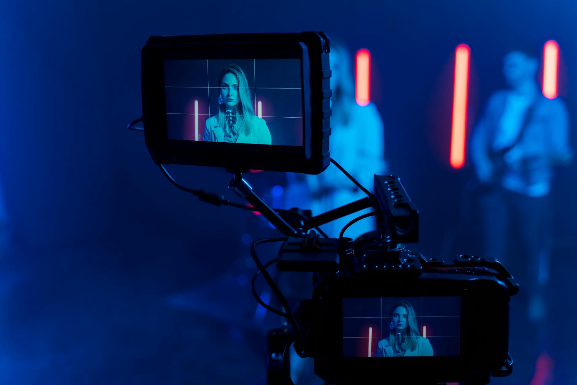
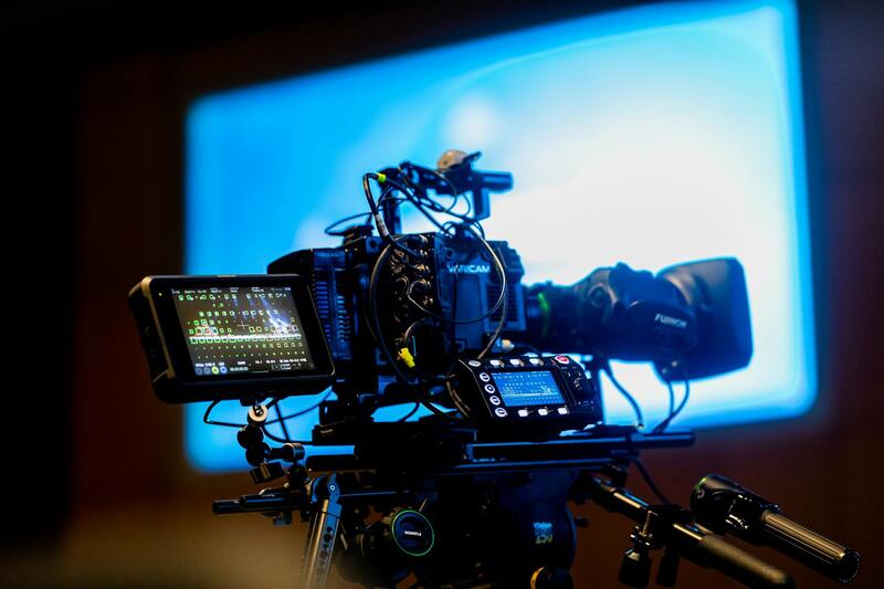
High-resolution aerial images enhancing property visibility and appeal in Miami’s competitive market
Official Procedures for Authentic Residential Drone Photography
Ensuring that your residential drone photography aligns with established protocols begins with selecting a licensed drone operator. Reputable service providers in Miami adhere to standardized processes that include comprehensive planning, operational safety measures, and adherence to specified flight paths. These professionals possess the necessary certification, which verifies their training in drone operation, safety protocols, and airspace awareness. When engaging a drone photographer, verify that they can provide proof of certification and an appropriate insurance policy, which covers potential damages or accidents during flights.
Prior to the scheduled shoot, a detailed flight plan should be discussed and approved. This plan encompasses the desired angles, altitude limits, and areas to avoid, ensuring a controlled and precise capture of images. The operator should conduct a pre-flight site assessment to identify potential obstacles such as power lines, trees, or other structures that could impede a safe flight. Once the parameters are established, the drone operator will execute the flight, capturing high-quality aerial visuals tailored to the client's specifications.
Adherence to Local Regulations and Best Practices
Miami-based drone operators follow both federal and local guidelines that govern drone flights within city limits. These guidelines typically specify restrictions on altitude, flight zones, and operational hours. Operators are often required to obtain necessary permits when flying over certain areas, especially in proximity to sensitive locations such as airports, government buildings, or public events. Ensuring compliance involves consistent communication with local authorities and adherence to posted no-fly zones.
Safety considerations are paramount, including maintaining line-of-sight with the drone, avoiding populated areas, and ensuring that flights are conducted during optimal weather conditions. Experienced operators implement risk mitigation strategies such as setting geofences, using return-to-home features, and conducting routine equipment checks to prevent malfunctions. These practices not only guarantee high-quality image acquisition but also uphold safety standards for residents and property.
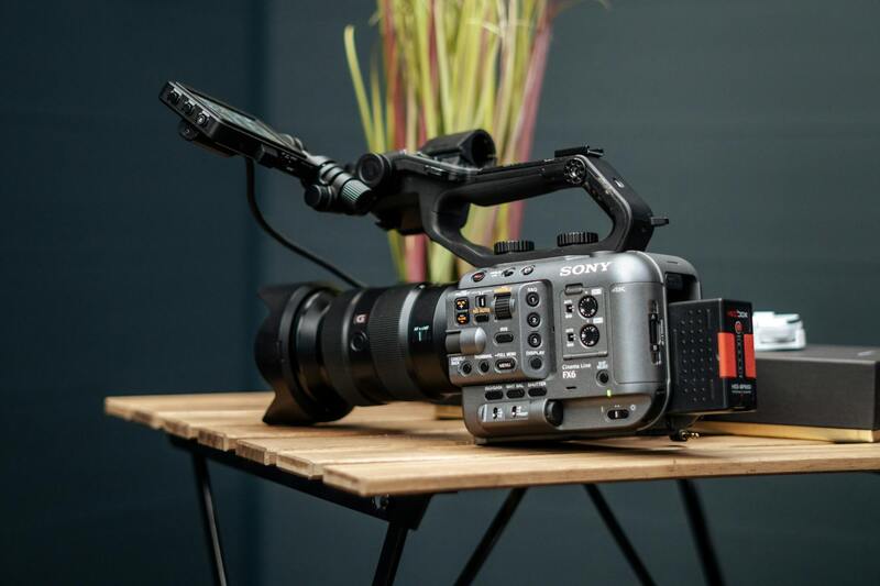
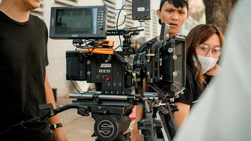
Equipment and Technology Used in Residential Drone Photography
The success of residential drone photography hinges on the deployment of advanced equipment tailored to capture crisp, detailed aerial visuals of properties. A diverse array of drones are utilized, each selected based on specific project requirements, property size, and desired image quality. High-end quadcopters equipped with stabilized gimbal systems ensure smooth, jitter-free footage even in moderate wind conditions. These gimbals maintain camera stability, allowing for sharp, professional-grade images without distortion.
Specialized cameras are integral to achieving high-resolution visuals. Many residential drone operators employ mirrorless or DSLR cameras with large image sensors, capable of capturing vivid details and accurate color reproduction. The inclusion of wide-angle lenses facilitates comprehensive views of properties and landscapes, providing potential buyers or viewers with a complete visualization.
In addition to primary imaging equipment, operators often incorporate accessories such as polarized filters, which reduce reflections from glass surfaces and water, enhancing overall image clarity. ND (neutral density) filters are also used to optimize exposure in bright lighting conditions. Advanced drones may feature obstacle avoidance sensors and GPS stabilization systems, which further enhance flight precision and safety.
It is also common to utilize programmable flight paths and autonomous flight modes. These features facilitate systematic coverage of entire properties, including intricate landscaping, backyard features, and hard-to-reach roof sections. Such technological integrations not only improve the efficiency of shoots but also ensure thorough coverage, providing clients with comprehensive visual documentation.
Overall, the combination of cutting-edge drones, precise imaging equipment, and supplementary accessories creates a robust toolkit for residential drone photography specialists. This technological synergy results in compelling visual content that effectively highlights the unique appeal of each property and supports diverse marketing and documentation needs.
Legal Regulations and Safety Considerations
Engaging in residential drone photography necessitates adherence to established operational standards designed to ensure responsible and secure drone usage. Certified operators implement protocols that maintain flight safety, protect privacy, and mitigate potential hazards. Prior to conducting shoots, professionals typically obtain necessary permissions and coordinate with property owners, ensuring clear communication regarding flight times and routes.
Aircraft used in residential drone photography are regularly inspected and maintained to guarantee optimal performance and safety. Operators employ flight planning tools that take into account local airspace restrictions, nearby structures, and environmental conditions. These measures help prevent accidents and ensure the safety of both the drone and the surroundings.
Additionally, professional drone pilots are trained to handle unexpected situations, such as sudden gusts of wind or technical issues, through emergency procedures and contingency planning. This training is complemented by insurance policies that provide coverage in the unlikely event of damage or accidents.
Courteous and strategic management of flight paths ensures minimal disturbance to residents and maximizes the quality of the footage captured. Respecting privacy boundaries by avoiding overflight of private spaces or sensitive areas is a fundamental aspect of ethical drone operation. Utilizing geofencing and no-fly zones during flight planning further supports compliance with local standards and promotes responsible imagery collection.
By integrating these practices, residential drone photography providers uphold a professional standard that emphasizes safety, respect, and high-quality results, fostering confidence among homeowners and real estate professionals alike.
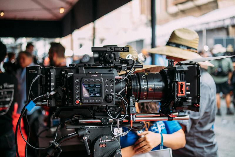
Equipment and Technology Used in Residential Drone Photography
Implementing high-quality residential drone photography requires advanced equipment and cutting-edge technology to ensure exceptional imagery and operational efficiency. Professional drone operators typically utilize multirotor or fixed-wing drones equipped with high-resolution cameras capable of capturing detailed images from various angles. These cameras often feature interchangeable lenses, stabilizers, and gimbals to achieve steady, clear footage, even in challenging conditions.
Recent advances in sensor technology enable capturing images in multiple formats, including 4K and higher resolutions, which are crucial for creating detailed virtual tours and promotional content. Some drones are equipped with infrared or thermal imaging capabilities, providing additional layers of insight, especially for inspection or specialized property assessments.
Flight controllers integrated with GPS and GLONASS systems facilitate precise navigation, allowing automated flight paths that improve coverage and consistency. Obstacle detection sensors, such as LiDAR or visual sensors, enhance safety by preventing collisions with trees, power lines, or structures during flight.
Software plays a significant role in the process, with professional-grade flight planning and image processing programs allowing for comprehensive pre-flight planning, real-time monitoring, and post-flight editing. These tools help optimize flight routes, monitor aerial images quality, and stitch images seamlessly to produce high-resolution, panoramic visuals.
Legal Regulations and Safety Considerations
Operating residential drone photography services within Miami requires adherence to specific guidelines designed to ensure safety and operational excellence. These regulations govern aspects such as flight altitude, airspace restrictions, privacy considerations, and operational permissions.
Maintaining a clear understanding of airspace classifications is critical for drone operators. The Federal Aviation Administration (FAA) designates certain zones as controlled or restricted airspace, especially near airports or military installations. Proper authorization must be obtained before conducting flights within these zones, which often involves securing airspace authorizations or waivers, particularly for commercial photography endeavors.
Flight altitude limitations typically restrict drones to a maximum of 400 feet above ground level, ensuring they do not interfere with manned aircraft. Adherence to these altitude caps minimizes potential hazards and maintains safe separation from other aerial activities.
Privacy considerations are paramount when capturing images around residential properties. It is essential for operators to respect private boundaries and avoid intrusive practices. Utilizing geofencing technology helps prevent drones from entering private properties without permission, maintaining respect for residents' privacy and property rights.
In addition to regulatory compliance, dedicated pre-flight planning is crucial. This involves assessing the specific layout and surroundings of each property, identifying potential obstacles such as mature trees, Utility poles, or neighboring structures, and establishing a safe flight path. For residential areas, precision in navigation and obstacle avoidance sensors, like LiDAR and visual detection, play vital roles in preventing accidents and ensuring smooth operations.
Safety protocols include conducting thorough equipment checks before each flight, implementing emergency procedures, and maintaining line-of-sight during operations. Training professional drone pilots in both aviation regulations and practical flight skills enhances safety and results in high-quality imagery. Regular updates and adherence to evolving regulations ensure that drone activities remain compliant and secure.
By observing these official methodologies, drone operators can provide high-quality residential photography that aligns with safety standards and respects privacy boundaries, thereby fostering trust and delivering impactful visual content.
Application of Drone Photography in Real Estate Marketing
Utilizing drone photography in the promotion of residential properties has revolutionized the way real estate agents and homeowners showcase their assets. High-quality aerial imagery provides a comprehensive view of a property and its surroundings, allowing prospective buyers to grasp the full scope of the residence effortlessly. This approach highlights key features such as spacious yards, swimming pools, landscaping details, and nearby amenities, which are often challenging to capture with traditional photography methods.
Furthermore, drone footage can be integrated into virtual tours, offering an immersive experience that enhances engagement and interest. Such visual content differentiates listings in competitive markets, attracting a broader pool of potential buyers who can appreciate the property’s setting from multiple angles. The dynamic aspect of aerial videos also enables the visualization of the property's placement within the neighborhood context, offering insights into accessibility, proximity to schools, parks, and commercial centers.

Real estate professionals often combine drone imagery with traditional photographs to create compelling marketing materials. Crisp aerial shots placed alongside detailed ground-level images present a comprehensive narrative that appeals to potential buyers. Additionally, the speed and efficiency of drone photography allow for rapid turnaround times in marketing campaigns, ensuring that properties remain at the forefront of the market.
On a broader scale, real estate agencies in Miami leverage drone footage to produce virtual open houses, social media campaigns, and online listings that stand out. This strategic use of aerial imagery maximizes exposure, accelerates the sales process, and fosters more informed decision-making among prospective buyers. Properly executed drone marketing content complies with all standard operational practices, ensuring both aesthetic quality and adherence to safety protocols, which ultimately supports a positive reputation for real estate agents and agencies involved.
Ensuring Compliance with Best Practices in Residential Drone Photography
To achieve exceptional aerial imagery that showcases residential properties effectively, professional drone operators in Miami adhere to a set of established best practices. These practices encompass comprehensive planning and execution stages, from pre-flight preparations to post-shoot processing, guaranteeing safety, quality, and operational efficiency.
Pre-Flight Planning and Site Assessment
Each drone photography session begins with meticulous planning. This involves evaluating the property’s surroundings, identifying potential obstacles, and determining optimal flight paths that maximize coverage while maintaining safety standards. Conducting a thorough site assessment helps in identifying power lines, trees, neighboring structures, and any other elements that could interfere with drone operation or affect image quality.
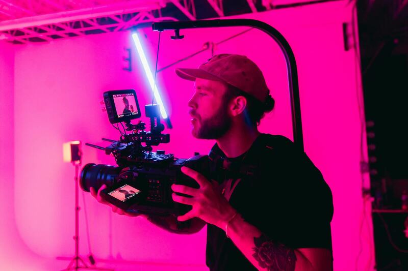
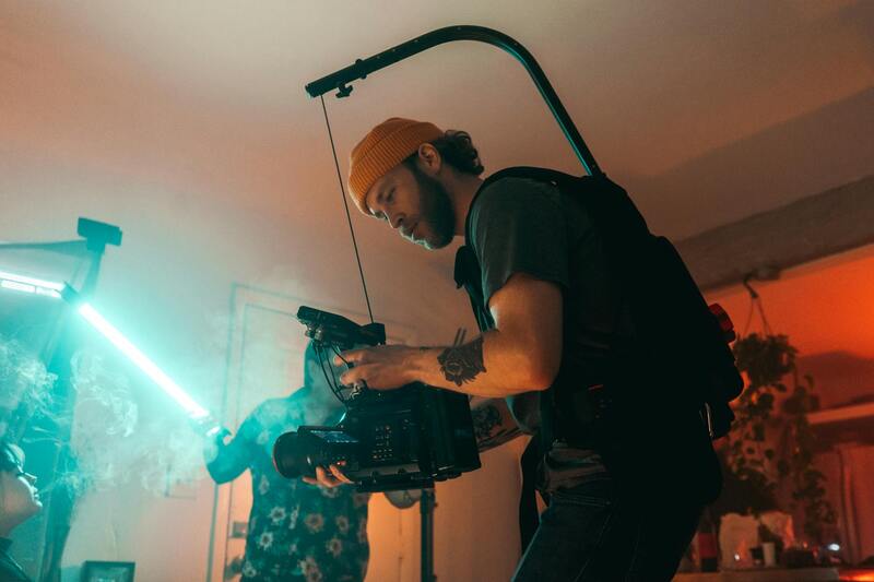
Optimal Equipment Selection
Professionals select high-resolution drones equipped with advanced stabilization systems and cameras capable of capturing sharp, detailed images from varying altitudes. These drones often feature gimbal-mounted cameras that allow precise tilting and panning, enabling dynamic and eye-catching shots of residential properties.
Operational Protocols and Safety Measures
Adherence to operational protocols includes maintaining line-of-sight during flight, avoiding flight over crowds or private properties without explicit permission, and respecting local airspace boundaries. Weather conditions such as wind, rain, or fog are also carefully monitored, ensuring flights are executed under safe conditions that prevent equipment damage or compromised images.
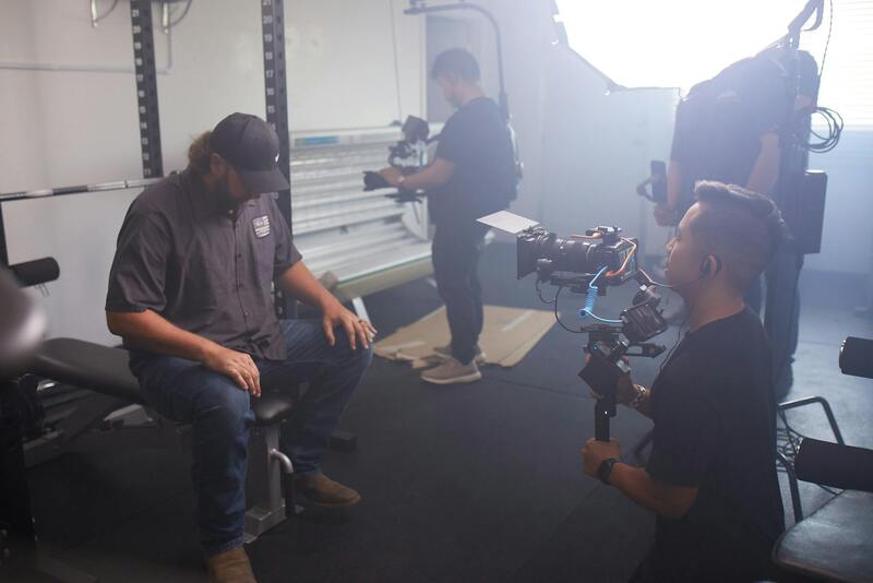
Image Capture and Data Management
During flight, multiple images and video clips are recorded from various angles and heights, capturing the property’s layout, roof details, and surrounding environment. Operators utilize autopilot modes and GPS-assisted controls for precise maneuvering. Post-flight, the data undergoes meticulous editing, color correction, and formatting to produce polished visual content suitable for marketing or documentation purposes.
Training and Certification
Expertise in residential drone photography is reinforced through specialized training programs that cover operation techniques, safety procedures, and industry standards. Certifications from authorized aviation authorities further attest to a professional’s ability to conduct drone flights responsibly and efficiently, which is vital when operating in residential areas with sensitive privacy considerations.
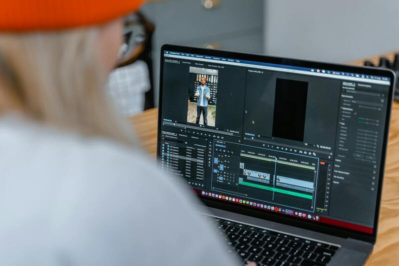
Post-Processing and Delivery
Once the flight data has been captured, skilled editors enhance the visuals using professional software, optimizing lighting and perspective to produce compelling imagery. The final deliverables—high-resolution images, virtual tours, or aerial videos—are then provided promptly to clients, ready for use in marketing, documentation, or personal viewing purposes.
By following these official, well-established procedures, residential drone photography in Miami can be executed seamlessly, providing clients with remarkable visual assets that accurately reflect the property’s unique features while upholding safety and operational excellence.