Understanding Drone Photography in Real Estate
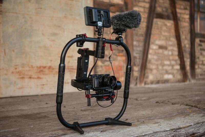
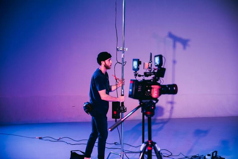
Drone photography has revolutionized the way properties are showcased, providing unique aerial perspectives that were previously difficult to capture. This technology involves the use of unmanned aerial vehicles (UAVs) equipped with high-resolution cameras to create detailed images and videos from a bird’s-eye view. As real estate continues to evolve, especially in competitive markets like Miami, drone imagery has become an essential tool for agents and sellers aiming to present properties in the most appealing manner.
Over the past few years, the integration of drone technology into real estate marketing has seen exponential growth. The ability to capture expansive views of the property perimeter, nearby amenities, and the surrounding neighborhood adds significant visual depth to listings. This comprehensive portrayal helps potential buyers grasp the true scale and context of the property, which traditional ground-level photography might fail to convey fully.
In Miami, where waterfront properties and expansive estates are prevalent, drone photography offers an unparalleled advantage. It accentuates the property's proximity to beaches, parks, or city skylines, emphasizing lifestyle benefits that appeal to prospective buyers. As the real estate landscape becomes increasingly digital, the quality and scope of aerial images tend to influence not just viewer engagement but also the perceived value of a listing.
Employing drone photography in real estate isn’t just about capturing impressive visuals; it’s about providing detailed, comprehensive views that allow potential buyers to visualize the property in its entirety. From showcasing expansive backyard spaces to highlighting architectural details from above, drone images serve as a powerful tool in crafting an effective and compelling property presentation. This modern approach to visual storytelling has increasingly become a standard expectation in Miami’s competitive market, where first impressions often determine the success of property sales.
Factors Connecting Drone Imagery and Real Estate Prices
High-quality drone imagery has become a pivotal element in the real estate market, especially in a vibrant and competitive city like Miami. The impact of these images on property prices can be attributed to several interrelated factors that emphasize the importance of professional aerial photography.
Firstly, drone images significantly enhance the visual appeal of a listing. By capturing expansive views of the property and its surroundings, they offer potential buyers a comprehensive perspective that ground-level photos cannot provide. This panoramic representation helps illustrate the size, layout, and value of the property more effectively, often making listings more attractive and credible.
Secondly, drone images emphasize unique selling points that can command higher prices. Waterfront locations, sprawling outdoor spaces, scenic vistas, and proximity to amenities such as parks or beaches are more vividly showcased through aerial shots. These features, highlighted effectively by drone photography, increase perceived value, encouraging buyers to offer more competitive bids.
In addition, drone imagery can reveal the true scale of outdoor elements, such as gardens, pools, or recreational areas, which may be understated or obscured in traditional photos. This clarity provides a realistic perspective, helping buyers assess the property's potential accurately. As a result, listings that incorporate professional drone images often attract more serious inquiries and tend to sell at superior prices.
The influence of drone photography extends beyond visuals; it impacts the perception of a property's overall desirability. Enhanced visual storytelling fosters trust and confidence among buyers, making the property seem more valuable and worth a premium. The trend is particularly evident in Miami's luxury market, where buyers seek properties that stand out visually and offer a comprehensive view of their investment.
Property developers and sellers who leverage drone imagery in their marketing strategies often position their listings as premium options. This positioning, supported by striking aerial visuals, can create a competitive edge, directly correlating to increased sale prices. Consequently, understanding the connection between drone imagery and property valuation is essential for professionals aiming to maximize returns in Miami's bustling real estate scene.
Factors Connecting Drone Imagery and Real Estate Prices
In the competitive Miami real estate landscape, the strategic use of drone imagery plays a crucial role in influencing property valuation. When high-quality drone pictures are integrated into property listings, they serve as a powerful visual asset that can elevate a property's market perception. This is particularly significant in Miami, where luxury homes and sprawling estates often feature expansive outdoor spaces, breathtaking views, and unique architectural details that are best captured from above.
Several key factors link drone imagery directly to property prices. Firstly, drone photographs deliver comprehensive aerial perspectives that showcase the property's surrounding environment. This allows potential buyers to appreciate the full extent of outdoor amenities such as landscaped gardens, outdoor entertaining areas, water features, and proximity to desirable locations. When these elements are presented through crisp, professional drone images, they often translate into higher perceived value, encouraging buyers to consider offers at premium levels.
Secondly, drone visuals can highlight the scale and grandeur of a property more effectively than traditional ground photos. For luxury real estate, capturing the grandeur of the estate from the air provides a sense of exclusivity and prestige, which can be a decisive factor in setting higher asking prices. Additionally, aerial shots can reveal property features that are hidden or difficult to photograph from the ground—such as the layout of multiple structures, roof conditions, or access points—adding a layer of transparency that boosts buyer confidence.
Another aspect is the emotional impact created by striking aerial visuals. Drone photography enhances storytelling by providing dynamic, panoramic views that evoke a sense of lifestyle and exclusivity attached to Miami properties. When listing images stir emotional responses, potential buyers are more inclined to assign a higher value to the property, which can reflect in increased market prices.
Furthermore, an integrated visual strategy that emphasizes drone imagery can position a property as a premium offering, setting it apart from competitors. Properties that leverage this technology often attract more serious inquiries and generate higher competitive bidding, directly impacting final sale prices. As the market continues to evolve, the ability to present an immersive, detailed view of a property from above becomes a market advantage—aligning visual presentation directly with property valuation and pricing strategies.

Ultimately, the connection between drone imagery and property valuation highlights a broader trend towards innovative marketing practices within Miami’s real estate sector. High-quality aerial visuals not only enhance listing appeal but also create tangible value perceptions that translate into higher market prices. For professionals aiming to maximize returns, understanding and leveraging the impact of drone photography remains a vital component of a successful marketing strategy in today’s competitive environment.
Factors Connecting Drone Imagery and Real Estate Prices
High-quality drone imagery significantly impacts how prospective buyers perceive a property’s value. The clarity and resolution of aerial images are paramount, as crisp visuals allow viewers to appreciate every detail of the property and its surroundings. When images are pixelated or blurry, viewers may question the professionalism of the listing, potentially diminishing confidence in the property’s worth.
Angles and perspectives captured through drone photography play a critical role in shaping perceptions of a property's value. Strategic use of vantage points—such as top-down views or panoramic shots—highlight expansive land, unique architectural features, and proximity to desirable amenities. For instance, a well-composed shot showcasing a sprawling backyard or waterfront access can elevate the perceived desirability and, consequently, the price point.
Presenting a property through engaging, well-organized imagery enhances buyer engagement, making the listing stand out in a crowded market. The presentation must be curated to tell a story about the property's lifestyle appeal, emphasizing its exclusivity and scenic benefits. Such visual storytelling creates an emotional connection, which is a decisive factor in real estate valuation.
Similarly, the integration of sunlit aerial views during different times of the day, or capturing seasonal landscapes, adds layers of context that influence perceived value. When potential buyers can visualize their life in the space, they tend to assign a higher worth to the property. This perception shift can lead to a premium pricing strategy, particularly for luxurious offerings where visual impact is a key motivator.
In addition, the presentation format of drone images—such as interactive virtual tours or high-resolution galleries—can amplify their influence on valuation. A cohesive visual narrative that aligns aerial shots with interior and ground-level photos helps buyers form a comprehensive understanding of the property, fostering a stronger perception of worth.
Real estate professionals leveraging advanced drone photography techniques can fine-tune their marketing approach, ensuring the imagery aligns with strategic pricing goals. Enhanced visuals create a competitive edge, attracting more qualified inquiries and facilitating favorable negotiation positions. Consequently, pristine, thoughtfully captured drone imagery isn't just about aesthetics—it serves as a key component in shaping perceived value and influencing market prices in dynamic environments like Miami.
Legal and Regulatory Considerations in Miami
In the realm of drone photography for real estate, understanding the regulatory landscape in Miami is essential to ensure smooth operations and uphold professional standards. Local agencies have established a framework that governs drone usage, emphasizing responsible and secure practices tailored to urban environments with vibrant real estate markets.
Operators must adhere to the guidelines set by agencies overseeing aerial activities, which include registration procedures, altitude restrictions, and designated flight zones. Additionally, specific protocols are in place to prevent privacy infringement and to respect airspace controls, particularly in densely populated neighborhoods and sensitive areas.
Establishing a clear understanding of these parameters safeguards your projects from disruptions and possible fines, while also protecting the reputation of your services. Furthermore, maintaining detailed flight logs and obtaining necessary permits for commercial filming can streamline the integration of drone imagery into your marketing strategies. These measures promote an ethical approach that aligns with the expectations of property owners and local authorities alike.
Being proactive in understanding and implementing Miami's drone policies not only minimizes potential setbacks but also reinforces professional credibility. It demonstrates a commitment to legal compliance, which can be pivotal in building trust with clients and partners who value transparency and operational excellence in real estate marketing.
Understanding Drone Photography in Real Estate
Drone photography has revolutionized the way properties are showcased in the real estate industry. The strategic use of UAVs (unmanned aerial vehicles) allows agents and property owners to capture expansive views and highlight features that are often difficult to present through traditional photography. High-quality drone images provide a comprehensive perspective of a property’s exterior, landscaping, surrounding neighborhood, and proximity to amenities, offering potential buyers a compelling visual narrative. Employing drone technology for property photography involves meticulous planning and execution. Skilled operators use advanced equipment to secure sharp, stabilized images that reflect the property's true appeal. Drone footage can be integrated seamlessly into marketing materials, including online listings, virtual tours, and social media campaigns, thereby boosting visibility and engagement. The evolution of drone technology has also introduced features such as 3D mapping, thermal imaging, and variable-angle shots, which provide additional layers of information and aesthetic appeal. These capabilities enable real estate professionals to craft immersive experiences that set their listings apart in a competitive market. As a result, the quality of drone visuals directly influences the property's perceived value and attracts prospective buyers who prioritize detailed, professional representations of potential homes.

Role of Drone Images in Showcasing Property Features
Drone images serve as a powerful tool in illustrating the full scope and context of a property. Aerial shots can effectively display expansive land plots, sprawling gardens, modern architectural designs, swimming pools, and outdoor living spaces—all of which are crucial buyers consider during their decision-making process. Such visuals also provide insight into a property's relationship with its surroundings, including proximity to schools, parks, and commercial centers. In addition, drone photography helps to demonstrate the overall condition and layout of a property without intrusive onsite visits. This non-intrusive approach enhances the online viewing experience by providing a real-world feel, allowing prospective buyers to virtually explore the property from their devices. By emphasizing visual storytelling, agents can better communicate the unique value propositions of each listing, ultimately fostering a stronger emotional connection with potential buyers. A well-placed drone shot can highlight panoramic views, natural features, or access points that might otherwise be overlooked, turning a standard listing into a captivating visual presentation.

Impact of Drone Photos on Property Price Perception
High-quality drone imagery significantly influences how potential buyers perceive the value of a property. Premium aerial shots can elevate a listing’s attractiveness, making it seem more desirable and exclusive. Properties represented with compelling drone visuals often command higher interest levels, which can translate into increased offers or quicker sales. Furthermore, drone images tend to reduce uncertainties by providing a comprehensive overview, giving buyers confidence in the property's condition and surroundings. This clarity alleviates reservations and encourages more decisive engagement, often reflected in better negotiation positions for sellers. Additionally, for properties with unique features—such as waterfronts, large acreage, or private retreats—drone imagery accentuates these selling points, emphasizing exclusivity and potential lifestyle benefits. This heightened perception of value can directly impact the listed price and the final sale amount, especially in competitive markets.
Factors Connecting Drone Imagery and Real Estate Prices
Drone photography has become an influential element in the perception of property value within the Miami real estate market. Several factors explain how high-quality aerial images directly impact property prices and buyer interest. First, the scope and clarity provided by drone images offer an expansive view of the property’s surroundings, including neighborhood amenities, property size, and access points. These visual advantages help buyers assess the overall desirability, making properties stand out in listings and attracting a targeted audience.
Secondly, drone imagery enhances the visual storytelling of a property’s unique features. For waterfront properties, drone shots showcase panoramic views of the water, private docks, or boat access, which significantly adds to the property's appeal and perceived value. For properties nestled within lush landscapes or with extensive acreage, aerial photographs effectively communicate the scale, privacy, and lifestyle benefits, reinforcing their exclusivity.
Another contributing factor is the emotional connection created through immersive visuals. High-quality drone shots stimulate a sense of place and lifestyle that static images or ground-level photos may not capture. This emotional engagement often results in increased buyer interest, higher bid levels, and a more competitive market environment, ultimately influencing the property’s price point.

Furthermore, drone images contribute to transparency and confidence in the property viewing process. Buyers can more accurately evaluate the property’s size, layout, and surroundings before scheduling physical visits, reducing uncertainties and expediting decision-making. This clarity often translates into quicker sales at higher prices, particularly for high-end or luxury properties where visual impressions are crucial.
Benefits of Using Drone Pictures for Miami Real Estate Listings
- Enhanced Visual Appeal: Drone shots add a dramatic, professional touch, making listings stand out in competitive markets.
- Showcase of Property Scale and Surroundings: Aerial images provide context that ground photos cannot, such as neighborhood amenities, proximity to water, parks, or cityscape.
- Marketing Versatility: Drone visuals are highly adaptable for online listings, virtual tours, social media campaigns, and promotional materials, broadening reach and engagement.
- Highlighting Unique Features: Waterfront access, expansive land, or architectural highlights are more effectively showcased from above, emphasizing the property's exclusivity.
- Faster Buyer Decision-Making: Improved visual clarity and emotional engagement foster quicker offers and reduced days on market.
Legal and Regulatory Considerations in Miami
Operators deploying drone imagery for real estate in Miami must adhere to specific local guidelines that govern aerial photography. This includes complying with airspace regulations and obtaining necessary permits when capturing images over private properties or areas with sensitive environmental or security considerations. Properly managing these elements ensures that the imagery collection process remains smooth and professional, reinforcing trust with clients and maintaining a positive reputation within the marketplace.
Engaging licensed and experienced drone operators who are familiar with Miami’s specific requirements can mitigate potential issues and guarantee that all images are captured legally and ethically. This diligence not only safeguards the integrity of the real estate marketing process but also validates the high standards associated with premium property listings.
Maximizing Value Through Drone Photography in Miami Real Estate
Drone images serve as a decisive factor in appraising property worth, especially in dynamic markets like Miami where visual impact significantly influences buyer perception. When high-quality drone photos are integrated into listings, they not only enhance the aesthetic appeal but also provide a comprehensive view of the property’s outdoor features, surroundings, and architectural details. This comprehensive visual documentation helps potential buyers and appraisers assess the full scope of the property’s value, often leading to higher bidding enthusiasm and an increased final sale price.
Furthermore, drone visuals can highlight aspects that traditional photography might overlook, such as the property's proximity to key amenities, access points, or the scenic quality of nearby water bodies. These elements, crucial in Miami’s real estate landscape, directly correlate with market valuations. The strategic positioning of drone shots—showcasing waterfront views, expansive plots, or luxurious outdoor living spaces—can significantly elevate perceived property value, making listings more attractive and justifying premium pricing.
Analysts and real estate professionals also recognize that properties with immersive drone visuals tend to generate increased online engagement and showings. Elevated interest levels contribute to a competitive market environment, which can lead to upward adjustments in property prices. In highly sought-after Miami neighborhoods, where visual storytelling is key, the integration of aerial imagery ensures that listings stand out, capturing attention amidst the multitude of available options.
Connecting Drone Imagery with Market Dynamics
- Property Scarcity and Drone Showcase: In neighborhoods with limited inventory, compelling drone photos can accentuate exclusive features, making properties appear more desirable and supporting higher price points.
- Market Trends and Buyer Preferences: As buyer preferences lean towards virtual and remote viewing options, optimized drone content adapts seamlessly, encouraging quicker offers and influencing market values accordingly.
- Enhanced Perception of Value: Visual storytelling through drone shots creates an emotional connection, which can justify higher asking prices by emphasizing lifestyle benefits and property uniqueness.
Leveraging Drone Images for Strategic Marketing
For Miami real estate agents and developers, deploying drone imagery as part of a comprehensive marketing campaign can significantly impact property pricing strategies. High-quality aerial photos are particularly effective in competitive markets, ensuring listings are more visible across digital platforms, including social media, virtual tours, and premium listing portals. This increased visibility can accelerate sales cycles and elevate property prices, especially when combined with targeted advertising campaigns.
Implementing drone photography with a professional approach guarantees that images depict properties accurately and attractively, reinforcing the value proposition to prospective buyers. Consistent use of compelling aerial visuals positions listings as premium offerings, justifying and often encouraging higher pricing aligned with the property's market potential.