Benefits of Aerial Photography in Real Estate
In the competitive Miami real estate market, capturing the attention of potential buyers requires more than just traditional listing photographs. Aerial photography has become a vital tool for estate agents aiming to present properties in a compelling and distinctive manner. Utilizing high-quality aerial images can significantly enhance property listings by providing a comprehensive view that ground-level shots often cannot achieve.
One of the primary advantages of aerial photography is its ability to attract more prospective buyers by showcasing the full scope of a property's lot and surroundings. This is especially valuable for large estates, waterfront properties, or homes with significant outdoor amenities. Well-composed aerial shots allow potential buyers to appreciate property boundaries, landscaping design, and neighboring features at a glance.
Furthermore, aerial imagery offers an exceptional way to highlight unique property features. For example, expansive gardens, pools, tennis courts, shaded patios, or guesthouses can be displayed prominently, emphasizing the property's luxury and lifestyle appeal. The panoramic perspective provides a sense of scale and grandeur that enhances the property's perceived value.
In an increasingly visual-driven marketplace, aerial images serve to differentiate listings from competitors. A property with striking, professional-quality aerial visuals stands out in online listings, social media campaigns, and marketing brochures. These images not only captivate the viewer but also convey a sense of professionalism and thoroughness on the part of the estate agent, fostering trust and confidence among potential buyers.
Additionally, aerial photography facilitates a narrative about the property's location advantages. Proximity to beaches, parks, transportation hubs, and commercial centers can be depicted vividly from above, aiding buyers in visualizing the property's neighborhood context. This broader perspective helps in positioning the property as part of a desirable community or lifestyle.
Overall, integrating aerial photography into real estate marketing strategies enables agents to present properties more effectively, reach wider audiences, and ultimately accelerate sales. As technology advances and image quality continues to improve, aerial imagery remains a compelling asset in showcasing the full potential of any property in the Miami area and beyond.
Types of Aerial Photography Equipment and Techniques
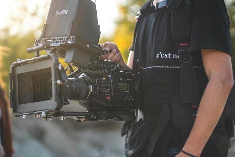
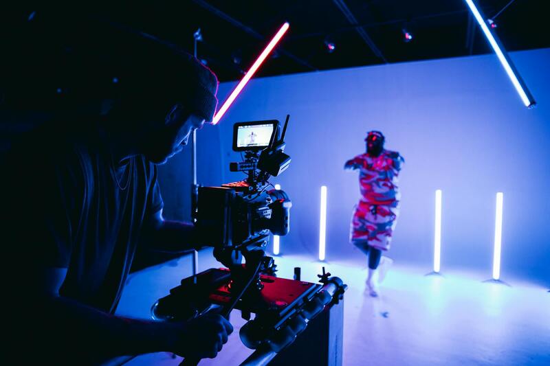
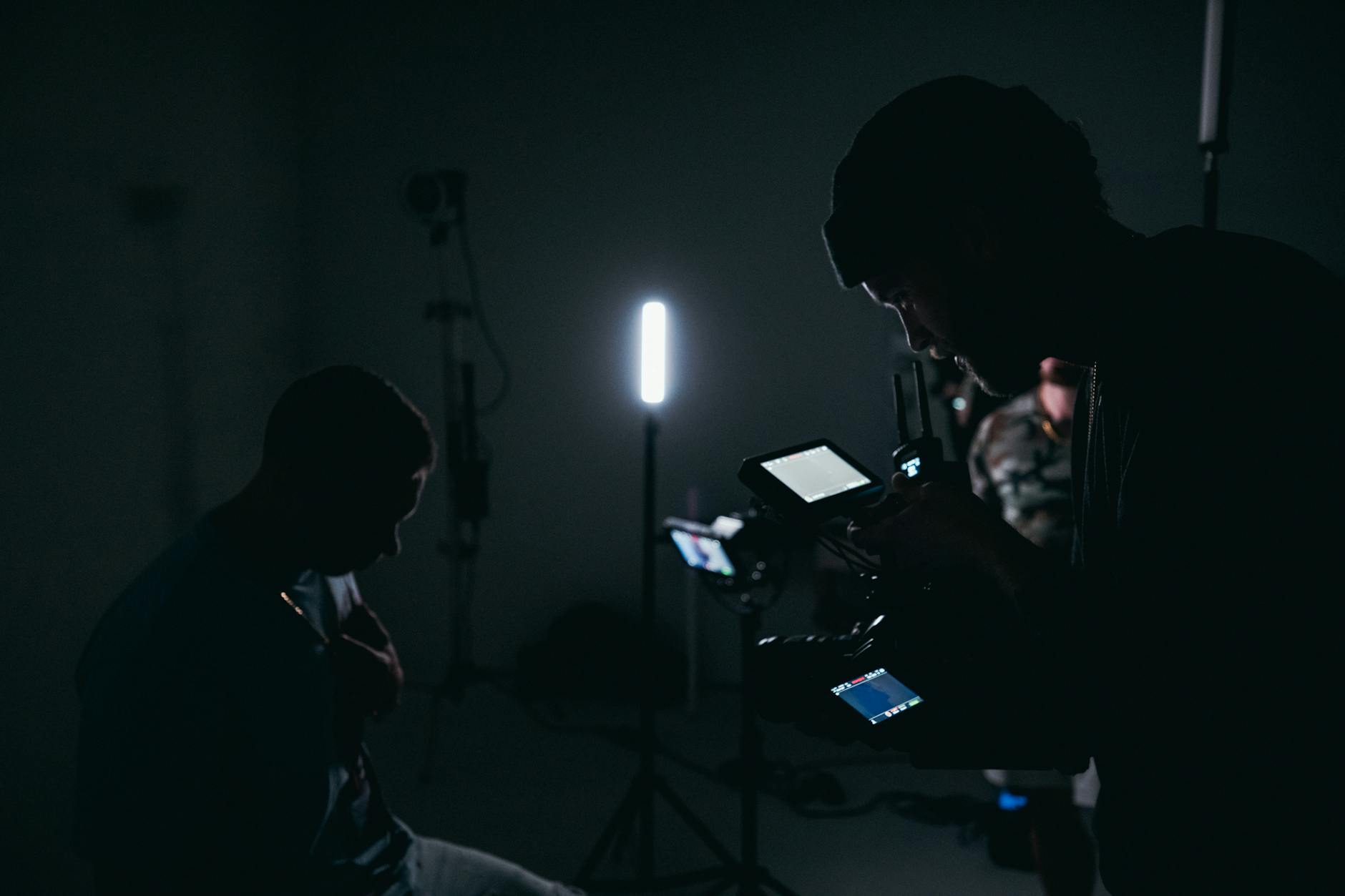
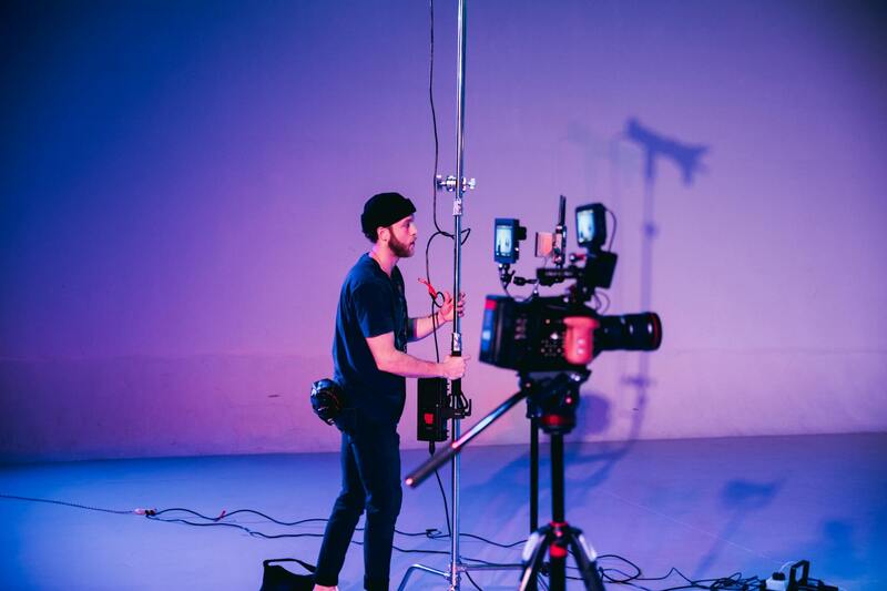
To achieve captivating and professional-quality aerial images, estate agents and photographers rely on a variety of advanced equipment and shooting techniques. The core technology used in modern aerial photography is predominantly drone-based, providing flexibility and access to previously inaccessible viewpoints, with minimal disruption to the property or surroundings.
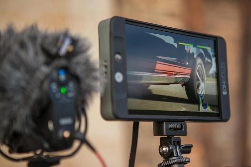
Drone technology has evolved significantly, with lightweight, portable units equipped with high-resolution cameras capable of capturing detailed images from multiple angles. These drones often feature stabilized gimbals, which ensure smooth footage even in turbulent conditions, resulting in sharper and more appealing visuals. High-end camera options include full-frame sensors and wide-angle lenses, allowing for expansive vistas and crisp detail, essential for showcasing large estate properties.
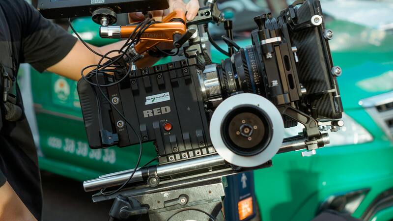
In addition to drone-mounted cameras, traditional aerial photography methods such as helicopter or light aircraft flights are occasionally employed, particularly for extensive land parcels or commercial developments. These methods provide a broader perspective, but typically require more planning, higher costs, and logistical coordination.
Shooting techniques in aerial photography involve strategic planning to maximize visual impact. Common methods include:
- Vertical Shoots: Capturing images directly overhead for clear property boundaries and land assessment.
- Oblique Angles: Angled shots that provide a dynamic perspective, emphasizing architectural details and landscaping.
- Panoramic Shots: Combining multiple images to create wide, sweeping vistas, ideal for emphasizing expansive estates and surrounding environments.
- Time-of-Day Selection: Opting for golden hour lighting to add warmth and depth to images, highlighting textures and natural features.
Proper planning and an understanding of both equipment capabilities and shooting techniques are vital. Skilled operators are able to select appropriate altitude, angles, and lighting conditions, ensuring that each shot effectively communicates the estate’s unique selling points and complements other marketing materials.
Proper Planning and Shooting Techniques for Aerial Photography
Achieving high-quality aerial images requires meticulous planning and an understanding of the unique capabilities of drone equipment. Prior to each shoot, it’s essential to determine the optimal altitude and angles that best showcase the property’s key features. This involves analyzing the estate’s layout, surroundings, and desired visual narrative.
Operators often prepare a shot list to ensure a comprehensive capture of the property. Vertical shots are used to outline property boundaries and assess land size, providing a straightforward perspective that complements marketing listings. Oblique angles introduce a dynamic element, emphasizing architectural details, landscaping, and outdoor amenities. These slightly angled images draw viewers into the property, making it more appealing and memorable.
Panoramic shots, achieved through stitching multiple images, are particularly effective for illustrating sprawling estates or their surrounding landscapes. These expansive views create a sense of scale and context that can significantly influence prospective buyers. Timing is also crucial; shooting during the golden hour—shortly after sunrise or before sunset—adds warmth and texture, further enhancing the visual appeal of each shot. Proper lighting brings out the natural beauty of the estate’s features, ensuring the images resonate on a professional level.
In addition to technical considerations, skilled drone operators are attentive to weather conditions, wind speeds, and airspace limitations. These factors influence flight safety and image quality. Clear, calm weather conditions are preferred for stable, crisp shots. Through experience, professionals can adapt their techniques to capture stunning images under various conditions, ensuring consistency and excellence in each project.
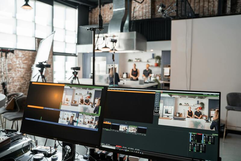
Post-production also plays a significant role. Refining images through color correction, contrast adjustments, and stitching panoramic views enhances the final presentation. When executed with precision, aerial photography not only highlights the estate’s features but also elevates the overall marketing campaign, making properties stand out in competitive markets.
Utilizing Advanced Techniques for Optimal Results
In the realm of aerial photography for estate agents, adopting advanced methods ensures high-quality imagery that effectively captures the property's essence. Techniques such as high-dynamic-range (HDR) imaging allow for detailed shots that balance shadows and highlights, making the property and landscape details stand out vividly. Additionally, aerial temporal sequencing involves capturing images at different times during the day, providing prospective buyers with a comprehensive view of how the estate appears under various lighting conditions, thus showcasing its versatility and appeal.
Utilizing Multiple Camera Angles and Perspectives
Employing a range of perspectives from different altitudes and angles allows for a more dynamic presentation of the estate. Overhead shots emphasize the entire property layout, landscaping features, and outdoor amenities, while closer-in shots focus on architectural details and finishes. By combining oblique (angled) shots with vertical (straight-down) images, estate agents can create a comprehensive visual experience that guides potential buyers through every aspect of the property. This multi-angle approach not only highlights key features but also provides a realistic sense of scale and spatial relationships that static ground-level photos may fail to deliver.
Optimal Timing and Environmental Considerations
Choosing the right timing for aerial shoots is vital for capturing the estate at its best. Early mornings and late afternoons, when natural light is softer and warmer, often produce the most appealing images. The presence of minimal wind during these periods contributes to steadier drone flights, resulting in sharper images. Moreover, environmental factors such as cloud cover, air quality, and airspace activity can impact the outcome; planning flights during clear, calm days ensures higher image clarity and safety. Experienced operators continuously monitor weather updates and airspace restrictions to adapt their flight plans accordingly, maintaining a high standard of image quality and compliance with regulations.
Legal Considerations and Regulations in Miami
In the vibrant real estate market of Miami, adherence to regulations surrounding aerial photography is essential to ensure smooth and compliant operations. Professional agencies utilize established protocols to coordinate drone flights within the urban landscape, respecting designated airspace restrictions and temporary flight zones. Extensive planning and communication with local authorities enable the seamless integration of aerial shots into property marketing without disruptions.
Operational planning involves thorough assessments of local airspace classifications, proximity to airports, helipads, and other sensitive areas. This proactive approach guarantees that all activities are conducted in a manner that aligns with regional guidelines, thereby minimizing the risk of unforeseen delays or issues. Moreover, agencies maintain updated knowledge of Miami's specific airspace regulations, whether related to special events, construction zones, or restricted areas, ensuring every flight is properly authorized.
Employing experienced pilots who are familiar with Miami’s airspace environment is crucial. They leverage their expertise to navigate complex regulations, obtain necessary permits or authorizations, and execute flights safely. This professionalism ensures that property marketing campaigns meet high standards while adhering to all operational requirements set forth by local authorities.
Additionally, advanced technologies such as geofencing and real-time monitoring are utilized to prevent drone flights from entering restricted zones inadvertently. This not only preserves safety but also reinforces the integrity of the legal process surrounding aerial videography for estate agents.
By partnering with a qualified and knowledgeable aerial photography provider, estate agents can focus on showcasing their properties effectively while confidently navigating Miami’s regulatory landscape. This ensures that visual marketing efforts are both impactful and compliant, streamlining the entire process from planning to delivery.
Integrating Aerial Shots into Property Marketing
Effective integration of aerial photography into real estate marketing strategies requires a strategic approach that highlights the property's unique features from the sky while maintaining coherence with overall promotional material. High-quality aerial imagery should be seamlessly incorporated into various marketing channels, including online listings, virtual tours, and print advertisements, to maximize impact and reach potential buyers effectively.
One of the key benefits of aerial photography is its ability to showcase expansive property landscapes, surrounding amenities, and accessibility features that might not be visible through traditional photography. When integrating these images into property listings, it is essential to choose visuals that best represent the property's value proposition. For instance, sweeping drone shots of a sprawling estate or close-up views of a luxurious backyard can create an emotional connection with prospective buyers.
Furthermore, combining aerial images with ground-level photographs establishes a comprehensive visual story of the property. This holistic presentation not only attracts interest but also provides potential buyers with a clearer understanding of the property’s layout, proximity to key attractions, and overall neighborhood appeal.
In addition to enhancing online property profiles, aerial visuals can be employed in virtual tours, enabling prospective buyers to virtually explore the property from multiple perspectives. This immersive experience can be especially beneficial for out-of-town or international clients who cannot visit in person. Video walkthroughs incorporating smooth aerial footage can further differentiate your property from competitors, making it more memorable and engaging.
Print marketing materials also benefit from aerial photography through the creation of impressive brochures, flyers, and signage. These materials, enhanced by high-resolution aerial shots, can be distributed at open houses, real estate expos, and local events, broadening the property's exposure within the community.
To ensure a cohesive marketing campaign, professionals often employ a consistent visual style that aligns aerial imagery with branding elements such as color schemes, logos, and font choices. This consistency reinforces brand recognition and lends a professional appearance to all promotional efforts.
Ultimately, incorporating aerial photography into property marketing demands thoughtful planning to align visuals with messaging strategies. When executed correctly, it elevates the property's appeal, provides a competitive edge within the Miami real estate market, and accelerates the selling process by capturing the interest of potential buyers with compelling and comprehensive visual storytelling.
Cost Considerations and Scheduling for Aerial Shoots
Efficient planning and budgeting are essential components of successful aerial photography projects for real estate. Expenses can vary depending on several key factors, including the complexity of the shoot, the equipment used, and the experience level of the aerial photographer. High-end drone technology equipped with 4K or higher resolution cameras, stabilized gimbals, and advanced flight features often command higher rates, but they also deliver superior image quality and stability, ensuring captivating visuals that highlight a property's best features.
Timing is equally important to ensure optimal lighting and minimal atmospheric interference. The best times for aerial photography are typically during the golden hours—shortly after sunrise and before sunset—when natural sunlight bathes the property in warm tones and long shadows add depth to visuals. Planning the shoot during these periods can significantly enhance the aesthetic appeal of aerial shots, making properties more inviting and visually striking.
Scheduling should be flexible, accounting for weather conditions to avoid delays caused by wind, rain, or overcast skies. Conducting a weather assessment a few days in advance enables producers and agents to choose the most suitable windows for shooting. It's also advisable to coordinate with property owners and relevant stakeholders to avoid conflicts and ensure access to the property, especially when shooting involves restricted or sensitive areas.
When budgeting, professionals often include costs for permits, insurance, and post-production editing. Permits may be necessary in certain London neighborhoods or protected zones—proactive communication with local authorities can streamline this process. Insurance coverage protects against potential liabilities or damages, which is particularly important in busy urban environments like Miami. Post-production editing, such as color correction and image stabilization, ensures the final content meets high visual standards, contributing to a polished and professional presentation.
Balancing Cost and Quality for Optimal Results
While investing in high-quality equipment and professional services may increase initial costs, the return on investment is often reflected in the enhanced visual impact and marketability of the property. Properly scheduled shoots that leverage optimal lighting conditions and weather windows can save time and reduce the need for repeat sessions, ultimately delivering more compelling imagery within budget constraints.
Cost Considerations and Scheduling for Aerial Shoots
Effective planning of aerial photography campaigns involves careful consideration of costs and timing to maximize the visual impact and marketing value of each shoot. The selection of equipment, crew, and post-production processes can significantly influence the overall budget, which must be balanced with the desired quality and reach of the imagery. Many professional aerial photography providers offer tiered service packages, allowing estate agents to choose options that best fit their marketing goals and financial plans.
Scheduling is equally critical to ensure optimal lighting conditions and weather suitability. In Miami, where weather can change rapidly, professionals typically monitor weather forecasts and atmospheric conditions days in advance. This proactive approach facilitates the identification of ideal shooting windows, reducing the likelihood of rescheduling due to adverse weather such as rain or high winds. Proper scheduling also involves coordination with property owners and stakeholders to prevent access issues or conflicts that could delay the shoot.
In addition to weather considerations, timing the shoot according to the property’s value proposition is crucial. For instance, capturing footage during sunset or sunrise can produce striking visuals that highlight architectural features and surroundings. These times often provide the best natural lighting, creating images that stand out in online listings or promotional materials.
Budgeting for aerial photography projects should also include expenses related to obtaining necessary permits, which can involve engaging with local authorities or property management entities, especially in restricted or sensitive zones. Insurance coverage is another vital component, protecting against potential damages or accidents during flight operations. Skilled operators and crew may also require specific permits and certifications, which should be factored into the planning process.
Leveraging experienced professionals who are familiar with Miami’s regulatory landscape and weather patterns ensures that the shoot proceeds smoothly and efficiently. Communicating clearly with all involved parties about timing, expectations, and access details prevents unforeseen delays. When executed thoughtfully, aerial photography not only enriches the visual presentation of properties but also optimizes marketing campaigns for faster sales and higher property valuations.