Importance of Drone Photography in Real Estate Marketing
In the competitive landscape of the real estate market, visual appeal plays a crucial role in capturing the interest of prospective buyers. High-quality imagery, especially aerial views, offers a compelling perspective that traditional ground photography cannot replicate. Drone photography elevates property listings by providing comprehensive, detailed, and dynamic visual content that highlights the unique features of each property. These aerial images and videos allow potential buyers to assess property size, layout, and surrounding amenities from a bird's-eye view, fostering a better understanding of the property's overall value.
Utilizing professional drone photography services enables real estate agents and property developers to distinguish their listings in a crowded marketplace. Engaging aerial shots can illustrate property boundaries, landscape features, nearby infrastructure, and neighborhood character, which are critical factors influencing buyer decisions. Interactive virtual tours and high-resolution footage can significantly increase online engagement, leading to faster sales and higher offers.
In addition, aerial photography helps showcase hard-to-capture areas such as rooftops, swimming pools, large gardens, and expansive open spaces. These visual assets are particularly effective in marketing luxury homes, commercial properties, and developments where the scope of the property extends over a broad area. By integrating drone footage into marketing strategies, real estate professionals enhance credibility and demonstrate their commitment to quality presentation.
Ultimately, effective drone photography translates into a competitive edge, ensuring listings stand out to wider audiences. When executed with precision and professionalism, aerial imagery becomes a vital component of modern real estate marketing, facilitating a seamless connection between property features and buyer interest. This approach not only attracts more inquiries but also accelerates the sales cycle, making it a smart investment for real estate marketing campaigns.
Equipment and Technology Used in Professional Drone Photography
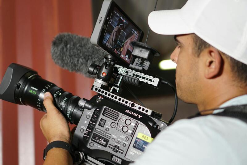
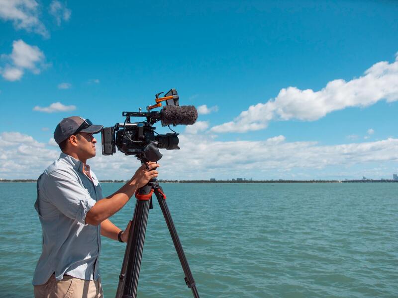
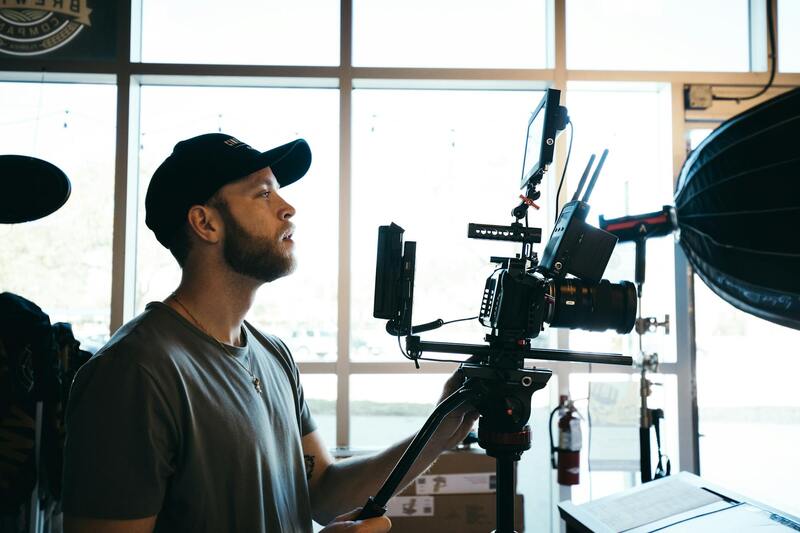
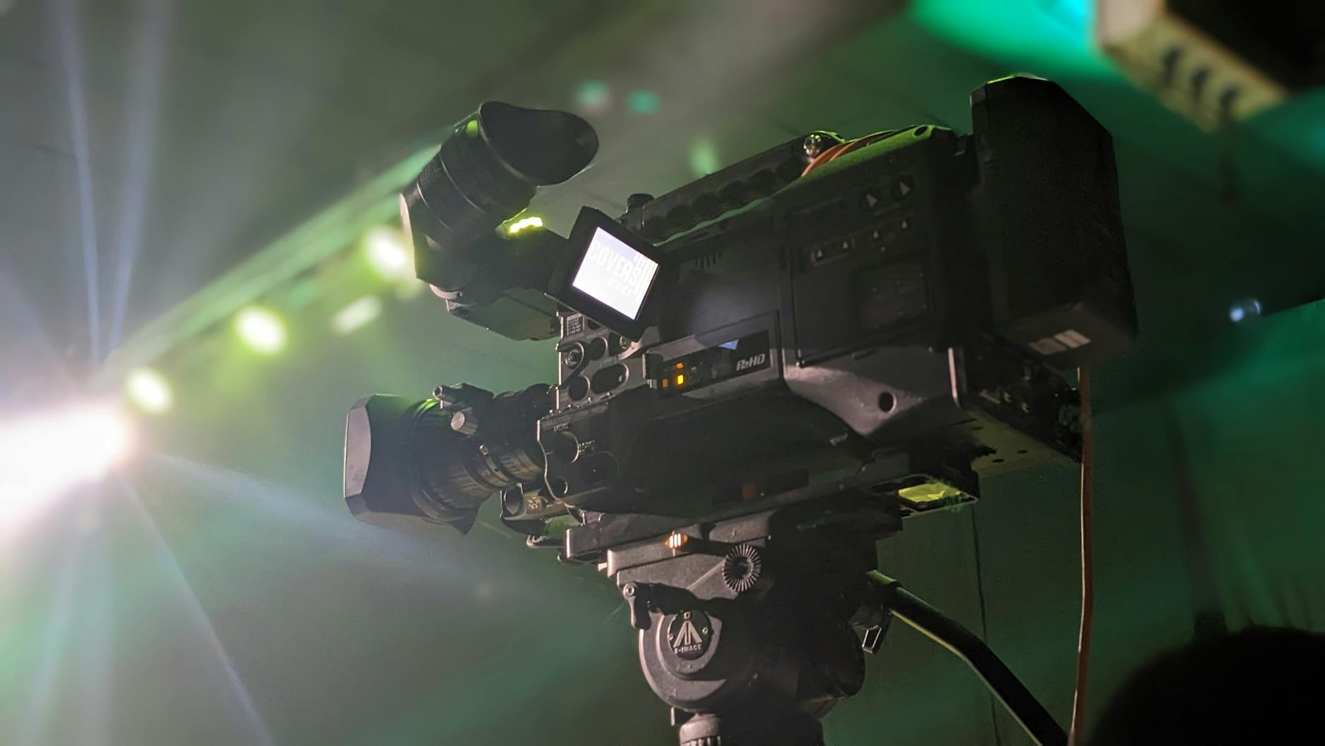
To achieve high-quality, impactful aerial images and videos of real estate properties, professionals rely on advanced drone equipment combined with cutting-edge technology. The core components include UAVs equipped with high-resolution cameras capable of capturing detailed imagery from varying altitudes and angles. Flight stability is paramount, hence drones are outfitted with sophisticated gimbals that ensure smooth, jitter-free footage even in moderate wind conditions.
Modern drone cameras typically feature sensors with large apertures to enhance low-light performance and deliver sharper images with vibrant colors. Professionals also utilize interchangeable lenses to adapt to diverse property types and shooting environments. For instance, wide-angle lenses are ideal for capturing expansive landscapes or large estates, while zoom lenses allow for close-up shots without physically approaching sensitive areas.
Advanced flight controllers and GPS systems enable precise navigation and automated flight paths, which are crucial for systematic coverage of large properties. These systems facilitate various shooting modes, including orbit, waypoint navigation, and follow-me functionalities, allowing for dynamic video sequences and comprehensive coverage without manual control. Additionally, high-capacity batteries ensure prolonged flight times, allowing more extensive shoots in a single session.
Best Practices for Capturing Effective Aerial Property Shots
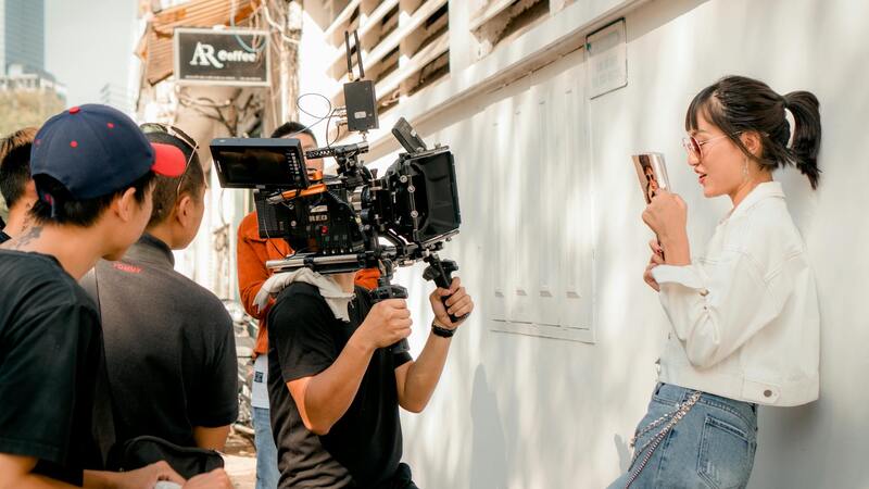
Capturing compelling drone imagery requires a combination of technical skill, strategic planning, and an understanding of the property’s unique features. Prior to flying the drone, a detailed assessment of the property and lighting conditions is essential. Optimal times for shooting often include early morning or late afternoon when natural light is softer, reducing harsh shadows and glare.
During flight, maintaining smooth, steady movements is critical to produce professional-looking footage. Pilots should plan flight paths that highlight the property's most attractive features, such as landscaped gardens, swimming pools, and distinctive architectural elements. Elevation is also a key factor; flying at different heights can provide varied perspectives, from sweeping overview shots to close-up details.
It’s important to avoid obstructed lines of sight and to respect surrounding properties and infrastructure. Clear, unobstructed views are essential to showcase the property's full scope. Using a combination of static shots and dynamic fly-throughs ensures viewers can appreciate both the layout and essence of the property.
Equipment and Technology Used in Professional Drone Photography
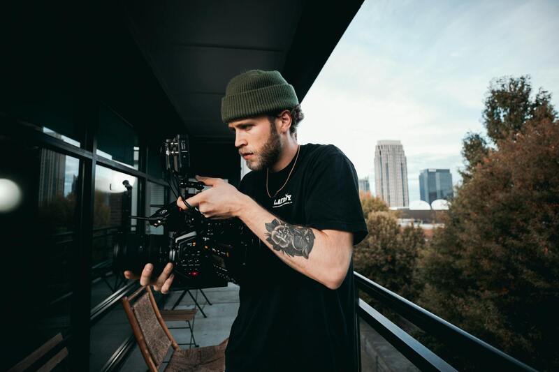
Achieving high-quality aerial imagery for real estate listings depends fundamentally on the selection of advanced equipment and cutting-edge technology. Professional drone operators employ a combination of sophisticated drones, high-resolution cameras, and stabilization systems to produce stunning visuals that captivate potential buyers and accurately represent the property.
Drones Designed for Professional Use
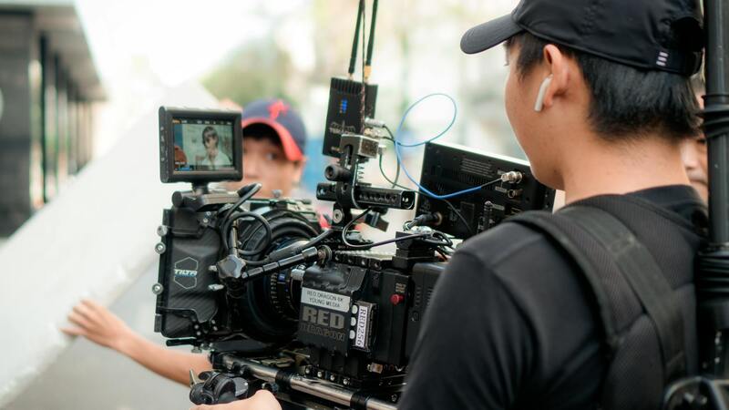
Industrial-grade drones feature powerful flight controllers capable of precise maneuvering and extended flight times, essential for covering expansive properties without frequent battery changes. These drones typically incorporate obstacle avoidance sensors, enabling safer operation in complex environments, especially in the proximity of structures, trees, or power lines.
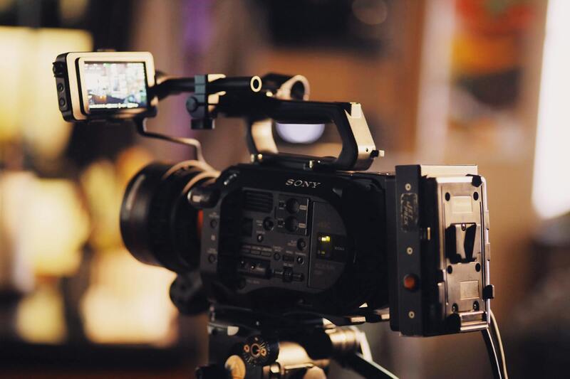
High-Resolution Cameras and Sensor Equipment
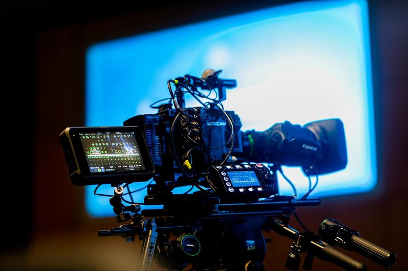
At the core of professional aerial photography is the use of high-resolution cameras capable of capturing detailed images in 4K or higher resolutions. Many systems employ interchangeable lens options, allowing flexibility in framing and depth of field to highlight specific architectural features or landscape elements.
Furthermore, sensors capable of capturing HDR imagery ensure well-balanced exposures in varying lighting conditions, particularly during sunrise or sunset shoots, when natural light can be challenging to manage. This technological advancement aids in producing images that are both vivid and true to life.
Stabilization and Gimbal Technology
Gimbals provide crucial stabilization during flight, reducing vibrations and compensating for drone movement. This results in smooth, professional-quality footage that enhances the visual appeal of the property. Some models incorporate 3-axis stabilization, delivering steady shots even when flying in windy conditions.
Additional Equipment and Accessories
- Extended battery packs for longer shoot durations
- ND filters to manage exposure in bright conditions
- High-capacity memory cards for extensive footage storage
- Remote controllers with real-time video feed for precise framing
Utilizing this array of advanced equipment ensures that every aspect of the property is captured in the highest possible quality, translating into compelling marketing content for real estate agents and property owners.
Equipment and Technology Used in Professional Drone Photography
Achieving outstanding aerial images requires the utilization of specialized equipment and cutting-edge technology. High-quality drones equipped with premium cameras capable of capturing images in 4K or higher resolutions form the backbone of professional real estate photography. These cameras often feature interchangeable lenses, granting photographers the flexibility to select the optimal focal length for architectural details or landscape compositions.
Sensor technology plays a vital role, with High Dynamic Range (HDR) imaging capabilities allowing for perfectly balanced exposures when shooting in high contrast lighting environments. This ensures that both shadows and highlights are rendered with clarity, vital for showcasing properties during sunrise or sunset when natural lighting can pose challenges.
Stabilization is facilitated through sophisticated gimbals, typically 3-axis systems, which compensate for drone movements and vibrations. This technology delivers smooth, cinematic footage that enhances the visual experience. When combined with features such as extended battery life, ND filters for controlling light intake, and high-capacity memory cards, drones become invaluable tools for capturing comprehensive property views.
Remote controllers featuring real-time video feeds enhance pilot control, allowing precise framing and consistent shot quality. With these technological advancements, professional drone operators can produce images and videos that meaningfully elevate real estate marketing efforts.
Best Practices for Capturing Effective Aerial Property Shots
To maximize the impact of aerial imagery, meticulous planning of flight paths and shooting angles is essential. Opting for high, sweeping shots from multiple angles provides viewers with a comprehensive understanding of the property's layout and surrounding environment. Optimal timing, such as early morning or late afternoon, offers natural lighting that accentuates structural details and landscape features.
Ensuring proper lighting and shot composition is critical. Maintaining steady drone movements, avoiding rapid or jittery motions, results in professional-grade footage that accurately represents the property's potential.
Image Placeholder_2
Implementing these best practices helps in creating compelling visual stories that attract prospective buyers and elevate the property's market appeal. Coupling technical mastery with strategic planning ensures every shot contributes meaningfully to effective marketing campaigns.
Ensuring Quality and Adherence to Best Practices in Drone Photography
Achieving outstanding results in professional drone real estate photography requires adherence to proven techniques that emphasize safety, image quality, and consistency. First and foremost, meticulous pre-flight planning is essential. This involves assessing weather conditions, ensuring proper flight permissions, and identifying optimal shooting locations to capture the property from the most advantageous perspectives.
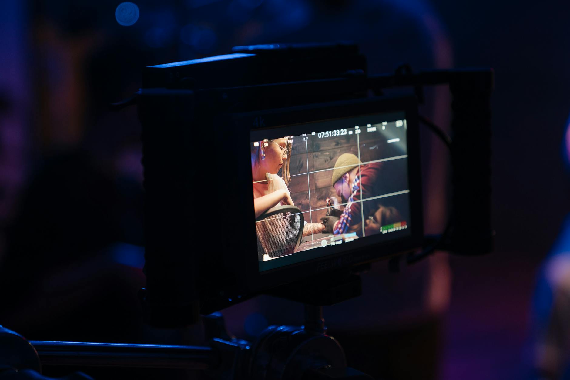
Equipped with high-resolution cameras, professional drone operators focus on utilizing optimal camera settings tailored for real estate imagery. This includes adjusting ISO levels for clarity, setting appropriate shutter speeds to minimize motion blur, and employing filters to manage reflections or glare. These adjustments ensure that visual content showcases properties in the most flattering light, highlighting both the structure and the surrounding landscape effectively.
Integral to this process is choosing the right flight paths and angles. High, sweeping shots from various vantage points convey the property's size and context within its environment, while closer, detail-focused shots emphasize unique architectural features. When planning these movements, maintaining steady and controlled flight paths prevents jittery footage, resulting in a smooth, professional appearance.
Timing plays a crucial role; shooting during golden hours—early morning or late afternoon—utilizes natural lighting that enhances textures and colors, creating more inviting and attractive visuals. Furthermore, operators should consider year-round weather patterns to avoid capturing images during cloudy or rainy periods, which can obscure details and reduce overall image impact.
Post-flight, the editing process is pivotal in refining the captured footage. Adjustments to color grading ensure that the images possess vibrancy and depth, accurately representing the property's true appearance. Stabilization tools within editing software correct minor camera shakes, providing smooth, cinematic transitions essential for marketing presentations. Adding overlays, branding, or annotations can also enhance informational content and viewer engagement.
Legal considerations often extend to equipment use and flight operations, with platforms requiring strict adherence to established guidelines. Using certified, well-maintained drones and complying with operational protocols enhances safety and reliability, which ultimately translates into higher-quality results. Maintaining a comprehensive understanding of the latest advancements in drone technology ensures continuous improvement of visual assets, further elevating the standard of real estate marketing efforts.
Investing in professional-grade equipment and training ensures that every aerial shot aligns with the highest standards of quality and professionalism. As a result, real estate listings benefit from striking visual storytelling that attracts potential buyers and helps properties stand out in competitive markets.
Leveraging Official Licensing and Certification for Drone Photography
Engaging in professional drone real estate photography involves adhering to a set of established standards and certifications that demonstrate expertise and commitment to safety and quality. Certified drone operators typically hold industry-acknowledged credentials issued by recognized organizations or regulatory bodies, confirming their training in navigation, safety protocols, and responsible operation. These certifications often require operators to pass rigorous examinations that cover technical knowledge, airspace management, and safety measures, ensuring they are well-equipped to handle complex shooting environments while maintaining high standards of professionalism.
Using certified operators reassures clients that the drone work complies with the best practices established by industry leaders. It also underscores the operator's dedication to ongoing education, staying current with technological advancements and evolving best practices. Certifications may include specific endorsements for aerial photography, videography, or specialized environmental conditions, providing added confidence in the ability to deliver exceptional imagery consistently.
Utilizing Commercial Drone Software and Authorized Airspace Management
In addition to personal certifications, utilizing officially sanctioned flight planning and management software ensures that flights are done within permitted airspace boundaries. These tools incorporate real-time airspace data, restrictions, and notifications about temporary flight advisories or no-fly zones. This approach minimizes risks associated with unauthorized airspace breaches and enhances operational safety.
Moreover, integrating authorized airspace management platforms can streamline flight permissions, reduce project delays, and reinforce a professional image. Professionals typically collaborate with local authorities and use certified platforms to pre-plan flights, especially in urban environments like Miami where airspace can be busy and regulated. This layered approach to compliance underscores a commitment to responsible operation while achieving high-quality results.
Maintaining Equipment and Software Compliance for Consistent Quality
Consistent quality in drone real estate photography relies heavily on the maintenance and calibration of equipment and software. Professional operators regularly service their drones to preserve performance capabilities, ensuring stability, image resolution, and obstacle avoidance systems function optimally. Firmware updates are routinely applied to keep hardware compatible with the latest technological standards and safety features.
Additionally, using approved and licensed imaging software guarantees data integrity and high standards in post-production processes. These tools offer advanced editing capabilities, color correction, stabilization features, and format management, which are vital for producing polished marketing materials. Regular updates and compliance checks reflect a dedication to excellence and reliable service delivery in every project.
Documentation and Record-Keeping for Transparency and Quality Assurance
Maintaining detailed records of all flights, certifications, and maintenance activities supports transparency and accountability in professional drone real estate photography. Documenting flight logs, weather conditions, and operational procedures not only demonstrates due diligence but also helps verify adherence to safety guidelines during audits or client review processes.
Proper record-keeping ensures a clear chain of responsibility, facilitates troubleshooting, and provides valuable data for improving future operations. This transparency reassures clients of the provider’s professionalism and commitment to quality, fostering trust and long-term partnerships.
Equipment and Technology Used in Professional Drone Photography
Utilizing cutting-edge equipment is fundamental to capturing high-quality aerial images that truly showcase a property's features. Professional drone operators rely on advanced UAVs equipped with high-resolution cameras, often with stabilized gimbals to ensure smooth footage even in challenging conditions. These tools allow for detailed, crisp images and videos that emphasize the property's scale, layout, and surrounding environment.
In addition to the drone hardware, industry-standard imaging equipment such as high dynamic range (HDR) photography systems and wide-angle lenses are employed to maximize image clarity and aesthetic appeal. These components contribute to creating visually compelling visuals that attract prospective buyers.
The integration of sophisticated flight controllers and GPS systems enhances navigation accuracy and allows for precise framing and repeatability. This technology supports complex flight paths necessary for comprehensive coverage of large or intricately designed properties.
Furthermore, safety-focused accessories like obstacle avoidance sensors and redundancy systems are vital, especially for complex shoots or in urban environments. Ensuring the drone hardware is compatible with the latest technological standards guarantees the safety of the operation and the quality of the footage.
Advanced Techniques for Ensuring Compliance and Maximizing Impact in Miami
To achieve the highest standards in professional drone real estate photography in Miami, practitioners must employ rigorous methods that prioritize operational excellence and visual quality. Emphasizing meticulous planning, thorough pre-shoot assessments are essential to understand the specific features of each property, including its surroundings, lighting conditions, and optimal flight paths. This preparatory stage ensures that the drone captures comprehensive and compelling visuals while maintaining a seamless integration with the property’s unique geography.
During operation, maintaining precision control and optimal camera settings is vital. High-quality stabilization systems and adjustable gimbals are used to prevent motion blur and produce sharp, detailed images from aerial perspectives. Operators meticulously calibrate cameras for color accuracy and exposure, adapting to varying lighting scenarios common in Miami’s diverse environments—from sunlit beachfronts to shaded urban landscapes.
Post-flight, rigorous editing processes refine the raw footage. Adjustments in color grading, contrast, and sharpness enhance visual appeal without compromising authenticity. Enhancing clarity and detail draws viewers into the property’s space, creating an aspirational impression aimed at prospective buyers and investors alike.
Operational Safety and Data Management
Beyond capturing footage, holistic management of the drone operations involves careful data handling. Secure storage solutions are implemented to safeguard high-resolution images and videos, allowing easy access for editing and distribution. Additionally, protocols are followed to document each flight, including flight paths, camera settings, and environmental conditions, ensuring transparency and traceability of each project.
Building a Strong Portfolio and Portfolio Presentation
Consistently delivering high-quality, professionally shot aerial imagery enriches a drone photography service’s portfolio. Showcasing a diverse range of properties—luxury estates, commercial spaces, and urban developments—demonstrates versatility and expertise. An organized presentation of these visuals, complemented by detailed project descriptions, positions the photography service as a trusted partner in the real estate marketing field.
Continuous Training and Technology Upgrades
Staying ahead in this competitive arena requires ongoing investment in training and equipment. Mastery of the latest drone models, camera systems, and editing software ensures the production of cutting-edge visual content. Engaging in industry workshops and certifications further enhances technical skills, enabling operators to adapt swiftly to emerging trends and complex project demands.
In summary, adopting advanced, compliant, and precise techniques in drone operation, coupled with meticulous post-production processes, optimizes the visual storytelling of Miami real estate properties. This strategic approach not only elevates marketing effectiveness but also solidifies the reputation of drone photography professionals as leaders in the field.