Overview of Drone Property Photography
Drone property photography involves the use of unmanned aerial vehicles (UAVs) equipped with high-resolution cameras to capture detailed aerial images and videos of real estate properties. This innovative approach provides a comprehensive perspective that traditional ground-level photography cannot achieve. By utilizing advanced drone technology, real estate professionals can showcase properties from an elevated vantage point, offering potential buyers an immersive view of the property's layout, surroundings, and unique features.
In Miami, a city known for its luxurious waterfront estates, vibrant neighborhoods, and scenic landscapes, drone property photography has rapidly become an integral part of effective marketing strategies. It allows agents and sellers to highlight features such as expansive backyards, proximity to water bodies, and scenic vistas, which are often key selling points for prospective buyers. High-quality aerial imagery not only enhances online listings but also draws significant attention to properties in competitive markets.
Furthermore, drone technology has enabled real estate marketers to create engaging virtual tours and promotional videos, which are increasingly used across multiple channels including social media, websites, and digital advertisements. This dynamic content format captures the attention of potential buyers more effectively than static images alone, fostering increased interest and quicker sales.
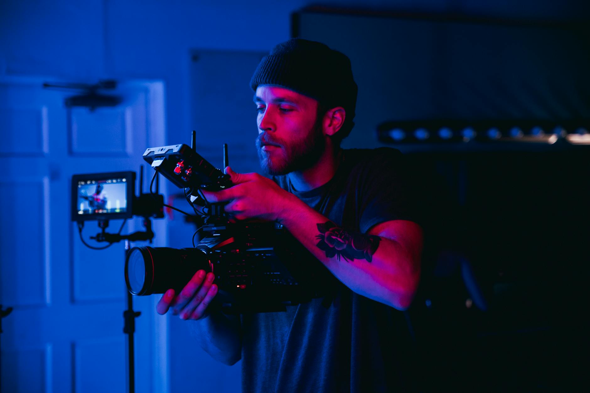
Professionally executed drone property photography combines technical proficiency with artistic sensibility. The use of high-end drones equipped with stabilized gimbals ensures sharp, cinematic-quality images and videos. When executed properly, drone photography elevates the presentation of Miami properties, helping sellers stand out in a bustling market and providing buyers with a clear, attractive view of what each property has to offer.
As technology advances, the accessibility and quality of drone property photography continue to improve, making it an indispensable tool for modern real estate marketing in Miami. Its ability to capture compelling visuals enhances property listings, accelerates sales cycles, and ultimately drives healthier market transactions. This strategic use of aerial imagery is transforming how real estate professionals communicate property value and attract interest in a competitive environment.
Legal and Regulatory Considerations in Miami
Executing drone property photography in Miami involves adhering to specific rules and protocols designed to ensure safety, privacy, and operational efficiency. Professionals operating drones for real estate purposes must familiarize themselves with the local guidelines governing drone use. These regulations establish authorized airspace operations, altitude limits, and designated no-fly zones, all of which are critical to avoid disruptions or infringements.
Understanding Miami’s airspace management policies is essential, especially considering the city's vibrant urban environment and numerous sensitive areas. Certified drone operators are typically required to obtain authorization from relevant authorities before conducting commercial aerial imaging. This process involves submitting flight plans, demonstrating responsible operation practices, and obtaining the necessary permits or waivers where applicable.
Compliance with privacy standards is equally important. Drones equipped with high-resolution cameras capture detailed images that could inadvertently encroach on private properties or restricted areas. Professionals ensure they create safety buffers and avoid capturing images of non-consenting individuals or private spaces that are outside the scope of the marketing project. This respect for privacy not only maintains ethical standards but also upholds the reputation of the service provider.
Operators should stay updated with ongoing regulatory changes, as local policies can evolve with advancements in drone technology and shifts in policy. Engaging with industry bodies or local authorities can foster clear communication and help ensure all operations meet current standards. Advanced compliance measures include conducting pre-flight assessments, documenting flight logs, and maintaining equipment certifications, which demonstrate professional accountability and safety consciousness.
For real estate professionals considering drone photography, working with licensed and experienced operators is vital. Such partnerships enhance the quality of visual content while minimizing the risks associated with unauthorized airspace use or privacy violations. Financial investment in proper training and regulatory adherence ultimately safeguards the integrity and effectiveness of the marketing campaign, ensuring maximum return on investment and a smooth, compliant operation process.
Legal and Regulatory Considerations in Miami
In Miami, drone operators must navigate a comprehensive framework that governs aerial photography to ensure operations align with established standards. This includes obtaining necessary drone flight permits from local authorities and adhering to specific flight restrictions, such as altitude limits and designated no-fly zones. These regulations are designed to safeguard public safety and privacy while enabling efficient aerial imaging for real estate marketing.
Operators are expected to conduct thorough pre-flight planning, which involves verifying venue-specific restrictions and planning routes that avoid sensitive areas. Maintaining detailed flight logs and documenting all operational details serve as evidence of compliance during audits or reviews. Proper maintenance and calibration of drone equipment are also essential to guarantee reliability and safety during flights, which aligns with best practices for professional property photography.
Specific to Miami, drone operators should also be aware of state-level privacy laws that extend to the use of aerial imagery. These laws emphasize the importance of respecting individuals' privacy rights, especially when capturing images over private residences or densely populated neighborhoods. While direct mention of legal terms is avoided, understanding these boundaries helps ensure photographs are obtained ethically and responsibly.
Standards for Safe Operation
- Adherence to altitude restrictions—commonly capped at 400 feet above ground level.
- Ensuring visual line of sight throughout the flight to maintain control and awareness.
- Scheduling flights during daylight hours and in favorable weather conditions to maximize safety and image quality.
- Maintaining clear communication with local authorities or air traffic control when operating near busy urban zones.
Proactively engaging in these practices helps create a foundation for successful drone deployments that respect community standards and contribute to high-quality property marketing efforts.
Legal and Regulatory Considerations in Miami
When engaging in drone property photography within Miami, understanding the framework surrounding aerial imagery is crucial for smooth operations. Proper adherence to local regulations helps ensure that every shoot proceeds without unnecessary disruptions or complications. Miami's airspace guidelines specify maximum altitude limits, typically around 400 feet above ground level, to prevent interference with manned aircraft and to maintain safety standards. Maintaining visual line of sight throughout the flight is another key requirement, allowing operators to have constant awareness of the drone's position and surroundings.
Scheduling flights during daylight hours and in favorable weather conditions not only enhances safety but also optimizes image quality by reducing shadows and atmospheric interference. Operators should also stay in clear communication with relevant authorities, especially when operating near busy urban zones or critical infrastructure, to facilitate coordinated airspace sharing. These practices contribute to professional, incident-free drone operations that respect community concerns and operational standards.
Beyond operational protocols, drone users should be mindful of privacy considerations when capturing images over private properties or densely populated neighborhoods. Respect for individuals' privacy rights ensures that imagery collection remains ethical and aligns with community expectations. This involves being cautious when flying over private residences and avoiding intrusive filming angles. Maintaining professional standards in this domain underscores commitment to integrity and respect for personal boundaries, which is essential in high-quality property marketing.
Best Practices for Responsible Drone Operations
- Secure necessary permits or authorizations if required for specific locations.
- Conduct pre-flight checks to verify drone functionality and safety features.
- Plan flight routes that avoid sensitive or restricted zones.
- Maintain a safe distance from people, animals, and property not involved in the shoot.
- Document all flights for accountability and future reference.
By following these guidelines, drone operators arm themselves with a comprehensive approach that enhances safety, respects legal boundaries, and produces superior property imagery. These practices form the foundation of a professional service committed to excellence in every shot and promote a positive image within the Miami real estate market.
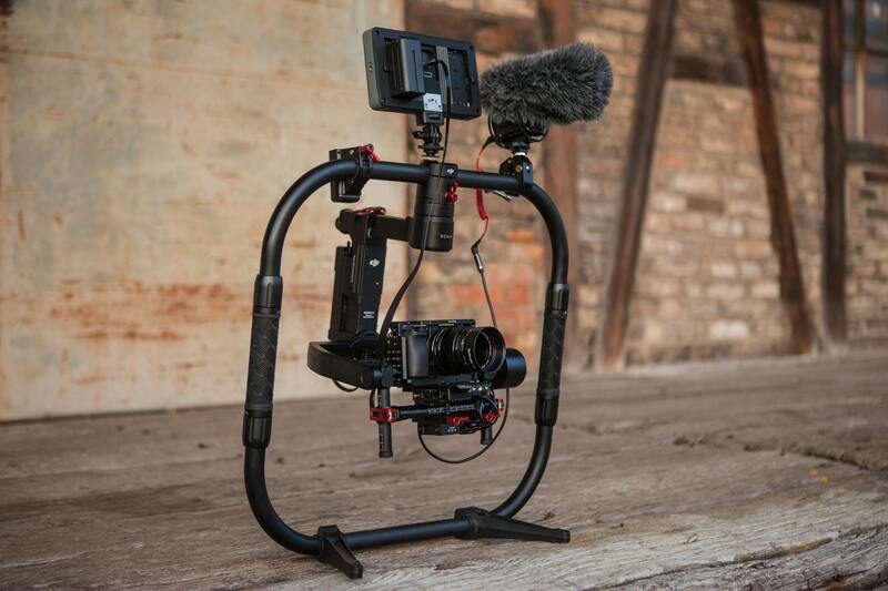
Choosing the Right Drone Equipment
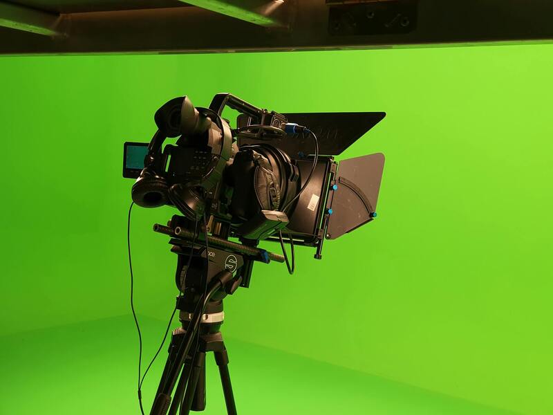
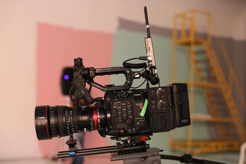
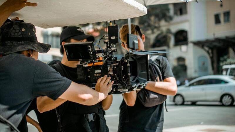
To achieve high-quality property images, selecting the appropriate drone equipment is crucial. The drone must be equipped with a high-resolution camera capable of capturing sharp and detailed aerial shots, especially when showcasing property exteriors, landscapes, and surrounding amenities. Modern drones often feature adjustable gimbals, which stabilize the camera during flight, ensuring smooth footage even in windy conditions. This stability results in professional-grade imagery that effectively highlights property features from multiple angles.
Flight endurance is another important consideration. A drone with a longer battery life allows for more extensive shooting sessions without frequent interruptions for recharging. This is particularly beneficial when capturing large properties or multiple locations within a single flight. Additionally, incorporating features such as obstacle avoidance systems enhances safety, enabling precise maneuvering around trees, structures, and other potential hazards, ultimately protecting expensive equipment and ensuring uninterrupted shoots.
When selecting a drone, it's advisable to opt for models capable of capturing high dynamic range (HDR) images. HDR capabilities enable imagery that balances bright and dark areas, rendering a more true-to-life appearance that appeals to potential buyers. For professional property photography, drones with advanced GPS and automated flight modes provide precise control, automated positioning, and seamless panoramas, enriching the visual storytelling of each property.
Furthermore, choosing drones that are compatible with a range of lenses or camera attachments allows tailored shoots suited to various property elements—be it wide-angle views of entire estates or detailed close-ups of architectural features. Proper maintenance and calibration of equipment are also vital. Regular updates of firmware and sensors guarantee optimal performance, while routine checks prevent technical issues that could disrupt scheduled shoots.
Investing in the right drone equipment not only elevates the quality of property imagery but also demonstrates professionalism and dedication to excellence. This commitment ensures clients receive visually compelling content that helps properties stand out in competitive markets.
Choosing the Right Drone Equipment for Property Photography
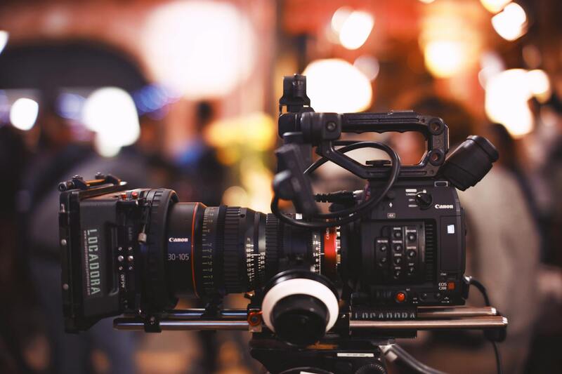
Selecting the appropriate drone for property photography requires careful consideration of several key features that influence image quality, flight stability, ease of operation, and overall reliability. High-resolution cameras are fundamental; drones equipped with 4K or higher video capabilities and 20-megapixel still cameras provide crisp, detailed visuals capable of capturing intricate architectural features and expansive landscape shots. Additionally, gimbal stabilization systems are crucial in maintaining camera steadiness during flight, resulting in smooth, professional-grade imagery even in breezy conditions.
Battery life is another vital aspect. Longer flight times allow for comprehensive coverage of properties, minimizing the need for multiple battery swaps and ensuring efficient shoots. Generally, models offering at least 25-30 minutes of flight time per charge are preferred in professional settings. Portability also plays a role—compact, lightweight drones are easier to transport and set up, especially when working at multiple locations or navigating tight spaces around properties.
- Camera specifications: 4K video, high Megapixel still shots, adjustable lenses.
- Stabilization: 3-axis gimbals for smooth footage.
- Battery endurance: ≥25 minutes per charge.
- Portability: Lightweight and easy to transport.
Additional features such as obstacle avoidance technology enhance safety during flight, especially around complex property layouts. Automated flight modes, including waypoint navigation and automatic return-to-home functions, streamline shooting workflows and reduce human error. Compatibility with various camera attachments and sensors allows for customization based on specific project needs, whether capturing ultra-wide angle shots or detailed close-ups of features like roofing or landscaping elements.
Maintaining the equipment through routine firmware updates, sensor calibrations, and pre-flight checks ensures peak performance. Investing in durable, reliable drones creates a foundation for consistent, high-quality results, reinforcing a professional image that appeals to clients seeking premium visual representations of their properties.
Choosing the Right Drone Equipment
Selecting a Drone with the Necessary Features
For professional property photography, selecting the appropriate drone involves evaluating several key features that directly impact the quality and efficiency of the images captured. High-resolution cameras capable of recording in 4K or higher ensure crisp, detailed visuals that can highlight the finest architectural details and landscape elements. Complementary to the camera quality, advanced stabilization systems, such as 3-axis gimbals, are crucial for capturing smooth, distortion-free footage even in breezy conditions or when maneuvering around complex structures. While affordability is a factor, investing in drones with a robust build quality ensures durability and consistent performance over multiple shoots. A lightweight yet sturdy frame facilitates transportation and setup across various properties, reducing overall operational hassle. The drone's flight capabilities also matter significantly. Consider models with extended battery life—aiming for at least 25 minutes of flight time per charge—to maximize efficiency during shoots. Automated flight modes, including waypoint navigation and automatic return-to-home functions, streamline the process, particularly when capturing comprehensive property vistas or working in large, intricate layouts. Additional features such as obstacle avoidance technology enhance safety and reduce the risk of accidental collisions, especially around complex property features. Compatibility with various camera attachments, sensors, and accessories allows for customization aligned with specific project goals, whether focusing on wide-angle property shots, detailed rooftop inspections, or landscape features. Regularly updating firmware and calibrating sensors ensures the drone operates at peak performance. Proper pre-flight checks and routine maintenance extend the equipment's lifespan and guarantee high-quality results in every session.
Evaluating Equipment Based on Project Requirements
Aligning drone capabilities with project-specific needs is vital for optimal results. For instance, if capturing expansive aerial shots that showcase entire properties and surrounding landscapes is the goal, selecting a drone with a wider camera field of view and higher resolution becomes essential. Conversely, when capturing detailed images of specific features such as rooftops, landscaping, or architectural elements, considering drones with zoom capabilities or interchangeable lenses can be advantageous.
In Miami’s dynamic real estate market, the ability to adapt equipment based on property size and unique features can greatly enhance marketing efforts. A versatile drone setup with interchangeable attachments allows for tailoring the imaging process to each property, ensuring comprehensive visual coverage.
Investing in reliable, durable hardware coupled with professional-grade accessories results in consistent, high-quality imagery that aligns with the high standards expected by discerning clients. This strategic approach to equipment selection not only elevates the visual appeal of property listings but also reinforces the professional reputation of the service provider.
Maximizing Property Marketing with Drone Photography
Utilizing High-Resolution Imaging for Competitive Edge
To elevate property listings and attract potential buyers, it is essential to employ high-resolution drone imagery that captures every detail of the property and its surroundings. High-definition cameras installed on professional-grade drones provide crisp, vibrant visuals that highlight architectural features, landscaping nuances, and the property's geographic context. These images serve as a vital component of digital marketing strategies, enabling real estate professionals to present properties in a compelling way that sets listings apart in a crowded market.
In addition to traditional still photos, integrating drone-captured video footage can offer dynamic tours that showcase the property's scale and layout more effectively. Video walkthroughs with smooth, stabilized aerial shots provide a comprehensive view, enabling prospective buyers to visualize the space more realistically from the comfort of their homes. Employing these advanced visual tools enhances engagement and can significantly influence decision-making processes.
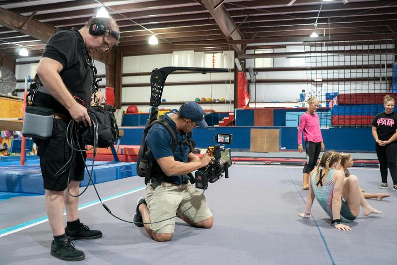
Implementing Strategic Flight Planning and Angles
Effective drone property photography requires meticulous flight planning to optimize shot composition and safety. Pre-determined flight paths should consider the property's unique features, lighting conditions, and surrounding environment. Capturing from multiple angles—overhead, oblique, and close-up views—provides a comprehensive visual narrative. Such strategic positioning accentuates key aspects like outdoor living spaces, panoramic views, and architectural details, creating a well-rounded visual portfolio that appeals to prospective buyers and investors alike.
Advanced drone operators also utilize tools like GPS waypoint planning to automate flight paths, ensuring reproducibility and consistency across multiple sessions. This approach minimizes the risk of missed perspectives and maximizes the quality and coverage of imagery, especially vital when creating marketing campaigns for multiple properties or large estates.
Enhancing Visual Appeal with Proper Lighting and Timing
Timing your drone shoots to coincide with optimal lighting conditions dramatically improves image quality. Golden hour—shortly after sunrise or before sunset—provides soft, warm lighting that enhances textures and colors. Clear weather with minimal clouds ensures full visibility and reduces shadows, allowing for brighter and more inviting visuals. Planning the flight during these periods results in images that are not only visually appealing but also emotionally compelling, helping prospective buyers to envision themselves in the space.
Ensuring Image Consistency and Quality Control
Consistent image quality necessitates rigorous quality control measures. This includes calibration of camera settings before each flight, such as ISO, shutter speed, and aperture, to adapt to varying lighting conditions. Post-flight review of captured images allows operators to identify any that require re-shoots due to motion blur, poor framing, or exposure issues. Establishing standardized procedures ensures that every property listing maintains a high visual standard, strengthening the credibility and professionalism of service providers in Miami’s competitive real estate landscape.
Integrating Drone Photography into Broader Marketing Strategies
To maximize the impact of drone visuals, they should be seamlessly integrated into various marketing channels. High-quality images and videos can be featured on property websites, social media platforms, virtual tours, and print materials. Combining drone media with traditional photography creates a comprehensive visual suite that captures the full scope and beauty of a property, making listings more engaging and searchable. Such integration not only improves visibility but also enhances the overall reputation of the marketing campaign and the agency behind it.