Understanding Aerial Property Photography
Aerial property photography entails capturing images of real estate from an elevated perspective, typically using specialized flying equipment such as drones equipped with high-resolution cameras. This method offers a comprehensive and visually impactful view of properties, showcasing their size, layout, and surrounding environment in a way traditional ground-level images cannot replicate. The primary goal is to provide prospective buyers with a thorough understanding of a property's spatial relationships and landscape features, which can significantly enhance marketing efforts.
Unlike conventional photos taken from the ground, aerial images allow for a broader contextual presentation. They highlight features such as outdoor amenities, landscaping, neighboring properties, and access points, creating an immersive view that emphasizes a property's unique selling points. These images can be particularly compelling for large estates, waterfront properties, or those with scenic surroundings, where the landscape plays a crucial role in buyer interest.
The technology behind aerial photography has advanced considerably, making high-quality images more accessible and affordable for real estate professionals. Today’s professional-grade drones and stable camera systems enable stunning, crisp visuals that meet stringent quality standards. This evolution in photography technique enhances the visual storytelling of a property's features and helps listings stand out in competitive markets.
By utilizing accuracy in perspective and framing, aerial property photos serve as powerful marketing tools. These images not only attract attention in listings but also assist agents and sellers in effectively communicating a property's value and appeal to potential buyers. With the ability to capture expansive landscapes, intricate property details, and environmental context from above, aerial photography has become an indispensable component of modern real estate marketing strategies.
Legal and Regulatory Considerations in Miami
When incorporating aerial property photos into real estate marketing efforts in Miami, understanding the framework of responsible drone operation is crucial. This ensures that every shoot adheres to local standards and best practices, promoting safety, privacy, and professionalism.
Miami agencies specializing in aerial photography routinely follow established operational procedures, such as obtaining necessary authorizations for drone flights over private and public lands. This might include coordination with local authorities or property owners to ensure that drone operations are conducted smoothly and without interruptions. Proper planning and communication prevent potential conflicts and facilitate a seamless filming process.
Operators are equipped with comprehensive knowledge of drone airspace regulations specific to Miami. This includes respecting no-fly zones such as airports, certain government facilities, and densely populated areas. Compliance with altitude restrictions and maintaining line-of-sight control over drones are central tenets of responsible aerial operation, safeguarding both the public and the equipment.
Furthermore, professional aerial photographers in Miami implement strict privacy protocols. They are diligent in avoiding intrusive flights over private spaces or areas where individuals might expect privacy, thus maintaining trust and integrity in their services. These considerations uphold a high standard of ethical work, ensuring that all images are captured without infringing upon personal or community rights.
Understanding and respecting these operational guidelines are essential for real estate professionals seeking to leverage aerial photos legally and ethically. Successful collaborations with certified drone operators enhance listing appeal while maintaining compliance with the regulatory environment.
Any licensed Miami-based drone service provider will be versed in these local standards, providing peace of mind that visual content creation aligns with regional policies. This professional approach ensures that aerial property imaging remains a powerful, compliant tool for marketing high-value real estate assets in Miami's dynamic market.
Equipment and Techniques for Aerial Photography
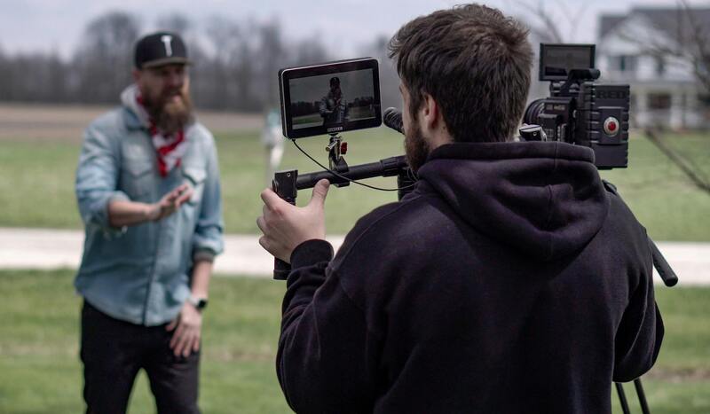
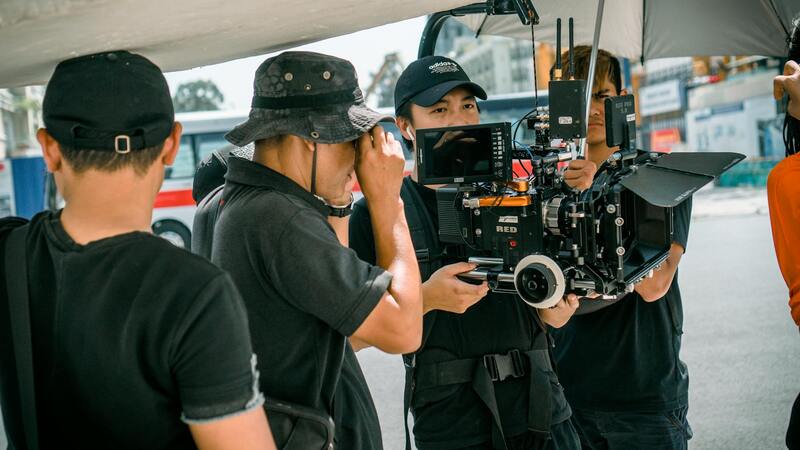
Success in aerial property photography hinges on employing the right equipment and mastering advanced techniques to produce compelling images that showcase property features from the optimal perspective. High-quality drones equipped with stabilized gimbals, high-resolution cameras, and versatile lenses are essential for capturing crisp, detailed shots under various lighting conditions. Professional operators often utilize drones with obstacle avoidance systems and GPS stabilization to ensure safety and image precision during flight.
Camera settings are fine-tuned to match specific lighting scenarios, emphasizing proper exposure and sharpness. Photographers often implement manual focus and adjust ISO, shutter speed, and aperture to achieve the desired depth of field and image clarity. Strategic flight planning, including determining optimal altitudes, angles, and flight paths, ensures comprehensive coverage of the property, highlighting both the overall layout and key architectural details.
Advanced techniques such as HDR (High Dynamic Range) imaging allow for capturing a wider range of luminance, balancing shadows and highlights for vibrant, true-to-life visuals. Panoramic shots and 360-degree imaging can provide potential buyers with immersive virtual experiences, fostering a more engaging property presentation. During the shoot, maintaining precise control over drone movement and stability helps avoid motion blur, ensuring the final images are professional-grade.
Best Practices for Capturing Aerial Property Photos
Capturing effective aerial property photos involves meticulous planning and execution. Photographers should conduct pre-flight site assessments to identify the best angles, lighting conditions, and any potential obstacles. Early morning or late afternoon light provides soft, diffused illumination that enhances the property’s appeal, avoiding harsh shadows or overexposure.
Utilizing consistent height levels across shots offers a cohesive look when showcasing multiple angles. Elevating the drone to heights ranging from 50 to 150 feet typically strikes a balance between capturing expansive property views and maintaining detail. Overhead shots from directly above the property emphasize the layout and surrounding landscape, facilitating effortless top-down perspectives for marketing materials.
When composing images, keep the property centered, and include contextual elements like neighboring properties, landscaping, and access roads to give potential buyers a comprehensive understanding of the overall setting. For properties with extensive land or unique surroundings, strategic use of wide-angle lenses can maximize the viewer’s perspective without sacrificing detail.
It’s also crucial to plan for safe, respectful operation, ensuring that flights are conducted in clear weather conditions to avoid wind or rain disturbances. Regular drone maintenance and pre-flight system checks eliminate technical issues, ensuring seamless execution during the shoot.
Ensuring Optimal Image Quality and Composition in Aerial Property Photography
Achieving high-quality aerial property photos requires a combination of strategic planning, precision equipment, and refined techniques. The choice of drone and camera system plays a fundamental role in capturing clear, detailed images that truly showcase a property's features. High-resolution camera sensors ensure that even distant or expansive shots retain sharpness, enabling viewers to see fine details such as landscaping textures, driveway patterns, or architectural elements.
Flight planning is integral to capturing compelling aerial images. This involves determining optimal flight paths, heights, and angles tailored to the specific property and its surroundings. Pre-visualizing shots helps in selecting vantage points that accentuate key features—such as swimming pools, gardens, or scenic views—while avoiding obstructions like trees, power lines, or neighboring structures. Tools such as mapping software or flight planning apps facilitate precise route creation, ensuring comprehensive coverage of the property from various perspectives.
During the shoot, techniques such as maintaining consistent altitude and camera orientation contribute to a cohesive visual presentation. Utilizing gimbals and stabilization equipment minimizes motion blur, resulting in crisp images even in breezy conditions. Employing multiple exposures and bracketing methods helps in managing dynamic lighting environments, preventing overexposed highlights or underexposed shadows. This systematic approach ensures that every shot maximizes clarity and detail, providing a more engaging and realistic depiction of the property.
Post-flight, the editing process further enhances image quality. Adjustments for brightness, contrast, and color correction can bring out the property's natural appeal, emphasizing landscaped areas and architectural elements. Cropping or perspective correction may be necessary to align images perfectly and highlight the property’s layout. These edits should be subtle and professional, enhancing rather than altering the true appearance of the property.
Furthermore, consistency in image style and quality across different shots creates a unified visual narrative for marketing materials. This consistency makes it easier to craft engaging virtual tours, property websites, or print brochures that effectively attract potential buyers or tenants.
Methods of Legally Capturing Aerial Property Photos in Miami
Successfully obtaining aerial property images in Miami hinges on adhering to established procedures that ensure responsible and compliant operations. Professionals rely on officially sanctioned methods to capture high-quality aerial visuals that showcase real estate assets effectively.
One of the primary approaches involves utilizing common devices such as drones, which have become a staple in modern aerial photography. When operating drones for property photography, accredited operators ensure that flights are conducted within the designated airspace, following predefined guidelines for altitude and distance from structures and individuals. These operations typically involve obtaining necessary authorizations from pertinent authorities, which may include notifications to the Federal Aviation Administration (FAA) and other local agencies. This process ensures that all flights are performed legally, with proper clearance to avoid infringing upon protected airspace or privacy boundaries.
In addition to drone photography, helicopters and fixed-wing aircraft may be employed for large-scale or commercial projects, especially when capturing expansive landscapes or multi-acre properties. These methods require licensing from relevant aviation bodies, adherence to specific flight plans, and compliance with safety standards established by authorities. Using approved aircraft ensures that the operation is conducted within regulated parameters, minimizing risks to the public and property.
Moreover, to uphold ethical standards and respect privacy rights, professionals operating aerial photography equipment should communicate transparently with property owners and stakeholders. Securing explicit consent before capturing images from above is considered a best practice, cultivating trust and cooperation. Additionally, scheduling flight times during optimal lighting conditions, such as late morning or early evening, enhances image quality without infringing on privacy or causing disturbance. These practices ensure that aerial property photography remains respectful of residents' rights and property regulations while achieving exceptional visual results.
Compliance with established protocols not only guarantees the safety and legality of aerial imagery collection but also elevates the professionalism and credibility of the service provider. When executed correctly, these methods produce compelling visual content that effectively highlights the property's features, promotes transparency, and supports the marketing objectives of real estate professionals seeking to attract potential buyers or tenants in Miami.
Best Practices for Capturing Aerial Property Photos
Achieving high-quality aerial property images requires meticulous planning and a professional approach to photography. To ensure optimal results, operators should start by conducting detailed site assessments before flying. This involves examining the property layout, identifying the best angles to showcase key features, and understanding any potential obstructions or hazards. Clear flight plans should be established to cover the entire property region, ensuring comprehensive coverage while maintaining safety and efficiency.
Optimal lighting conditions are critical for capturing vivid, detailed images. Schedule shoots during times with natural, diffuse light—typically late morning or early evening—to minimize shadows and glare. This timing enhances the property's visual appeal and highlights architectural details effectively.
Choosing the right equipment is essential for professional results. High-resolution drones equipped with stabilized gimbals and wide-angle lenses enable crisp, distortion-free imagery. Maintaining the equipment properly—such as keeping propellers clean and batteries fully charged—ensures smooth operation and consistent image quality.
Operators must also pay attention to flight altitude and camera settings. Flying at a controlled height—usually between 50 and 150 feet—strikes a balance between broad land coverage and detailed visuals. Camera settings should be adjusted for the current lighting conditions, with appropriate ISO, shutter speed, and aperture choices made to maximize clarity and color accuracy.
Adherence to Safety and Compliance Protocols
Executing aerial photography in Miami involves strict adherence to operational standards that prioritize safety. This includes verifying local airspace restrictions, avoiding no-fly zones, and coordinating with relevant authorities when necessary. Regularly updating pilots and operators on flight regulations helps prevent unforeseen issues.
Additionally, gaining explicit permissions from property owners before initiating drone flights demonstrates respect for privacy and property rights. Communicating clearly about flight plans, timings, and purpose fosters trust and cooperation among all parties involved.
Post-Flight Review and Quality Checks
Once images are captured, thorough review processes should be in place to select the best shots. High-resolution images need to be checked for clarity, proper framing, and color consistency. Image stabilization and post-processing techniques such as cropping, color correction, and contrast enhancement can further improve visual clarity and appeal.
Understanding the Technical Aspects of Aerial Property Photography
Achieving high-quality aerial property photos hinges on the effective use of sophisticated equipment and refined techniques. Professionals utilize high-resolution drones equipped with stabilized gimbal cameras to ensure clarity and sharpness in every shot. The choice of drone model often depends on the specific requirements of the property, such as size, landscape complexity, and desired image resolution.
Strategic flight planning is essential, including pre-mission site surveys to identify optimal flight paths and angles. Elevation control plays a critical role; flying at an altitude that provides a comprehensive view without sacrificing detail is key—typically around 50 to 150 feet above ground level. This range offers a max coverage area while maintaining image resolution suitable for marketing purposes.
The camera settings are adjusted meticulously based on surrounding lighting conditions. ISO values are kept low to reduce noise, shutter speeds are optimized for motion stability, and aperture settings are chosen to balance depth of field with light intake. Utilizing RAW image formats allows for extensive post-capture editing, ensuring the images adhere to professional standards.
In addition to hardware choices, the execution of aerial photography heavily depends on environmental considerations such as wind speed, weather conditions, and ambient lighting. Time of day impacts the quality and mood of the images, with early morning and late afternoon offering softer light and desirable shadows that highlight property features effectively.
Technical Best Practices for Superior Aerial Images
- Utilize high-resolution cameras with optical zoom capabilities for versatile framing.
- Maintain steady drone hover with calibration of GPS and inertial measurement units (IMUs) to prevent image distortion.
- Capture multiple angles and heights to provide a comprehensive visual narrative of the property.
- Employ automated flight missions with pre-set waypoints to ensure consistency and coverage precision.
Post-capture, images should be processed with clarity-focused editing tools—adjusting contrast, color balance, and cropping as necessary. This step is vital for producing visually compelling content that appeals to potential buyers and enhances property listings.
Ultimately, the combination of advanced equipment, careful planning, and precise execution guarantees the production of impactful aerial property photography. These images serve not only to present the property accurately but also to evoke emotional responses that drive engagement and interest.
Effective Techniques for Enhancing Aerial Property Photography
Capturing compelling aerial images requires a strategic approach that combines technical skill with artistic vision. One of the most effective methods involves planning shoot scenarios during optimal lighting conditions. Early mornings and late afternoons, known as the golden hours, provide soft, warm light that minimizes harsh shadows and enhances the textures of the landscape, making the property appear more inviting and vibrant.
Utilizing dynamic camera settings is also crucial. High-resolution sensors paired with lenses that offer optical zoom capabilities enable photographers to maintain image clarity while capturing distant or intricate features. Adjusting aperture settings to achieve maximum depth of field ensures that both foreground and background elements are sharply rendered, offering viewers a comprehensive perspective of the property.
Steady flight operation remains essential to produce sharp images free from motion blur. This can be achieved through rigorous calibration of the drone’s GPS and inertial measurement units (IMUs). Multiple image captures from varying angles and altitudes should be prioritized to build a detailed visual narrative that highlights different features and aspects of the property, from expansive lawns to architectural details.
Automated flight plans using waypoint missions are the backbone of consistency in aerial photography. These pre-defined routes allow for precise coverage of the property, ensuring no critical element is overlooked. Post-shoot processing involves meticulous editing—enhancing contrast, adjusting color balance for natural vibrancy, and cropping images to focus on key features. Proper editing not only elevates visual appeal but also ensures the images accurately represent the property’s true character.
Ensuring Compliance and Quality in Miami’s Aerial Photography
Strict adherence to established procedures and safety protocols guarantees high-quality results that meet the expectations of clients and stakeholders. Professional aerial photographers and videographers should utilize certified equipment with well-maintained firmware and calibration to prevent technical issues during shoots. Regular training and updates on the latest industry best practices empower operators to maximize their equipment’s potential while maintaining safety and quality standards.
Implementing comprehensive quality control measures, such as reviewing images immediately post-capture for focus, exposure, and framing, ensures that only images meeting the highest standards are delivered to clients. This process minimizes re-shoots and accelerates project timelines, delivering value and professionalism to the client’s marketing efforts.
Leveraging Software Tools for Post-Processing and Image Management
Advanced photo editing software plays a vital role in transforming raw aerial images into striking visual assets. Techniques such as high-dynamic-range (HDR) blending can enhance details in both shadowed and brightly lit areas, providing a balanced, natural appearance. Georeferencing and tagging images facilitate efficient organization and integration into digital marketing platforms, allowing seamless updates and revisions.
- Utilize professional editing tools to fine-tune lighting, contrast, and color accuracy.
- Apply perspective correction to ensure buildings and landscape features appear true to scale and shape.
- Organize images systematically for easy access and efficient integration into property listings.
Implementing these refined techniques and tools ensures the delivery of exceptional aerial property imagery that effectively supports real estate marketing initiatives. Precision, attention to detail, and adherence to best practices form the foundation of successful aerial photography campaigns.