Overview of Aerial Property Photography
Aerial property photography has emerged as a pivotal tool in the realm of real estate marketing, particularly in vibrant markets like Miami. By capturing images from elevated angles, this technique offers a comprehensive and visually striking depiction of properties that traditional ground-level photography cannot provide. The use of drones or aircraft to obtain high-altitude views allows real estate professionals, property owners, and investors to showcase a property's unique features, surrounding landscape, and neighborhood context with unparalleled clarity and appeal.
In the dynamic Miami real estate market, where luxury homes, waterfront estates, and commercial properties dominate, aerial shots serve to elevate property listings, attracting more prospective buyers and investors. These images not only highlight architectural details and expansive land plots but also give viewers a sense of scale and environment that enhances overall property presentation. As a result, aerial property photography has become an essential component in the marketing portfolios of successful Miami real estate agents and developers.
Utilizing this technique effectively demands a strategic approach to capturing captivating visuals that resonate with target audiences. Well-executed aerial photographs can communicate the property's value proposition instantaneously, fostering greater engagement and interest among potential buyers. As the competition for premium Miami properties intensifies, professional aerial property photography continues to grow in importance for making listings stand out in a crowded marketplace.
Moreover, aerial images provide a compelling narrative about the property's location and neighborhood surroundings, emphasizing proximity to beaches, parks, commercial centers, and transport links. This broader geographic context helps prospective buyers visualize the lifestyle associated with the property, making aerial photography an invaluable asset in the comprehensive marketing strategy.
In summary, aerial property photography offers an innovative, visually immersive perspective that enhances real estate advertising efforts in Miami. By combining advanced equipment with professionally executed techniques, real estate professionals can elevate their property listings, increase visibility, and facilitate quicker transactions in an increasingly competitive market environment.
Legal and Safety Considerations in Miami
Executing aerial property photography in Miami requires adherence to specific guidelines and adherence to established operational standards to ensure safety and professionalism. Professionals in this field utilize comprehensive knowledge of local regulations and best practices to deliver high-quality images while maintaining compliance.
Authorized operators typically undergo specialized training that emphasizes safe drone handling, understanding airspace restrictions, and maintaining respectful distances from populated areas and private properties. This training helps prevent accidental intrusions into restricted zones or disruptions in crowded locales.
Pre-emptive planning includes assessing the environment, noting potential hazards such as power lines, tall structures, or busy streets that could pose risks during flight. This foresight not only safeguards the operator and equipment but also ensures the safety of residents and pedestrians.
In Miami, where airspace can be complex due to numerous airports and restricted zones, obtaining necessary permissions and understanding the local airspace map are critical steps in the planning process. Operators often coordinate with relevant authorities to secure flight authorizations, particularly for flights over densely populated or sensitive areas.
Maintaining transparency with clients about safety protocols and operational procedures fosters trust and aligns expectations. Moreover, comprehensive insurance coverage adds an additional layer of assurance, covering potential damages or mishaps during the shoot.
Adhering to all safety protocols and operational guidelines not only streamlines the process for aerial photography but also exemplifies professionalism and dedication to responsible operation—key qualities in Miami’s competitive real estate marketing landscape.
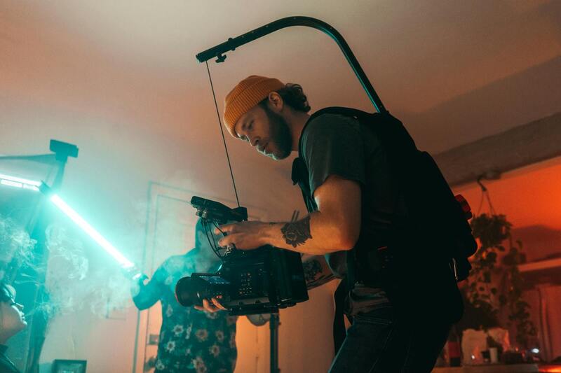
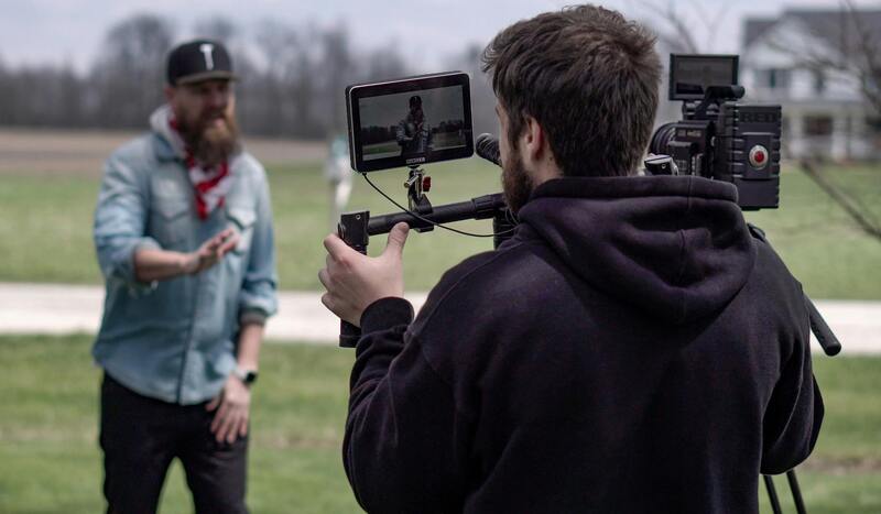
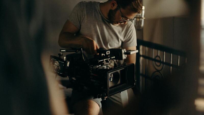
Understanding the Equipment for Aerial Property Photography
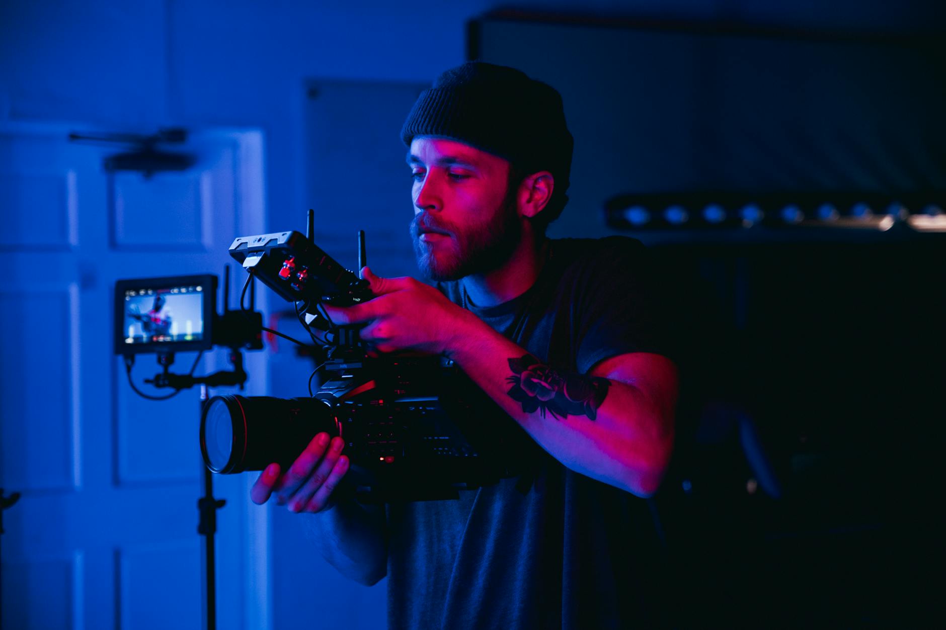
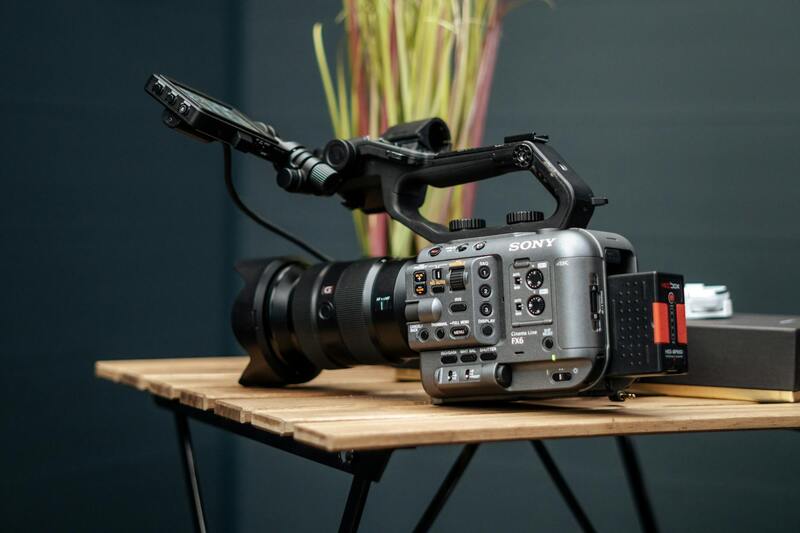
Precision and reliability are fundamental when selecting equipment for aerial property photography. Professional-grade drones equipped with high-resolution cameras are essential for capturing detailed imagery that highlights the property's features and surroundings. These drones typically feature stabilized gimbals, which are crucial for maintaining image clarity and sharpness during flight, especially in windy conditions or when executing complex maneuvers.
In addition to drones, specialized accessories such as wide-angle lenses are often employed to maximize the field of view, allowing for expansive shots that showcase extensive property layouts. Advanced imaging sensors are also used to capture high dynamic range (HDR) images and even 4K or higher video resolutions, providing versatile content for various marketing platforms.
Battery life and flight stability are other critical considerations; thus, professional setups usually include multiple batteries and robust flight controllers to ensure continuous shooting sessions without interruptions. For operations over larger properties, multi-rotor drones with extended flight times offer the ability to cover extensive areas without frequent returns to base.
Operating these high-end devices also requires specialized controllers that provide manual control over camera angles and flight paths. These controls enable precise framing of shots and dynamic aerial views, such as circular or orbiting captures around key property features.
Environmental and Technical Preparation
Preparatory steps often involve comprehensive pre-flight assessments, evaluating weather conditions and potential obstacles to optimize safety and shot quality. Software platforms are commonly used for flight path planning and simulation, ensuring seamless operation and reducing the risk of errors during actual drone flights.
In Miami, where the urban landscape combines high-rise buildings and lush landscapes, having equipment capable of adapting to diverse environments is vital. The ability to quickly switch between photography modes—from wide panoramic shots to detailed close-ups—empowers professionals to create comprehensive visual narratives of properties.
Investing in reliable, state-of-the-art equipment ensures that every aerial property shoot can produce exceptional visuals that stand out in competitive real estate markets. The combination of advanced technology, environmental awareness, and meticulous preparation underpins successful aerial photography projects in Miami's vibrant real estate scene.
Types of Equipment Used
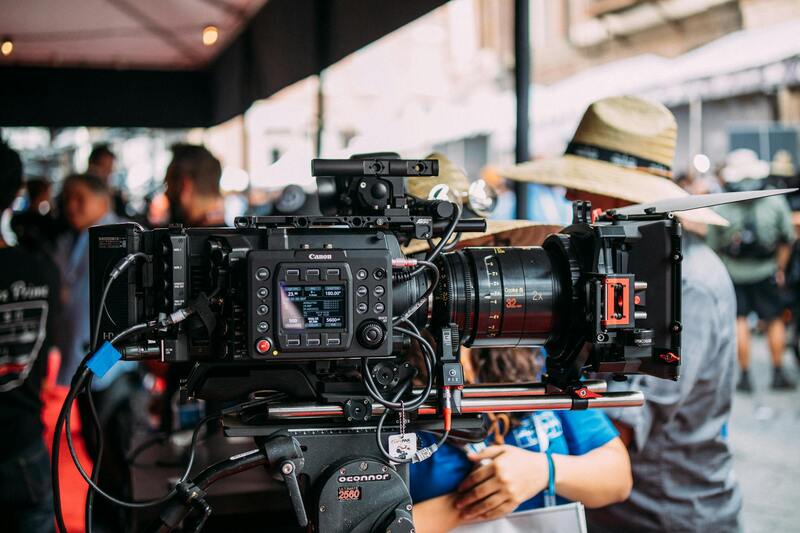
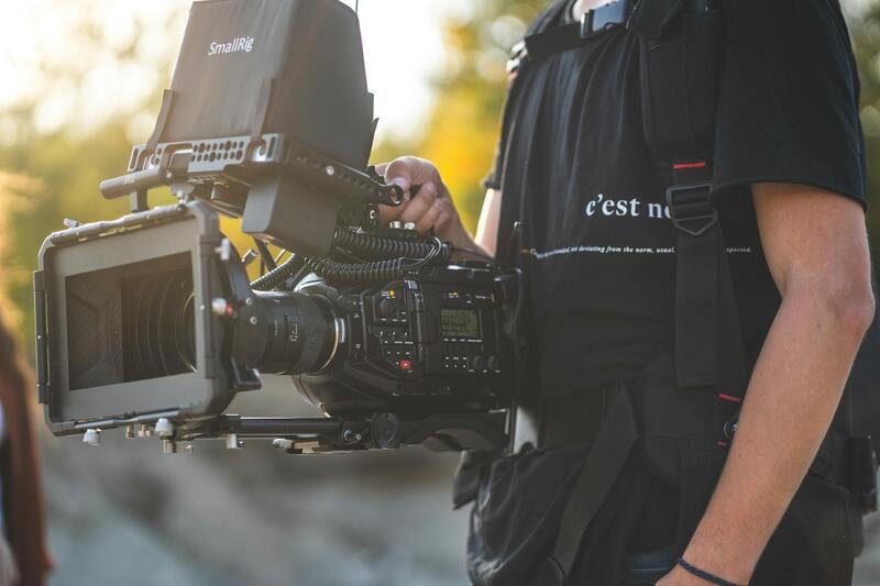
In the realm of aerial property photography, utilizing the right equipment is essential to achieve high-quality, detailed visuals that meet the standards of real estate professionals and property owners. The equipment arsenal typically includes professional-grade drones, stabilized camera gimbals, and high-resolution imaging devices, each selected based on the specific requirements of the property and shooting conditions.
Advanced drones equipped with aerodynamic designs and multiple rotors provide stable flight and smooth footage, even in challenging weather conditions. These unmanned aerial vehicles (UAVs) often feature GPS-assisted flight capabilities, enabling precise positioning and automated flight paths that follow predefined routes. This automation ensures consistency across multiple shots and allows for complex maneuvers that highlight various facets of a property.
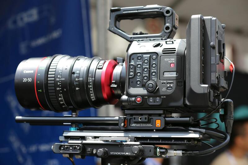
Payload capacity is another consideration, as some projects demand high-resolution cameras or specialized lenses such as wide-angle or zoom lenses, which facilitate capturing expansive views or detailed close-ups. Dual-camera systems are increasingly popular, allowing the simultaneous capture of high-definition still images and 4K video footage, providing versatile media options for marketing and promotional activities.
Stabilization is crucial for producing crisp, clear images free of motion blur. Gimbals—motorized stabilization systems—keep cameras steady during flight, even when drones encounter turbulence or abrupt movements. The integration of sophisticated stabilization technology results in smooth, cinematic footage that presents properties in the best possible light.
Lighting conditions, another vital factor, influence equipment selection. High-dynamic-range (HDR) cameras can adapt to varying light levels, capturing detailed shadows and highlights without overexposure. Filters such as ND (Neutral Density) filters are also used to control exposure, especially in bright sunlight typical of Miami's sunny climate.
Furthermore, software platforms for flight planning are essential tools for professionals in aerial property photography. These platforms facilitate meticulous pre-flight assessments, allowing operators to design flight paths, set waypoints, and simulate flights to ensure safety and shot quality. The ability to modify plans based on environmental factors ensures optimal results, particularly when capturing properties with diverse terrains or nearby obstacles.
Finally, storage solutions capable of handling large media files—such as high-capacity SSDs and cloud-based storage—are integral to managing the high volume of data generated during shoots. Rapid data transfer methods enable quick editing turnaround and efficient project management, which are vital for meeting tight real estate marketing schedules.
Understanding Official Methods for Aerial Property Photography in Miami
Securing aerial property images in Miami requires adherence to specific operational procedures that ensure safety, image quality, and compliance with established standards. Professionals in this field utilize validated techniques that are accepted within the industry and are tailored to meet the demands of real estate marketing.
One primary method involves conducting comprehensive pre-flight planning. This includes detailed site assessments to identify potential obstacles such as power lines, tall structures, or dense foliage. Flight paths are meticulously charted using advanced software to optimize angles and coverage while maintaining a safe distance from sensitive areas. These plans are often adjusted based on environmental conditions like wind speed, sunlight, and nearby surrounding activity, ensuring stable and high-quality captures.
Equipment choice is crucial. State-of-the-art drones equipped with high-resolution sensors, stabilized gimbals, and HDR capabilities are employed to produce clear, detailed, and color-accurate images. For larger or more complex properties, multiple flights may be necessary to capture different angles and perspectives, which are later stitched together for comprehensive visual presentations.
Furthermore, professionals utilize specialized flight planning platforms that facilitate meticulous operation execution. These platforms allow pre-programmed flight paths, automatic altitude adjustments, and real-time monitoring during the shoot. Incorporating these methods guarantees the procurement of high-quality imagery consistent with professional standards.
Post-flight procedures also play an essential role. Data transfer protocols using high-capacity SSDs or cloud solutions enable swift access to footage for editing and enhancement. Through controlled editing workflows, images are refined to improve clarity, color balance, and contrast, ensuring they meet the highest standards for marketing and presentation purposes.
Best Practices for Employing Valid Methods in Miami
- Conduct thorough pre-flight site assessments to identify potential obstacles and environmental factors.
- Utilize high-quality drone platforms with stabilized gimbals, HDR imaging, and obstacle avoidance technology.
- Develop meticulously detailed flight plans with the aid of professional software to enhance safety and shot efficiency.
- Record multiple footage angles to ensure comprehensive property visualization and utilize stitching techniques for wider perspectives.
- Implement robust data management systems for quick access and editing of high-resolution images.
By following these officially recognized methods, drone operators in Miami can produce consistent, high-quality aerial property images that effectively showcase real estate assets while maintaining operational integrity.
Legal and Safety Considerations in Miami
When engaging in aerial property photography within Miami, adhering to official procedures ensures a smooth and compliant operation. Professional operators utilize slew of verified methods to carry out flights responsibly, including obtaining the necessary authorizations, adhering to specific altitude restrictions, and selecting appropriate times to optimize lighting conditions. Pre-flight planning includes comprehensive site surveys to identify potential obstacles such as power lines, tall structures, or densely populated areas, thereby minimizing risk during operations.
Operational safety is further enhanced through the use of advanced drone technology equipped with obstacle avoidance sensors, GPS stabilization, and fail-safe systems. These features allow for precise navigation around complex environments, reducing the chance of accidents or damage. Pilots and operators conduct detailed risk assessments aligned with official guidelines, ensuring each flight is conducted within authorized zones and under suitable weather conditions.

Understanding local airspace regulations and respecting privacy concerns remain integral to maintaining professionalism and community trust. Operators often coordinate with Miami’s aviation authorities to confirm flight permissions, especially when operating near airports or designated no-fly zones. Clear communication and thorough documentation of flight plans support transparency and accountability, further aligning with established standards for aerial photography in urban areas.
These practices help maintain high standards of safety and operational efficiency, enabling real estate professionals to showcase properties effectively while upholding responsible aerial photography standards within Miami’s dynamic environment.
Legal and Safety Considerations in Miami
When integrating aerial photography into property marketing, understanding the official guidelines and recommended procedures for drone operations is essential. Miami's urban landscape, with its dense skyline and proximity to airports, demands meticulous planning and adherence to established operational standards. Operators should secure the necessary clearances from aviation authorities, coordinate with local air traffic control, and respect designated no-fly zones. Ensuring that flights are conducted within approved airspace minimizes disruptions and maintains the smooth flow of air traffic in the area.
Pre-flight assessments include analyzing current weather conditions such as wind speed, visibility, and precipitation, which can affect drone stability and image quality. It is crucial to avoid adverse weather to prevent accidents and ensure high-quality captures. Operators often utilize specialized tools and official weather reports to determine suitable flying windows, aligning with safety protocols that prioritize operational excellence.
In densely populated regions like Miami, operational safety extends to strict adherence to altitude restrictions and flight path planning. This includes maintaining safe distances from buildings, power lines, public gatherings, and other structures. The use of obstacle avoidance technology embedded in modern drones allows for safer navigation around complex environments, reducing the risk of accidents or damage.
Operators must also stay informed about local noise ordinances and community sensitivities. While drone technology has advanced significantly, maintaining respectful distances from residents and private properties is vital to fostering trust and cooperation. Clear communication and transparency about the scope and purpose of aerial photography exercises help uphold professional standards and community relations.
Ensuring compliance with these official procedures not only enhances safety but also contributes to the reputation of aerial photography professionals as responsible and trustworthy partners for real estate ventures. By leveraging industry-approved practices and collaborating closely with authorities, aerial property photographers can deliver exceptional results that elevate property marketing efforts in the vibrant Miami real estate market.
Choosing a Local Aerial Photography Partner
When seeking high-quality aerial property photography services within Miami, it's essential to collaborate with a reputable local agency that specializes in drone cinematography. Partnering with a seasoned team ensures adherence to all official procedures and standards, enabling seamless execution of your project. A Miami-based aerial photography company with a strong local presence possesses a comprehensive understanding of regional airspace protocols, permits, and community sensitivities, which is vital for successful property shoots.
Key factors to consider when choosing a partner include:
- Experience and Portfolio: Examine previous work to assess the quality and diversity of aerial shots, especially those capturing real estate in Miami's unique environment.
- Knowledge of Local Regulations: Confirm that the provider stays updated with Miami-specific drone regulations, ensuring all operations are compliant with city and state requirements.
- Operational Equipment: Verify that the agency uses modern, industry-approved drones equipped with obstacle avoidance, GPS stability, and high-resolution cameras to produce superior imagery.
- Safety Protocols and Certifications: Ensure the team follows all necessary safety procedures, including pilot certifications and insurance coverage, to mitigate risks associated with aerial flights.
- Community Engagement: Choose providers who prioritize respectful flight practices, maintaining appropriate distances from private properties and residents to foster positive community relations.
Establishing clear communication channels and setting expectations upfront can significantly enhance project outcomes. An experienced local partner can navigate the complex regulatory landscape while delivering captivating visuals that elevate your property marketing efforts in the competitive Miami real estate market.