Understanding Aerial House Photography
Aerial house photography represents a specialized approach that captures properties from elevated perspectives, providing comprehensive views that traditional ground photography cannot achieve. This technique utilizes advanced imaging platforms to depict the full scope of a property's layout, nearby features, and surrounding environment. The significance of aerial photography in real estate cannot be overstated; it has become an essential component in modern marketing strategies, offering potential buyers a unique vantage point that enhances their understanding and appreciation of a property.
Typically executed through the use of unmanned aerial vehicles, commonly known as drones, or manned aircraft in some cases, aerial house photography offers high-resolution images that highlight architectural details, landscaping, proximity to amenities, and overall property size. These perspectives can reveal aspects of a property that might remain hidden in conventional photography, such as backyard dimensions, driveway layouts, and neighboring community features.

The role of aerial house photography extends beyond simple visual appeal; it plays a strategic role in real estate transactions by attracting more inquiries, increasing listing visibility, and enabling prospective buyers to virtually explore a property from various angles. As technological advancements make aerial photography increasingly accessible and sophisticated, its integration into property marketing campaigns is now standard practice for real estate professionals aiming to stand out in competitive markets.
This branch of photography requires a thorough understanding of not only photographic composition but also the dynamics of aerial imaging platforms. The goal is to produce images that are both visually stunning and informative, assisting clients in making well-informed buying decisions. Consequently, investing in expert aerial house photography ensures that each image maximizes its impact, effectively showcasing every essential aspect of a property.
As the housing market evolves, an increasing number of real estate professionals recognize aerial photography as an indispensable tool. Its capacity to deliver engaging, detailed, and visually compelling images supports property differentiation and fosters quicker sales cycles. Understanding the importance of aerial house photography is fundamental for anyone involved in property marketing, as it combines technical expertise with artistic vision to produce images that truly capture the essence of a property from above.
Equipment and Technology Used in Aerial Photography
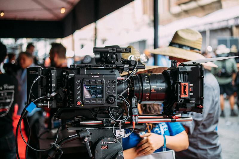
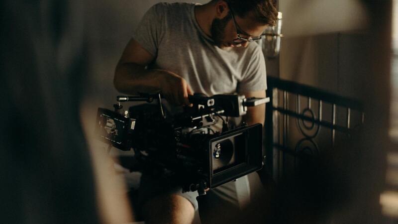
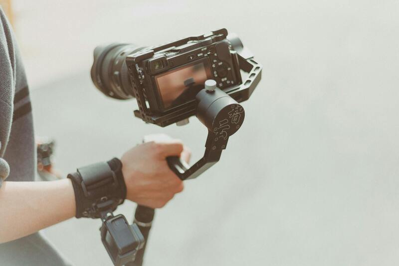
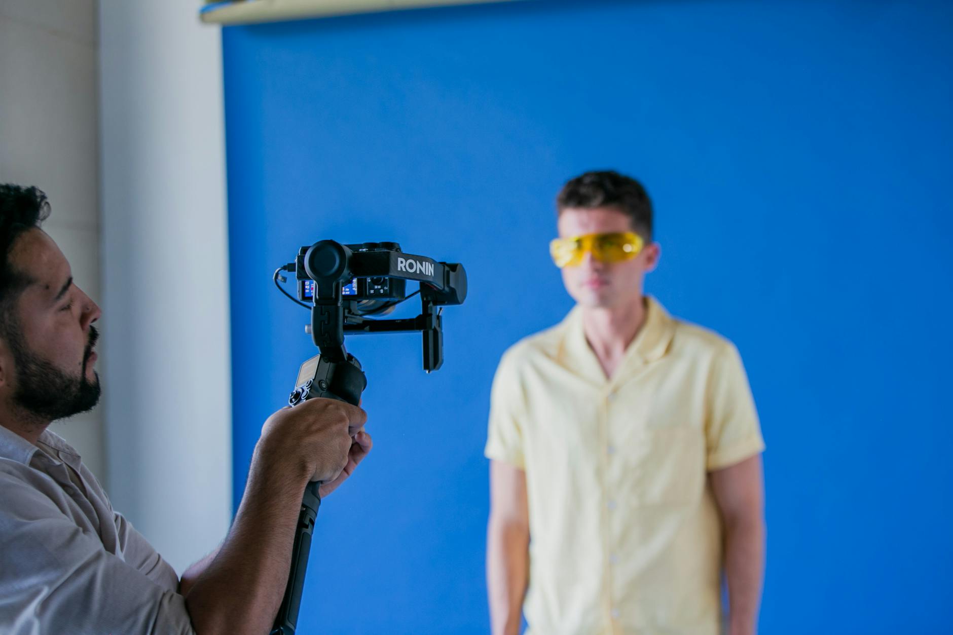
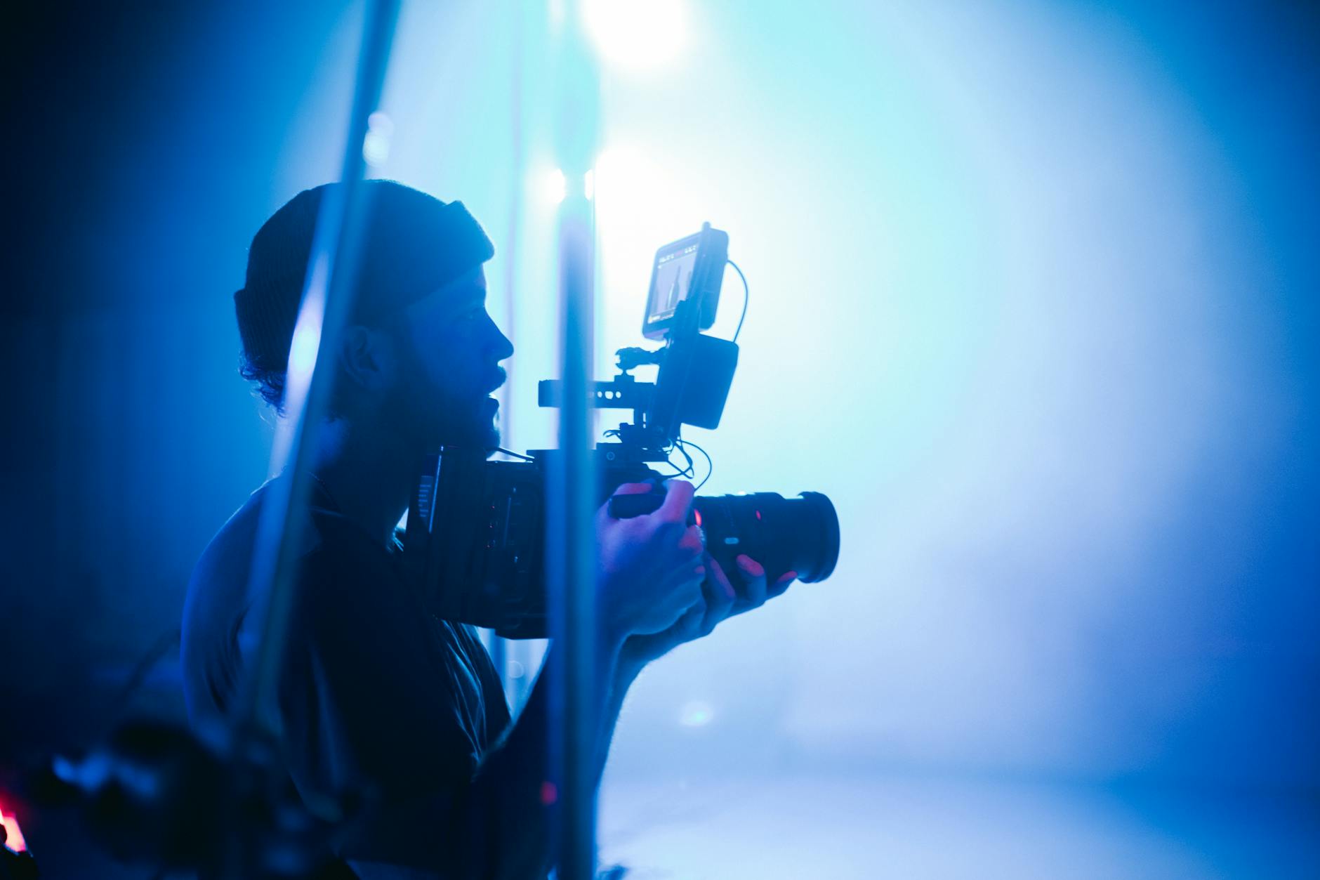
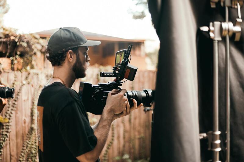
Achieving exceptional aerial house photography hinges on utilizing the right equipment and technology. The core tools include high-quality drones equipped with advanced stabilization systems, GPS navigation, and high-resolution cameras. These drones are designed specifically for capturing detailed images from numerous angles, ensuring consistency and safety during flight. Modern drones often feature obstacle avoidance sensors, which allow for intricate maneuvering around structures and over challenging terrains, producing clearer and more precise images.
Camera choice plays a pivotal role in capturing vibrant and detailed aerial photos. Full-frame sensors with large image sensors are preferred for their superior low-light performance and depth of field capabilities, resulting in sharp, high-resolution images that showcase the property’s features accurately. The lenses installed on these cameras typically range from wide-angle to telephoto, offering flexibility to frame expansive landscape shots or detailed close-ups of architectural elements.
In addition to drones and cameras, a suite of accessories enhances the quality and efficiency of aerial photography sessions. These include specialized gimbals for stabilization, remote controllers with enhanced interface options, high-capacity batteries for prolonged flight time, and software tools for flight planning and image processing. The integration of these technologies enables photographers to produce consistent, high-quality images that meet the demands of professional real estate marketing.
Choosing the right combination of equipment is critical for capturing images that highlight a property’s best features while minimizing motion blur and distortion. This technological foundation allows real estate professionals and photographers to deliver compelling visual content that significantly enhances property listings and marketing materials.
Best Practices for Capturing Aerial House Photos
To maximize the impact of aerial house photography, several best practices should be observed. These include selecting optimal weather conditions—preferably clear, windless days—to ensure stable flights and sharp images. Planning flight paths meticulously helps frame the property from the most advantageous angles, emphasizing its size, layout, and surroundings.
Timing is equally crucial. Taking images during the golden hours—shortly after sunrise or before sunset—provides natural lighting that accentuates architectural details and landscape features, creating warm, inviting visuals. Maintaining consistent altitude and perspective during a shoot enhances the cohesiveness of the collection of images.
Composition techniques such as rule of thirds, leading lines, and framing with natural or man-made elements can further elevate the visual appeal of aerial images. Additionally, multiple exposures and HDR (High Dynamic Range) techniques are employed to balance exposure levels across various lit areas, ensuring the final photos are well-exposed and vibrant.
Incorporating these practices results in high-quality visuals that attract prospective buyers’ attention and provide comprehensive overviews of the property. When executed skillfully, aerial photography becomes a powerful asset in real estate marketing, setting listings apart in a competitive market environment.
Legal Considerations and Permits
Securing appropriate permissions is a fundamental step in aerial house photography to ensure seamless operation and successful image capture. Approaching this process involves understanding the specific regulations and procedures required for filming or photographing from the air. This often includes identifying designated areas for drone flight, restricted zones around airports, military bases, or sensitive sites that might impose restrictions for safety or privacy reasons.
Documentation is crucial, with permits typically obtained through local aviation authorities or municipal agencies overseeing airspace management. These permits outline conditions for flight altitude, times of operation, and operational safety measures, which help prevent disruptions and maintain public safety standards. A comprehensive understanding of these guidelines allows photographers and operators to plan flights efficiently and avoid potential penalties or disruptions.
In addition to official permits, establishing clear communication with property owners and neighbors can facilitate smooth operations. Respecting the privacy of nearby residents and ensuring that the flights do not interfere with other aerial activities is essential. A well-coordinated approach, backed by proper permissions, enables consistent, high-quality captures without concerns over contention or compliance issues.
Working with experienced professionals who are familiar with the customs and legal frameworks of aerial photography can greatly simplify this process. They are often equipped with the necessary documentation and insights to navigate complex airspace rules efficiently, ensuring that the creative goals of the project are achieved without unnecessary obstacles.
Strategies to Optimize Aerial House Photography for Maximum Impact
Achieving compelling aerial house images that attract viewers and potential buyers requires a strategic approach. In addition to technical expertise, understanding how to position the drone, select the best angles, and utilize natural lighting can significantly influence the quality of the final images. Utilizing various flight paths allows capturing the property from multiple perspectives, highlighting unique architectural features and landscape elements. This versatility ensures that the visuals convey the property's full appeal. Timing is also crucial. Photographers often schedule shoots during the golden hour—shortly after sunrise or before sunset—when the natural light is soft and warm. This enhances the visual appeal of the property, creating a welcoming and luxurious atmosphere. Overcast days can also be ideal, as diffuse light reduces harsh shadows and produces even lighting across the entire estate. Additionally, incorporating contextual shots that showcase the property's surroundings can elevate the listing's attractiveness. Wide-angle images capturing the neighborhood, nearby amenities, or scenic views provide prospective buyers with an immersive experience. Properly framing each shot with attention to composition and line direction helps emphasize the property's best features and minimize distractions. Post-processing plays a vital role in refining aerial images. Adjustments in contrast, saturation, and clarity can enhance the overall image quality, ensuring the property looks its best. However, it is important to maintain a natural appearance and avoid over-editing, which could mislead viewers. Consistent styles across images foster a professional and cohesive presentation, reinforcing the property's appeal. The selection of equipment also influences the outcome. High-resolution cameras ensure sharp, detailed images, while gimbals or stabilizers prevent motion blur during flight. Drones equipped with advanced GPS and obstacle avoidance systems allow safer and more precise maneuvers, especially in complex environments where careful navigation is necessary. Maintaining a detailed flight plan, including designated shooting points and altitudes, ensures comprehensive coverage of the property. This planning reduces the need for additional flights, saving time and resources, while also guaranteeing that all desired views are captured. Finally, collaborating with a skilled aerial photographer familiar with the nuances of real estate marketing ensures that each shot not only meets technical standards but also resonates emotionally with viewers. Their expertise in framing, lighting, and editing culminates in images that effectively showcase the property's strengths, ultimately supporting compelling marketing campaigns and successful sales.
Understanding Aerial House Photography
Aerial house photography involves capturing images of residential properties from elevated perspectives, typically using remotely piloted aircraft systems such as drones. This method allows real estate professionals to showcase properties in a way that emphasizes their scale, surroundings, and unique architectural features, providing potential buyers with a comprehensive visual understanding that ground-level shots cannot offer. The strategic use of high vantage points reveals the overall layout, landscaping, and neighboring environment, creating engaging visual narratives that enhance marketing efforts.
Equipment and Technology Used in Aerial Photography
The backbone of successful aerial house photography relies on sophisticated equipment designed for stability, clarity, and precision. Modern drones equipped with high-resolution cameras capture crisp, detailed images with minimal motion blur. These drones often feature stabilization technology such as gimbals, which ensure smooth footage even in windy conditions. Advanced GPS and obstacle avoidance systems contribute to safe, accurate flights around complex environments, minimizing risks and ensuring consistent shot quality.
Popular camera options include full-frame sensors capable of capturing high dynamic range (HDR), which is particularly beneficial in challenging lighting conditions. Additionally, the integration of multi-axis gimbals allows for flexible framing and steady shots, regardless of drone movement. Certain applications may benefit from specialized imaging sensors, such as infrared or thermal cameras, to reveal aspects of the property not visible through standard photography.
Best Practices for Capturing Aerial House Photos
Achieving impactful aerial images requires meticulous planning and technique. The optimal time for shooting is during daylight hours when natural lighting enhances the property's features. Early mornings or late afternoons provide softer light conditions, reducing harsh shadows, while overcast days can offer diffused illumination ideal for capturing detailed textures. Planning consistent shot angles and altitudes ensures comprehensive coverage, highlighting key aspects of the property and its surroundings.
Careful framing emphasizes the property's architectural details and landscape elements. Using wide-angle lenses can maximize the sense of space, while maintaining appropriate camera settings ensures sharpness and color accuracy. Employing systematic flight paths helps avoid missed areas, capturing a cohesive suite of images for marketing use. Post-flight review and selection of the best shots allow for further refinements and adjustments, preparing images that resonate with prospective buyers.
Official and Legitimate Methods for Aerial House Photography
Employing aerial photography within professional standards involves reliance on trusted aircraft, certified operators, and regulated procedures. The use of compliant drones certified by relevant aviation authorities ensures safe operations, especially in urban or densely populated environments. Certifications and trained personnel further reinforce the quality and adherence to high safety standards, guaranteeing consistent results that meet industry expectations. Additionally, utilizing multi-rotor drones with fail-safe features and redundant systems minimizes operational risks.
Establishing clear flight plans prior to the shoot, including designated altitudes, angles, and no-fly zones, enhances efficiency and ensures comprehensive coverage while respecting controlled airspace restrictions. Consistent communication with relevant authorities or property owners minimizes misunderstandings and aligns expectations. In doing so, aerial house photography workflows become streamlined, professional, and dependable, leading to superior visual assets that elevate real estate marketing efforts.
Understanding Aerial House Photography
Aerial house photography involves capturing images of residential properties from elevated perspectives, providing a comprehensive view that ground-level photos cannot offer. This approach emphasizes showcasing the property's layout, surrounding environment, landscaping, and unique architectural features, making it a crucial component of modern real estate marketing strategies. High-quality aerial images help prospective buyers visualize the property within its broader context, including neighborhood amenities, nearby bodies of water, parks, and other local features that influence buying decisions.
Effective aerial house photography relies heavily on selecting the right platforms and techniques. Pitfalls such as distorted perspectives or inconsistent image quality can undermine marketing efforts. Therefore, employing official methods and trusted equipment is essential to deliver consistent, professional results. The strategic use of aerial photography elevates property listings by providing a more immersive view, engaging viewer interest more effectively than traditional ground-based shots.
Equipment and Technology Used in Aerial Photography
Implementing credible aerial house photography begins with the right set of tools. Drones equipped with high-resolution cameras are standard, providing flexibility and access to hard-to-reach areas. Certified multi-rotor drones with stable flight capabilities, obstacle avoidance sensors, and fail-safe systems ensure safe operations during shoots. These drones are generally regulated and authorized for commercial use, adhering to established standards and procedures.
For larger or special projects, light aircraft or helicopters may be employed, particularly when capturing expansive properties or vast neighborhoods. These methods, while more complex, provide expansive coverage without compromising image quality. Advanced imaging technology, such as thermal sensors or 3D mapping tools, can further enhance visuals, offering clients additional insights into property features beyond standard photography.
Best Practices for Capturing Aerial House Photos
Achieving optimal aerial images requires meticulous planning and execution. Before a shoot, a detailed flight plan outlines effective angles, altitudes, and specific property features to capture. Maintaining consistent altitudes and angles across shoots ensures a cohesive visual narrative, helping prospective clients compare listings effectively.
Operational safety and respect for airspace regulations are paramount. This involves coordinating with relevant authorities to establish no-fly zones, restricted areas, and understanding local regulations regarding drone operation. Clear communication with property owners and stakeholders helps align expectations, avoid disruptions, and ensure access when needed.
Timing also plays a vital role. Shooting during optimal lighting conditions, such as early morning or late afternoon, results in better image quality with natural light highlighting property features. Utilizing polarizing filters can reduce glare and reflections, especially in areas with water features or glass surfaces, ensuring clear and appealing visuals.
Post-shoot, reviewing images for clarity, composition, and color accuracy allows for selecting the best visuals. Basic editing enhances images further, adjusting brightness, contrast, and sharpness to meet marketing standards without compromising authenticity.
Understanding Aerial House Photography
In the realm of real estate marketing, aerial house photography has emerged as an essential tool for showcasing properties from a captivating perspective. This technique involves capturing images from elevated viewpoints, providing a comprehensive view of the entire property, its surroundings, and landscape features. Such imagery allows prospective buyers to grasp the property's scale, layout, and context within its environment, facilitating more informed decision-making. High-quality aerial photographs not only emphasize the property's architectural allure but also highlight key features like expansive lawns, swimming pools, nearby amenities, and the overall neighborhood vibe. As a visual storytelling medium, aerial photography can significantly enhance a listing’s appeal, creating an emotional connection before prospective clients even visit in person.
Equipment and Technology Used in Aerial Photography
The backbone of professional aerial house photography is advanced equipment that ensures high-quality results while maintaining operational safety. State-of-the-art drones equipped with high-resolution, wide-angle cameras enable photographers to capture crisp, detailed images from various altitudes. These drones often feature stabilized gimbals to minimize vibrations and ensure sharp visuals even in windy conditions. Modern aerial photography also relies on sophisticated flight control systems, GPS navigation, and obstacle avoidance sensors to facilitate precise maneuvers and safe operation. Additionally, aerial imaging can be complemented with accessories such as polarizing filters to reduce glare and reflections, especially over water features and glass surfaces, and ND filters for managing exposure in bright lighting. As technology advances, newer drones with longer flight times, higher image resolutions, and enhanced stability continue to push the boundaries of what’s possible in aerial property photography.
Best Practices for Capturing Aerial House Photos
Achieving stunning aerial images begins with careful preparation and strategic execution. Prior to the shoot, detailed planning involves creating a comprehensive flight plan that determines optimal flight paths, altitudes, and angles to capture the property’s most attractive features. Consistency in altitude and perspective across shots ensures a cohesive visual narrative, enabling viewers to appreciate the property's layout and design. Timing is crucial; golden hour—shortly after sunrise or before sunset—provides natural, warm lighting that enhances the property's visual appeal. During the shoot, pilots must prioritize operational safety by coordinating with airspace authorities if necessary and respecting no-fly zones. Maintaining a respectful distance from neighboring properties and infrastructure minimizes disruptions and ensures safety. Utilizing zoom functions and different camera angles helps to highlight unique property features, landscapes, or nearby amenities. Post-flight, reviewing the images for clarity, exposure, and composition allows editors to select the best visuals. Basic editing, including brightness adjustments, contrast, and sharpness, enhances the photographs’ professionalism while preserving authenticity and natural beauty.
Legal Considerations and Permits
Navigating the legal landscape is a fundamental aspect of successful aerial house photography. This involves adhering to established airspace guidelines, respecting privacy boundaries, and obtaining necessary permits when operating drones over private or restricted areas. Local regulations often specify flight altitude limits, no-fly zones around airports, government buildings, and certain natural reserves. To ensure smooth operations, it is advisable to consult with relevant authorities or agencies responsible for airspace management. Securing explicit permissions from property owners and neighbors when flying over or near private spaces can prevent disputes and facilitate access. Maintaining documentation of approvals and adhering to designated operational parameters helps establish a professional and compliant workflow. Employing experienced pilots who are well-versed in local regulations further ensures that aerial photography sessions proceed without unforeseen interruptions and complications, ultimately leading to high-quality visuals that meet all established guidelines.
Understanding Aerial House Photography
Aerial house photography has revolutionized the way real estate professionals, homeowners, and developers showcase properties. Utilizing high-altitude perspectives, these images provide an expansive view that captures the entirety of a property's footprint, its surroundings, and the architectural details often missed from ground level. This technique elevates property listings by offering potential buyers a comprehensive understanding of the property’s layout, landscaping, nearby amenities, and neighborhood context. Incorporating aerial imagery into marketing materials boosts engagement, as these images tend to stand out in digital listings. They provide a sense of scale and spatial relationships, which are critical for prospective buyers making informed decisions. Aerial shots also allow for highlighting unique features—such as large gardens, pools, or custom architecture—that may not be apparent from traditional ground photographs. The increasing accessibility of drone technology has democratized aerial photography, making it a vital component of modern real estate marketing assets. High-resolution images captured from the sky can be used across multiple platforms, including websites, social media, and printed brochures, to create a compelling visual narrative that enhances property appeal.
Equipment and Technology Used in Aerial Photography
Effective aerial house photography relies on specialized equipment designed for capturing stable, high-resolution imagery from elevated vantage points. The most common tools include drones equipped with advanced camera systems, which offer maneuverability and precision in tight spaces. These drones feature GPS stabilization, obstacle avoidance sensors, and adjustable camera settings, allowing for sharp, well-exposed images under various lighting conditions. Camera technology plays a crucial role; professional-grade drones often utilize full-frame sensors capable of capturing detailed photos with minimal noise. High dynamic range (HDR) capabilities enable imagery that maintains clarity in scenes with contrasting light levels, ensuring that both shadows and highlights are properly rendered. In addition to drones, some professional setups include tethered aerial rigs or helicopters for larger-scale properties or when specific angles require complex setups. Post-capture, editing software is employed to enhance image quality, correct distortions, and optimize visuals for different formats.
Best Practices for Capturing Aerial House Photos
To maximize the impact of aerial photographs, certain best practices should be followed. Planning is paramount: choosing optimal weather conditions, typically clear days with minimal wind, ensures stability and optimal lighting. Scheduling shoots during the golden hour—shortly after sunrise or before sunset—provides warm, diffuse light that enhances textures and colors. Camera settings should be adjusted based on the scene, emphasizing proper exposure, sharpness, and focus. Utilizing manual settings allows better control, preventing overexposed skies or underexposed landscaping. Consistent framing and composition are achieved through meticulous flight path planning, often using pre-mapped routes or waypoints. Shooting from multiple angles and altitudes guarantees comprehensive coverage, while maintaining a safe distance from structures and restricted zones is essential. Post-flight review helps select the best images, while editing enhances clarity, adjusts contrast and saturation, and removes any unintended elements.
Legal Considerations and Permits
Adhering to official guidelines and obtaining the necessary permissions is an integral part of professional aerial house photography. Before operating any aerial vehicle, operators should familiarize themselves with the designated airspace regulations, including altitude limits and restricted zones. Specific clearances might be required for flying over private property or near sensitive infrastructure. Property owners and neighboring residents should be approached for approval, especially when capturing images that may infringe on their privacy or involve close proximity. While formal permits are often handled through governmental agencies or local authorities, maintaining documentation of permissions can prevent delays or disruptions. Employing experienced pilots who are knowledgeable about local regulations ensures imaging sessions proceed smoothly. These professionals are also skilled at avoiding potential hazards and respecting operational boundaries, which solidifies a professional workflow that respects legal and safety standards.