Benefits of Drone Photography for Real Estate Marketing
In the competitive landscape of real estate, capturing high-quality visuals is essential for attracting potential buyers and standing out in listings. Drone photography has emerged as a transformative tool, providing a range of advantages that elevate property marketing efforts. Aerial images offer expansive views of a property's exterior, showcasing its size, layout, and surrounding environment in a way that traditional ground-level photos cannot replicate. This perspective helps prospective buyers quickly grasp the full scope of a property, including land features, landscaping, pools, outdoor amenities, and proximity to key locations.
One of the primary benefits of drone imagery is its ability to increase property visibility across digital platforms. High-quality aerial shots and dynamic videos grab viewers’ attention, resulting in increased engagement and more views on online listings. The immersive quality of drone footage creates a virtual experience for potential buyers, enabling them to explore the property remotely with more context and confidence.
Furthermore, drone photos can help highlight unique selling points that might be overlooked in traditional photography. For properties with expansive acreage, scenic views, or waterfront access, aerial imaging captures the full essence of what makes the property special. This comprehensive visual storytelling can significantly influence a buyer’s decision-making process.
Additionally, drone footage allows real estate professionals to produce engaging virtual tours and marketing videos. These multimedia presentations can be shared across social media, websites, and email campaigns, increasing outreach and visibility. The inclusion of high-definition drone images not only attracts more prospective buyers but also elevates the perceived value of listings by presenting them in a polished, professional manner.
Ultimately, integrating drone photography into real estate marketing strategies results in more comprehensive property showcases, wider exposure, and a competitive advantage in crowded markets. For realtors operating in vibrant communities like Miami, where oceanfront properties and sprawling estates are prevalent, the unique perspectives provided by drone imagery are invaluable in capturing the true essence of luxury and exclusivity.
Choosing the Right Drone Equipment and Camera Settings
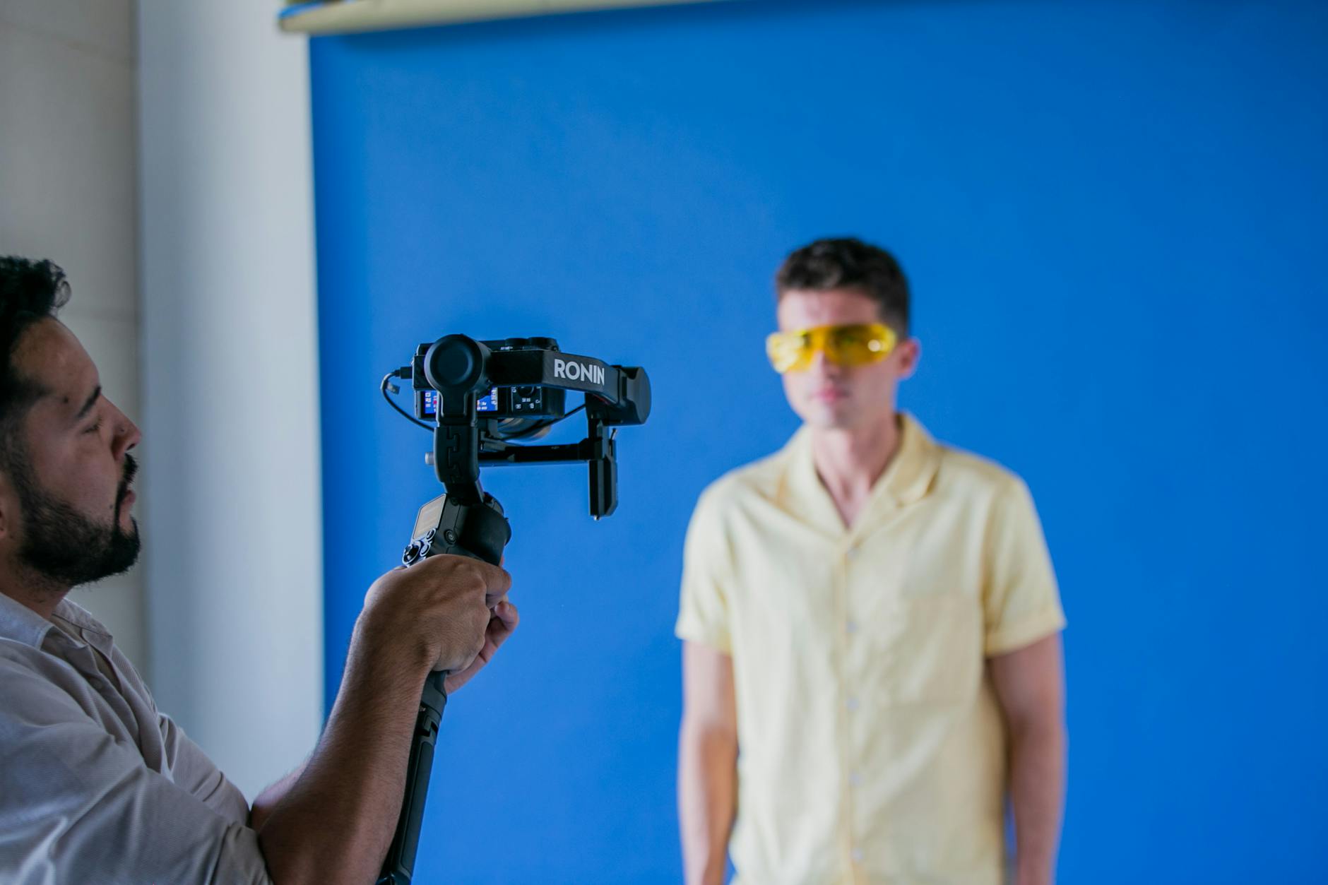
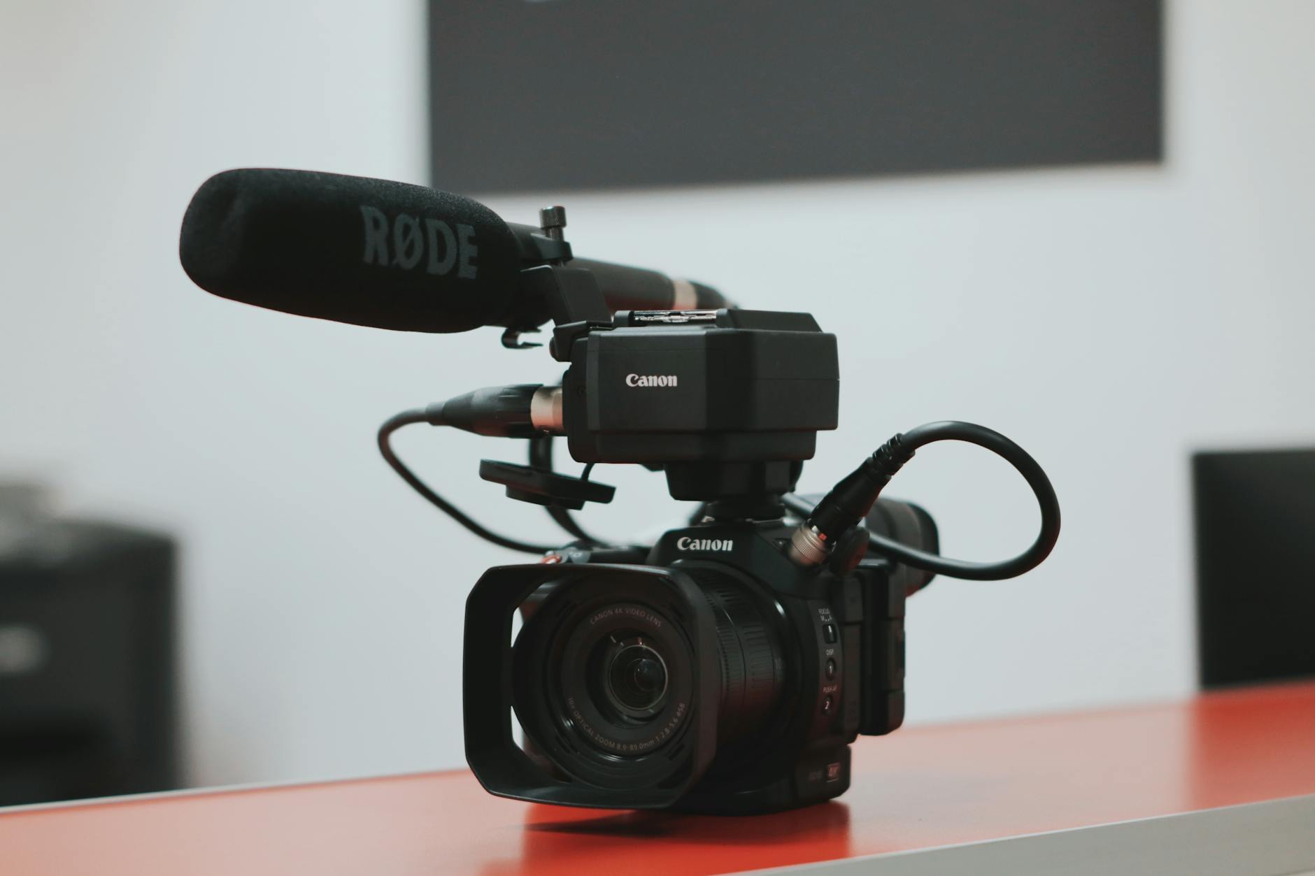
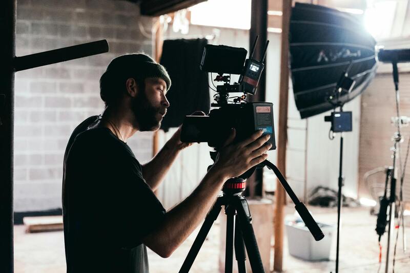
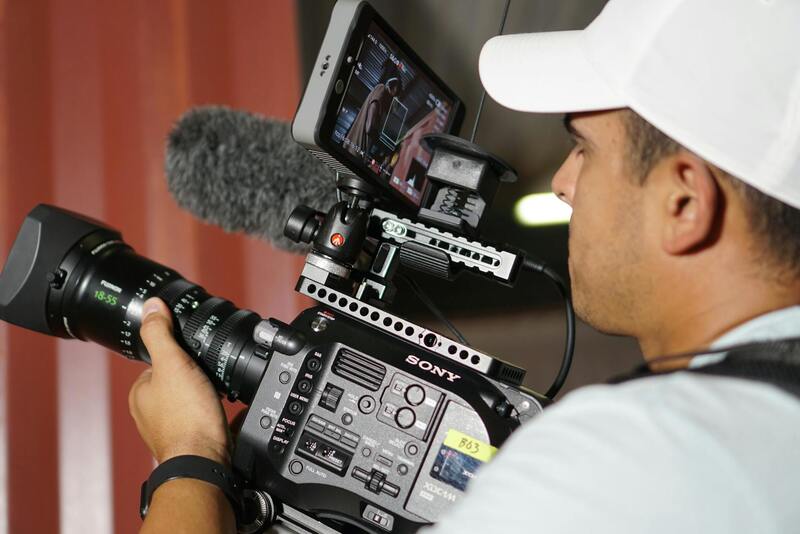
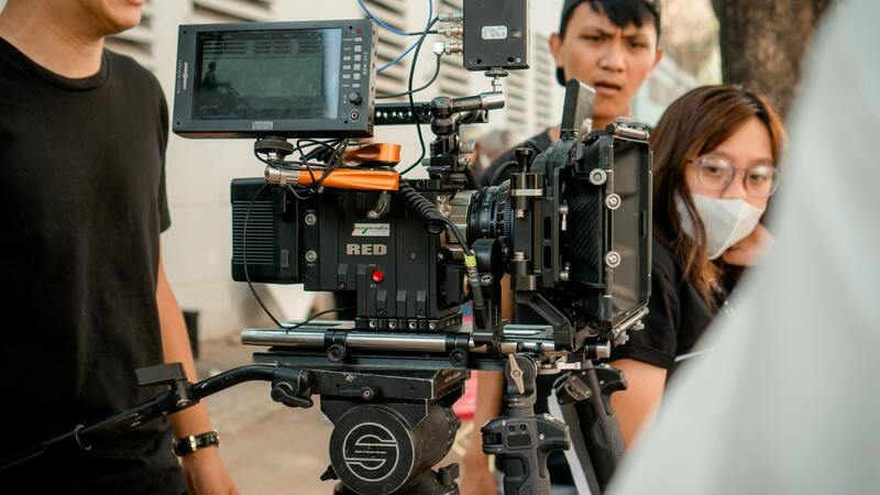
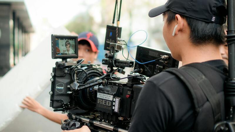
Selecting the appropriate drone equipment is fundamental to capturing high-quality real estate imagery that effectively showcases a property’s unique features. Professional-grade drones equipped with 4K or higher resolution cameras are preferred, as they provide detailed, sharp images that appeal to discerning buyers. Look for drones with stabilization technology, such as gimbal systems, to ensure smooth footage devoid of jitters or shakes. This stability is crucial for producing professional-grade visuals that stand out in property listings.
When configuring camera settings, it is essential to prioritize optimal exposure, focus, and color accuracy. Adjust ISO, aperture, and shutter speed to adapt to varying lighting conditions, such as bright sunlight or shaded areas. Shooting during the golden hours—early morning or late afternoon—can enhance natural light and create warm, inviting images. Additionally, employing a wider field of view enables capturing expansive landscapes and building layouts, giving potential buyers a comprehensive understanding of the property.
Understanding the Permitting and Documentation Process
Utilizing drone technology for real estate in Miami involves meticulous documentation to ensure a smooth operation and uphold standards that enhance the marketing process. It is important for professionals to prepare comprehensive flight plans that detail the intended use, location, and time of drone flights, aligning with the specific requirements set forth for aerial photography in commercial and residential property listings.
Securing proper permissions and recording flight details can contribute significantly to operational transparency and accountability. These records should include flight logs, equipment specifications, and adherence to safety protocols. Maintaining detailed documentation not only aids in operational efficiency but also demonstrates a commitment to best practices, fostering trust among clients.
Adopting a structured approach to regulatory compliance minimizes disruptions and ensures that drone flights are executed within the framework of official procedures. Clearly delineating geographic boundaries, flight altitudes, and times helps in avoiding unnecessary conflicts or misunderstandings, especially in densely populated regions like Miami.
Leveraging Professional Expertise and Certification
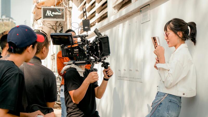
Partnering with licensed drone operators or certified aerial photographers guarantees adherence to established standards. These professionals often possess extensive experience in navigating the specific airspace considerations of Miami, enabling them to plan flights efficiently and safely while capturing compelling images. Their expertise allows for creative shot planning, such as dynamic angles and smooth footage that elevate a property’s visual appeal.
Certifications and ongoing training for drone pilots ensure familiarity with evolving technology and regulations, thereby providing clients with consistent quality and reliability. When selecting a drone photography service, verify credentials and request examples of previous work to assess their compliance with operational standards and their ability to produce high-caliber visuals.
Adopting these official and well-structured approaches establishes a professional foundation for drone photography projects, allowing realtors to showcase properties effectively while aligning with operational best practices. Combining accurate documentation with expert execution ensures that visual marketing efforts are both impactful and compliant, ultimately leading to a more engaging and trustworthy presentation of Miami real estate offerings.
Choosing the Right Drone Equipment and Camera Settings
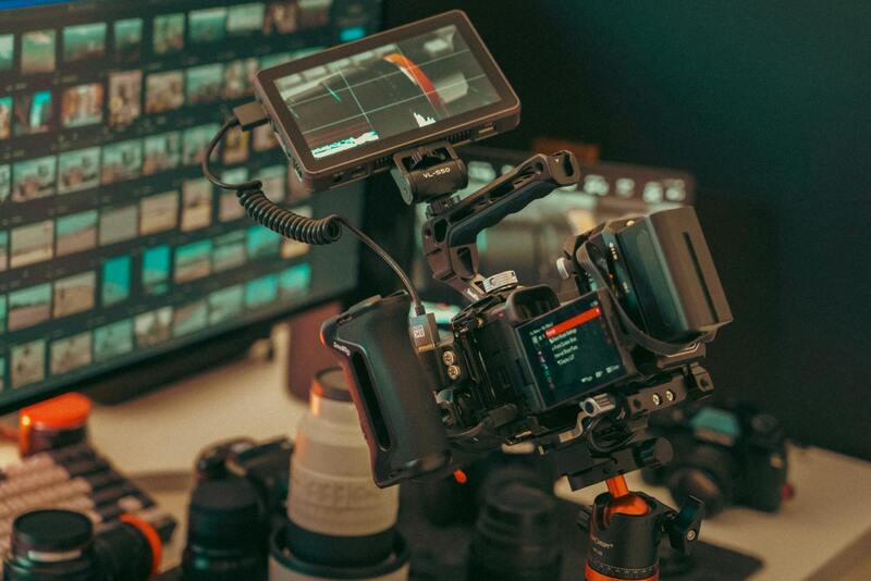
To achieve high-quality drone photography tailored for real estate marketing, selecting appropriate equipment and optimizing camera configurations are crucial steps. The right drone should feature stability, high-resolution cameras, and customizable settings that facilitate capturing detailed, vivid images of properties from various perspectives. Modern professional-grade drones often come equipped with 4K or higher resolution camera capabilities, ensuring that every shot captures intricate architectural details and landscaping features.
When configuring camera settings, focus on factors like ISO, shutter speed, aperture, and white balance to adapt to varying lighting conditions and ensure consistency across images. For daylight shooting, a lower ISO and a narrow aperture help maximize sharpness and depth of field, highlighting both the foreground and background elements of the property.
The choice of flight parameters, such as altitude and angle, significantly impacts the visual storytelling of a property. High vantage points and wide-angle lenses help create expansive views that showcase a property's size and surrounding environment effectively. Moreover, utilizing intelligent flight modes, such as automated waypoints or orbit functions, can produce smooth, professional footage that enhances property appeal.
Post-Production and Editing of Drone Footage
Once the drone captures high-resolution footage and images, the post-production process becomes essential in transforming raw files into captivating visual assets that elevate property listings. The initial step involves importing the footage into professional editing software, where technicians can organize and review the clips to select the most compelling sequences.
Color correction plays a pivotal role in ensuring consistency across images and achieving a vibrant, true-to-life appearance. Adjustments to white balance, contrast, and saturation help highlight the property's unique features while maintaining natural tones that appeal to prospective buyers. Skilled editors often enhance the clarity and dynamic range, especially in areas with mixed lighting or shadowed sections, to ensure the property looks inviting and well-lit.
Stabilization of drone footage is equally important in presenting smooth, professional shots. Techniques such as digital stabilization reduce jitters or unwanted movements, providing seamless panoramic views and sweeping shots that draw viewers into the property's environment. This results in a polished visual presentation that better captures the property’s scale and surroundings.
Additionally, advanced editing may involve stitching multiple footage clips into cohesive sequences, creating virtual tours or cinematic walkthroughs. Incorporating motion graphics, titles, or labels can further emphasize key features, areas, or property details, making the content more engaging and informative.
Efficient editing is vital for generating marketing-ready visuals that draw attention on digital platforms and through print media. This step ensures that every image and video clip aligns with the overall branding strategy, reflects the property’s best angles, and resonates with the target audience.
Using Approved Methods for Drone Operations
To ensure high-quality and compliant drone photography for real estate purposes, selecting officially recognized operational methods is essential. This approach guarantees that drone flights are conducted in a manner that maximizes safety, image quality, and professionalism. Proper planning involves obtaining necessary authorizations, understanding local airspace rules, and adhering to recommended flight procedures.
One effective method involves pre-mission planning, where detailed site assessments are performed to determine optimal flight paths, altitudes, and angles. This step helps in capturing comprehensive perspectives of the property while respecting boundaries and avoiding restricted zones. Utilizing UAV-specific software assists in mapping out safe routes, ensuring flight paths do not infringe upon sensitive areas or neighboring properties.
Furthermore, employing geofencing technology within drone systems serves as a safeguard, highlighting boundaries and no-fly zones to prevent accidental incursions. These digital boundaries act as an added layer of assurance, helping pilots stay within permissible areas and avoid inadvertent violations.
In addition, maintaining meticulous documentation of flight plans and operations contributes to transparency and accountability. This record-keeping is vital for demonstrating adherence to official procedures and standards, which is crucial when showcasing the professionalism of a drone photography service.
Choosing drones equipped with high-resolution cameras and advanced stabilization features enables capturing crisp, steady images and videos. Manual control methods, combined with automated flight modes, offer versatility, allowing operators to execute complex shots while maintaining control over framing, exposure, and focus.
To enhance safety and compliance, periodic training for drone pilots is recommended. Certified training programs emphasize safe flying techniques, understanding of airspace regulations, and emergency procedures. Engaging with licensed operators who are well-versed in approved methods is key to capturing compelling visuals that align with industry standards.
Best Practices for Shooting Real Estate Drone Photos
Executing successful drone photography for real estate requires adherence to established best practices that ensure high-quality, appealing visuals while maintaining safety and efficiency. First, planning the flight path meticulously allows for optimal coverage of the property, emphasizing key features such as curb appeal, landscaping, and unique architectural details. Utilizing pre-programmed flight modes or manually controlling the drone ensures precise framing, especially when capturing exterior shots from various angles.
Managing camera settings critically impacts the final quality of the images. Settings like shutter speed, ISO, and aperture should be adjusted based on lighting conditions to achieve sharpness and clarity. For instance, shooting in RAW format provides greater flexibility during post-processing, allowing adjustments without compromising image quality. Proper exposure and white balance are key to maintaining consistency across shots.
Lighting conditions significantly influence drone photography outcomes. Early morning or late afternoon, often referred to as the golden hours, offer softer lighting and warm tones that can enhance the property's appearance. Ensuring the drone operates when wind conditions are minimal reduces movement and results in steadier shots. Additionally, conducting multiple passes from different angles provides a comprehensive visual narrative of the property.
Proper altitude control is essential to balance detail and context. Flying too high may obscure details, while too low might limit the overall perspective. Typically, altitude ranges vary depending on the property size, but maintaining a consistent height provides cohesion across the imagery. Incorporating smooth, deliberate movements, such as gradual ascents or lateral sweeps, results in professional-looking footage.
Stability features like gimbals play a crucial role. They compensate for drone vibrations, ensuring steady images and videos even in less-than-ideal conditions. Regularly calibrating the drone and camera before shoots minimizes technical issues and guarantees optimal performance.
Finally, reviewing footage on-site allows for immediate quality checks. This practice helps identify any need for retakes or adjustments before leaving the location, ensuring the final product meets the highest standards. Employing these best practices consistently leads to compelling, high-impact visuals that elevate real estate marketing efforts.
Optimizing Drone Footage for Maximum Impact in Listings
To leverage drone imagery effectively within real estate marketing, it is essential to optimize the footage for visual clarity, strategic presentation, and audience engagement. This involves a combination of shot composition, technical adjustments, and integration into larger marketing strategies, ensuring that the aerial visuals enhance property listings and appeal to prospective buyers.
Strategic Shot Composition and Sequencing
Capturing the property from various angles and heights offers a multifaceted view that helps buyers understand both the property and its surroundings. Beginning with wide establishing shots sets the context, showcasing the property's size relative to neighboring landmarks or streets. Progressing to closer, detailed views of features like the landscape, fencing, or unique architectural details adds depth.
Sequencing videos logically, such as starting with a broad view and moving inward or upward to highlight property elevation, creates a natural narrative flow. This guiding approach ensures the viewer’s attention is captured and retained, highlighting key selling points without overwhelming with information.
Technical Adjustments for Enhancement
- Color Grading: Fine-tuning color balance adjusts warmth and vibrancy, making the property appear inviting and well-maintained.
- Sharpness and Clarity: Enhancing resolution and focus draws attention to architectural details and landscaping, which are critical differentiators in a competitive market.
- Stabilization: Ensuring footage is free of jitter or unwanted motion maintains professionalism and viewer comfort. Utilization of gimbals and stabilization software plays a crucial role here.
- Lighting Conditions: Shooting during favorable light—preferably in the early morning or late afternoon—reduces shadows and glare, resulting in balanced exposure throughout videos and photos.
Integration into Overall Marketing Strategies
High-quality drone content should seamlessly blend into comprehensive marketing plans. Embedding drone images and videos into listings, social media campaigns, virtual tours, and website galleries maximizes exposure and engagement.
For instance, combining aerial views with traditional interior photography provides a well-rounded depiction of the property, appealing to different buyer preferences. Automated slideshow presentations, 360-degree views, or interactive virtual tours can incorporate drone footage as a fundamental element, making the listing stand out in a saturated market.
Data-Driven Usage for Targeted Campaigns
Analyzing viewer interactions with drone-enhanced advertisements offers insights for refining marketing efforts. Platforms that support detailed analytics enable real estate professionals to understand which features attract the most attention and modify content accordingly. Succinctly, well-optimized drone imagery not only enhances visual appeal but also plays a pivotal role in strategic decision-making for marketing outreach.